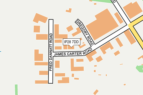
IP28 7DD is located in the Mildenhall Queensway electoral ward, within the local authority district of West Suffolk and the English Parliamentary constituency of West Suffolk. The Sub Integrated Care Board (ICB) Location is NHS Suffolk and North East Essex ICB - 07K and the police force is Suffolk. This postcode has been in use since July 1995.


GetTheData
Source: OS OpenMap – Local (Ordnance Survey)
Source: OS VectorMap District (Ordnance Survey)
Licence: Open Government Licence (requires attribution)
| Easting | 570325 |
| Northing | 275783 |
| Latitude | 52.353651 |
| Longitude | 0.499501 |
GetTheData
Source: Open Postcode Geo
Licence: Open Government Licence
| Country | England |
| Postcode District | IP28 |
➜ See where IP28 is on a map ➜ Where is Mildenhall? | |
GetTheData
Source: Land Registry Price Paid Data
Licence: Open Government Licence
Elevation or altitude of IP28 7DD as distance above sea level:
| Metres | Feet | |
|---|---|---|
| Elevation | 10m | 33ft |
Elevation is measured from the approximate centre of the postcode, to the nearest point on an OS contour line from OS Terrain 50, which has contour spacing of ten vertical metres.
➜ How high above sea level am I? Find the elevation of your current position using your device's GPS.
GetTheData
Source: Open Postcode Elevation
Licence: Open Government Licence
| Ward | Mildenhall Queensway |
| Constituency | West Suffolk |
GetTheData
Source: ONS Postcode Database
Licence: Open Government Licence
| Fincham Road (Folly Road) | Mildenhall | 761m |
| Fincham Road (Folly Road) | Mildenhall | 768m |
| Junction Road (Field Road) | Mildenhall | 916m |
| Junction Road (Field Road) | Mildenhall | 928m |
| Crossbills (Field Road) | Mildenhall | 963m |
GetTheData
Source: NaPTAN
Licence: Open Government Licence
GetTheData
Source: ONS Postcode Database
Licence: Open Government Licence


➜ Get more ratings from the Food Standards Agency
GetTheData
Source: Food Standards Agency
Licence: FSA terms & conditions
| Last Collection | |||
|---|---|---|---|
| Location | Mon-Fri | Sat | Distance |
| Comet Way | 11:30 | 11:30 | 476m |
| Folly Road | 17:00 | 08:00 | 690m |
| Royal Mail, Holborn Avenue | 17:15 | 10:30 | 752m |
GetTheData
Source: Dracos
Licence: Creative Commons Attribution-ShareAlike
The below table lists the International Territorial Level (ITL) codes (formerly Nomenclature of Territorial Units for Statistics (NUTS) codes) and Local Administrative Units (LAU) codes for IP28 7DD:
| ITL 1 Code | Name |
|---|---|
| TLH | East |
| ITL 2 Code | Name |
| TLH1 | East Anglia |
| ITL 3 Code | Name |
| TLH14 | Suffolk CC |
| LAU 1 Code | Name |
| E07000245 | West Suffolk |
GetTheData
Source: ONS Postcode Directory
Licence: Open Government Licence
The below table lists the Census Output Area (OA), Lower Layer Super Output Area (LSOA), and Middle Layer Super Output Area (MSOA) for IP28 7DD:
| Code | Name | |
|---|---|---|
| OA | E00152588 | |
| LSOA | E01029939 | Forest Heath 004B |
| MSOA | E02006241 | Forest Heath 004 |
GetTheData
Source: ONS Postcode Directory
Licence: Open Government Licence
| IP28 7DF | Gregory Road | 47m |
| IP28 7RD | Fred Dannatt Road | 126m |
| IP28 7RQ | James Carter Road | 236m |
| IP28 7SE | Miles Hawk Way | 356m |
| IP28 7BT | Folly Road | 381m |
| IP28 7SB | Courier Close | 412m |
| IP28 7FB | Flemington Close | 421m |
| IP28 7SD | Fairey Fox Drive | 452m |
| IP28 7BN | Campbell Close | 507m |
| IP28 7BL | Leyton Avenue | 524m |
GetTheData
Source: Open Postcode Geo; Land Registry Price Paid Data
Licence: Open Government Licence