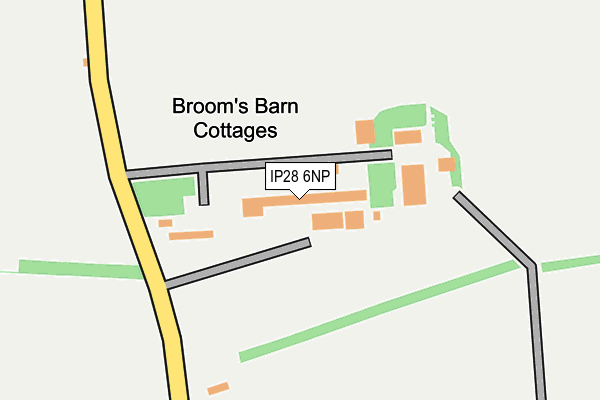
IP28 6NP is located in the Barrow electoral ward, within the local authority district of West Suffolk and the English Parliamentary constituency of West Suffolk. The Sub Integrated Care Board (ICB) Location is NHS Suffolk and North East Essex ICB - 07K and the police force is Suffolk. This postcode has been in use since January 1980.


GetTheData
Source: OS OpenMap – Local (Ordnance Survey)
Source: OS VectorMap District (Ordnance Survey)
Licence: Open Government Licence (requires attribution)
| Easting | 575237 |
| Northing | 265631 |
| Latitude | 52.260927 |
| Longitude | 0.566268 |
GetTheData
Source: Open Postcode Geo
Licence: Open Government Licence
| Country | England |
| Postcode District | IP28 |
➜ See where IP28 is on a map | |
GetTheData
Source: Land Registry Price Paid Data
Licence: Open Government Licence
Elevation or altitude of IP28 6NP as distance above sea level:
| Metres | Feet | |
|---|---|---|
| Elevation | 70m | 230ft |
Elevation is measured from the approximate centre of the postcode, to the nearest point on an OS contour line from OS Terrain 50, which has contour spacing of ten vertical metres.
➜ How high above sea level am I? Find the elevation of your current position using your device's GPS.
GetTheData
Source: Open Postcode Elevation
Licence: Open Government Licence
| Ward | Barrow |
| Constituency | West Suffolk |
GetTheData
Source: ONS Postcode Database
Licence: Open Government Licence
| Brooms Barn (Coalpit Lane) | Barrow | 174m |
| Brooms Barn (Coalpit Lane) | Barrow | 192m |
| War Memorial (Lower Green) | Higham | 710m |
| War Memorial (Lower Green) | Higham | 724m |
| War Memorial (Lower Green) | Higham | 758m |
GetTheData
Source: NaPTAN
Licence: Open Government Licence
GetTheData
Source: ONS Postcode Database
Licence: Open Government Licence


➜ Get more ratings from the Food Standards Agency
GetTheData
Source: Food Standards Agency
Licence: FSA terms & conditions
| Last Collection | |||
|---|---|---|---|
| Location | Mon-Fri | Sat | Distance |
| Post Office, Ley Road | 16:10 | 11:30 | 2,251m |
| Ley Road | 16:00 | 07:30 | 2,375m |
| Bury Road | 16:00 | 07:30 | 2,498m |
GetTheData
Source: Dracos
Licence: Creative Commons Attribution-ShareAlike
The below table lists the International Territorial Level (ITL) codes (formerly Nomenclature of Territorial Units for Statistics (NUTS) codes) and Local Administrative Units (LAU) codes for IP28 6NP:
| ITL 1 Code | Name |
|---|---|
| TLH | East |
| ITL 2 Code | Name |
| TLH1 | East Anglia |
| ITL 3 Code | Name |
| TLH14 | Suffolk CC |
| LAU 1 Code | Name |
| E07000245 | West Suffolk |
GetTheData
Source: ONS Postcode Directory
Licence: Open Government Licence
The below table lists the Census Output Area (OA), Lower Layer Super Output Area (LSOA), and Middle Layer Super Output Area (MSOA) for IP28 6NP:
| Code | Name | |
|---|---|---|
| OA | E00153422 | |
| LSOA | E01030098 | St Edmundsbury 008A |
| MSOA | E02006280 | St Edmundsbury 008 |
GetTheData
Source: ONS Postcode Directory
Licence: Open Government Licence
| IP28 6NH | 557m | |
| IP28 6NL | Lower Green | 735m |
| IP28 6NJ | Lower Green | 749m |
| IP28 6NY | Middle Green | 799m |
| IP29 5BE | Colethorpe Lane | 975m |
| IP28 6NZ | 1109m | |
| IP29 5BA | 1178m | |
| IP28 6PA | Upper Green | 1216m |
| IP29 5AY | Church Hayes | 1401m |
| IP29 5BG | Foundry Close | 1599m |
GetTheData
Source: Open Postcode Geo; Land Registry Price Paid Data
Licence: Open Government Licence