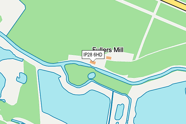
IP28 6HD is located in the Risby electoral ward, within the local authority district of West Suffolk and the English Parliamentary constituency of West Suffolk. The Sub Integrated Care Board (ICB) Location is NHS Suffolk and North East Essex ICB - 07K and the police force is Suffolk. This postcode has been in use since January 2007.


GetTheData
Source: OS OpenMap – Local (Ordnance Survey)
Source: OS VectorMap District (Ordnance Survey)
Licence: Open Government Licence (requires attribution)
| Easting | 580579 |
| Northing | 270929 |
| Latitude | 52.306780 |
| Longitude | 0.647289 |
GetTheData
Source: Open Postcode Geo
Licence: Open Government Licence
| Country | England |
| Postcode District | IP28 |
➜ See where IP28 is on a map | |
GetTheData
Source: Land Registry Price Paid Data
Licence: Open Government Licence
Elevation or altitude of IP28 6HD as distance above sea level:
| Metres | Feet | |
|---|---|---|
| Elevation | 20m | 66ft |
Elevation is measured from the approximate centre of the postcode, to the nearest point on an OS contour line from OS Terrain 50, which has contour spacing of ten vertical metres.
➜ How high above sea level am I? Find the elevation of your current position using your device's GPS.
GetTheData
Source: Open Postcode Elevation
Licence: Open Government Licence
| Ward | Risby |
| Constituency | West Suffolk |
GetTheData
Source: ONS Postcode Database
Licence: Open Government Licence
| Country Park (Ickingham Road) | West Stow | 789m |
| Country Park (Icklingham Road) | West Stow | 795m |
| Telephone Box (Icklingham Road) | West Stow | 904m |
| Telephone Box (Icklingham Road) | West Stow | 909m |
| Church (A1101) | Flempton | 1,195m |
GetTheData
Source: NaPTAN
Licence: Open Government Licence
GetTheData
Source: ONS Postcode Database
Licence: Open Government Licence


➜ Get more ratings from the Food Standards Agency
GetTheData
Source: Food Standards Agency
Licence: FSA terms & conditions
| Last Collection | |||
|---|---|---|---|
| Location | Mon-Fri | Sat | Distance |
| Forest Office | 16:00 | 09:00 | 1,118m |
| Crossroads | 16:00 | 10:00 | 1,200m |
| The Street | 17:00 | 11:15 | 3,244m |
GetTheData
Source: Dracos
Licence: Creative Commons Attribution-ShareAlike
The below table lists the International Territorial Level (ITL) codes (formerly Nomenclature of Territorial Units for Statistics (NUTS) codes) and Local Administrative Units (LAU) codes for IP28 6HD:
| ITL 1 Code | Name |
|---|---|
| TLH | East |
| ITL 2 Code | Name |
| TLH1 | East Anglia |
| ITL 3 Code | Name |
| TLH14 | Suffolk CC |
| LAU 1 Code | Name |
| E07000245 | West Suffolk |
GetTheData
Source: ONS Postcode Directory
Licence: Open Government Licence
The below table lists the Census Output Area (OA), Lower Layer Super Output Area (LSOA), and Middle Layer Super Output Area (MSOA) for IP28 6HD:
| Code | Name | |
|---|---|---|
| OA | E00153632 | |
| LSOA | E01030135 | St Edmundsbury 008E |
| MSOA | E02006280 | St Edmundsbury 008 |
GetTheData
Source: ONS Postcode Directory
Licence: Open Government Licence
| IP28 6HX | 540m | |
| IP28 6HB | Crooked Chimney Row | 704m |
| IP28 6HE | Wideham Cottages | 780m |
| IP28 6EZ | Icklingham Road | 836m |
| IP28 6EH | The Links | 1112m |
| IP28 6HA | 1129m | |
| IP28 6EL | The Green | 1168m |
| IP28 6EJ | Bury Road | 1178m |
| IP28 6EN | West Stow Road | 1195m |
| IP28 6HT | Bury Road | 1246m |
GetTheData
Source: Open Postcode Geo; Land Registry Price Paid Data
Licence: Open Government Licence