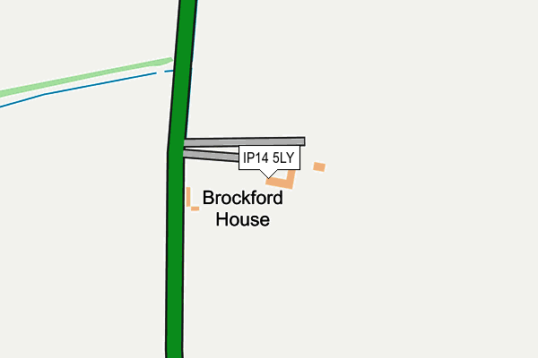
IP14 5LY is in Wetheringsett, Stowmarket. IP14 5LY is located in the Mendlesham electoral ward, within the local authority district of Mid Suffolk and the English Parliamentary constituency of Central Suffolk and North Ipswich. The Sub Integrated Care Board (ICB) Location is NHS Suffolk and North East Essex ICB - 06L and the police force is Suffolk. This postcode has been in use since January 1980.


GetTheData
Source: OS OpenMap – Local (Ordnance Survey)
Source: OS VectorMap District (Ordnance Survey)
Licence: Open Government Licence (requires attribution)
| Easting | 612042 |
| Northing | 263090 |
| Latitude | 52.225191 |
| Longitude | 1.103212 |
GetTheData
Source: Open Postcode Geo
Licence: Open Government Licence
| Locality | Wetheringsett |
| Town/City | Stowmarket |
| Country | England |
| Postcode District | IP14 |
➜ See where IP14 is on a map | |
GetTheData
Source: Land Registry Price Paid Data
Licence: Open Government Licence
Elevation or altitude of IP14 5LY as distance above sea level:
| Metres | Feet | |
|---|---|---|
| Elevation | 60m | 197ft |
Elevation is measured from the approximate centre of the postcode, to the nearest point on an OS contour line from OS Terrain 50, which has contour spacing of ten vertical metres.
➜ How high above sea level am I? Find the elevation of your current position using your device's GPS.
GetTheData
Source: Open Postcode Elevation
Licence: Open Government Licence
| Ward | Mendlesham |
| Constituency | Central Suffolk And North Ipswich |
GetTheData
Source: ONS Postcode Database
Licence: Open Government Licence
| Airfield Turn (A140) | Mendlesham | 770m |
| Airfield Turn (A140) | Mendlesham | 781m |
| Norwich Road (Debenham Road) | Mickfield | 1,092m |
| Norwich Road (Debenham Road) | Mickfield | 1,108m |
| Mickfield Turn (Norwich Road) | Mickfield | 1,195m |
GetTheData
Source: NaPTAN
Licence: Open Government Licence
| Percentage of properties with Next Generation Access | 100.0% |
| Percentage of properties with Superfast Broadband | 100.0% |
| Percentage of properties with Ultrafast Broadband | 100.0% |
| Percentage of properties with Full Fibre Broadband | 100.0% |
Superfast Broadband is between 30Mbps and 300Mbps
Ultrafast Broadband is > 300Mbps
| Percentage of properties unable to receive 2Mbps | 0.0% |
| Percentage of properties unable to receive 5Mbps | 0.0% |
| Percentage of properties unable to receive 10Mbps | 0.0% |
| Percentage of properties unable to receive 30Mbps | 0.0% |
GetTheData
Source: Ofcom
Licence: Ofcom Terms of Use (requires attribution)
GetTheData
Source: ONS Postcode Database
Licence: Open Government Licence


➜ Get more ratings from the Food Standards Agency
GetTheData
Source: Food Standards Agency
Licence: FSA terms & conditions
| Last Collection | |||
|---|---|---|---|
| Location | Mon-Fri | Sat | Distance |
| Whitehorse Corner | 09:45 | 09:00 | 3,285m |
| Pitmans Corner | 10:00 | 10:00 | 4,037m |
| Henry Street | 11:40 | 10:30 | 4,837m |
GetTheData
Source: Dracos
Licence: Creative Commons Attribution-ShareAlike
The below table lists the International Territorial Level (ITL) codes (formerly Nomenclature of Territorial Units for Statistics (NUTS) codes) and Local Administrative Units (LAU) codes for IP14 5LY:
| ITL 1 Code | Name |
|---|---|
| TLH | East |
| ITL 2 Code | Name |
| TLH1 | East Anglia |
| ITL 3 Code | Name |
| TLH14 | Suffolk CC |
| LAU 1 Code | Name |
| E07000203 | Mid Suffolk |
GetTheData
Source: ONS Postcode Directory
Licence: Open Government Licence
The below table lists the Census Output Area (OA), Lower Layer Super Output Area (LSOA), and Middle Layer Super Output Area (MSOA) for IP14 5LY:
| Code | Name | |
|---|---|---|
| OA | E00153363 | |
| LSOA | E01030087 | Mid Suffolk 007D |
| MSOA | E02006267 | Mid Suffolk 007 |
GetTheData
Source: ONS Postcode Directory
Licence: Open Government Licence
| IP14 5LX | Norwich Road | 544m |
| IP14 5LU | Norwich Road | 755m |
| IP14 5RL | Tan Office | 1112m |
| IP14 5HH | 1508m | |
| IP14 5JR | Debenham Road | 1517m |
| IP14 5NF | Town Lane | 1599m |
| IP14 5LB | Norwich Road | 1621m |
| IP14 5NQ | Norwich Road | 1654m |
| IP14 5TE | Oak Farm Lane | 1674m |
| IP14 5LA | Norwich Road | 1813m |
GetTheData
Source: Open Postcode Geo; Land Registry Price Paid Data
Licence: Open Government Licence