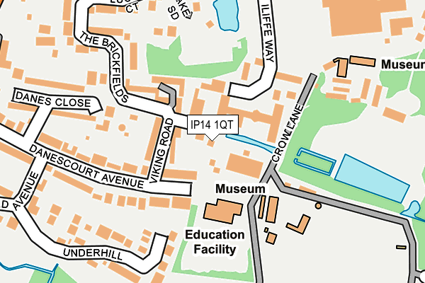
IP14 1QT lies on Sea Breeze Road in Stowmarket. IP14 1QT is located in the St Peter's electoral ward, within the local authority district of Mid Suffolk and the English Parliamentary constituency of Bury St Edmunds. The Sub Integrated Care Board (ICB) Location is NHS Suffolk and North East Essex ICB - 06L and the police force is Suffolk. This postcode has been in use since January 1980.


GetTheData
Source: OS OpenMap – Local (Ordnance Survey)
Source: OS VectorMap District (Ordnance Survey)
Licence: Open Government Licence (requires attribution)
| Easting | 604502 |
| Northing | 258389 |
| Latitude | 52.185833 |
| Longitude | 0.990147 |
GetTheData
Source: Open Postcode Geo
Licence: Open Government Licence
| Street | Sea Breeze Road |
| Town/City | Stowmarket |
| Country | England |
| Postcode District | IP14 |
➜ See where IP14 is on a map ➜ Where is Stowmarket? | |
GetTheData
Source: Land Registry Price Paid Data
Licence: Open Government Licence
Elevation or altitude of IP14 1QT as distance above sea level:
| Metres | Feet | |
|---|---|---|
| Elevation | 40m | 131ft |
Elevation is measured from the approximate centre of the postcode, to the nearest point on an OS contour line from OS Terrain 50, which has contour spacing of ten vertical metres.
➜ How high above sea level am I? Find the elevation of your current position using your device's GPS.
GetTheData
Source: Open Postcode Elevation
Licence: Open Government Licence
| Ward | St Peter's |
| Constituency | Bury St Edmunds |
GetTheData
Source: ONS Postcode Database
Licence: Open Government Licence
SEA BREEZE COTTAGE, 5, SEA BREEZE ROAD, STOWMARKET, IP14 1QT 2008 29 JAN £250,000 |
KEEPERS COTTAGE, SEA BREEZE ROAD, STOWMARKET, IP14 1QT 2007 7 MAR £260,000 |
SEA BREEZE COTTAGE, 5, SEA BREEZE ROAD, STOWMARKET, IP14 1QT 1999 29 OCT £123,000 |
GetTheData
Source: HM Land Registry Price Paid Data
Licence: Contains HM Land Registry data © Crown copyright and database right 2025. This data is licensed under the Open Government Licence v3.0.
| Recreation Ground (Finborough Road) | Stowmarket | 297m |
| Recreation Ground (Finborough Road) | Stowmarket | 313m |
| Danescourt Avenue (Finborough Road) | Stowmarket | 375m |
| Danescourt Avenue (Finborough Road) | Stowmarket | 381m |
| Argos Store (Market Place) | Stowmarket | 428m |
| Stowmarket Station | 0.8km |
| Needham Market Station | 5.8km |
GetTheData
Source: NaPTAN
Licence: Open Government Licence
| Percentage of properties with Next Generation Access | 100.0% |
| Percentage of properties with Superfast Broadband | 100.0% |
| Percentage of properties with Ultrafast Broadband | 0.0% |
| Percentage of properties with Full Fibre Broadband | 0.0% |
Superfast Broadband is between 30Mbps and 300Mbps
Ultrafast Broadband is > 300Mbps
| Percentage of properties unable to receive 2Mbps | 0.0% |
| Percentage of properties unable to receive 5Mbps | 0.0% |
| Percentage of properties unable to receive 10Mbps | 0.0% |
| Percentage of properties unable to receive 30Mbps | 0.0% |
GetTheData
Source: Ofcom
Licence: Ofcom Terms of Use (requires attribution)
GetTheData
Source: ONS Postcode Database
Licence: Open Government Licence


➜ Get more ratings from the Food Standards Agency
GetTheData
Source: Food Standards Agency
Licence: FSA terms & conditions
| Last Collection | |||
|---|---|---|---|
| Location | Mon-Fri | Sat | Distance |
| Royal Mail 62 Ipswich Street | 17:45 | 13:00 | 552m |
| Edgecomb Road | 17:00 | 11:00 | 955m |
| Stow Lodge | 16:15 | 11:00 | 1,299m |
GetTheData
Source: Dracos
Licence: Creative Commons Attribution-ShareAlike
The below table lists the International Territorial Level (ITL) codes (formerly Nomenclature of Territorial Units for Statistics (NUTS) codes) and Local Administrative Units (LAU) codes for IP14 1QT:
| ITL 1 Code | Name |
|---|---|
| TLH | East |
| ITL 2 Code | Name |
| TLH1 | East Anglia |
| ITL 3 Code | Name |
| TLH14 | Suffolk CC |
| LAU 1 Code | Name |
| E07000203 | Mid Suffolk |
GetTheData
Source: ONS Postcode Directory
Licence: Open Government Licence
The below table lists the Census Output Area (OA), Lower Layer Super Output Area (LSOA), and Middle Layer Super Output Area (MSOA) for IP14 1QT:
| Code | Name | |
|---|---|---|
| OA | E00153280 | |
| LSOA | E01030073 | Mid Suffolk 008A |
| MSOA | E02006268 | Mid Suffolk 008 |
GetTheData
Source: ONS Postcode Directory
Licence: Open Government Licence
| IP14 1QG | Danescourt Avenue | 62m |
| IP14 1SL | Iliffe Way | 85m |
| IP14 1QQ | Viking Road | 87m |
| IP14 1QF | Danescourt Avenue | 95m |
| IP14 1QH | Danescourt Avenue | 165m |
| IP14 1QE | Danescourt Avenue | 187m |
| IP14 1QY | Underhill | 187m |
| IP14 1SX | Finborough Road | 196m |
| IP14 1QJ | Danes Close | 221m |
| IP14 1RN | Lucena Court | 226m |
GetTheData
Source: Open Postcode Geo; Land Registry Price Paid Data
Licence: Open Government Licence