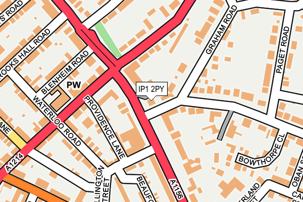
IP1 2PY is located in the St Margaret's electoral ward, within the local authority district of Ipswich and the English Parliamentary constituency of Ipswich. The Sub Integrated Care Board (ICB) Location is NHS Suffolk and North East Essex ICB - 06L and the police force is Suffolk. This postcode has been in use since January 1980.


GetTheData
Source: OS OpenMap – Local (Ordnance Survey)
Source: OS VectorMap District (Ordnance Survey)
Licence: Open Government Licence (requires attribution)
| Easting | 615399 |
| Northing | 245355 |
| Latitude | 52.064667 |
| Longitude | 1.141023 |
GetTheData
Source: Open Postcode Geo
Licence: Open Government Licence
| Country | England |
| Postcode District | IP1 |
➜ See where IP1 is on a map ➜ Where is Ipswich? | |
GetTheData
Source: Land Registry Price Paid Data
Licence: Open Government Licence
Elevation or altitude of IP1 2PY as distance above sea level:
| Metres | Feet | |
|---|---|---|
| Elevation | 10m | 33ft |
Elevation is measured from the approximate centre of the postcode, to the nearest point on an OS contour line from OS Terrain 50, which has contour spacing of ten vertical metres.
➜ How high above sea level am I? Find the elevation of your current position using your device's GPS.
GetTheData
Source: Open Postcode Elevation
Licence: Open Government Licence
| Ward | St Margaret's |
| Constituency | Ipswich |
GetTheData
Source: ONS Postcode Database
Licence: Open Government Licence
| Ymca (Norwich Road) | Westbourne | 48m |
| Ymca (Norwich Road) | Westbourne | 56m |
| Westwood Avenue (Norwich Road) | Westbourne | 221m |
| Westwood Avenue (Norwich Road) | Westbourne | 226m |
| Sirdar Road (Bramford Road) | Westbourne | 265m |
| Ipswich Station | 1.6km |
| Westerfield Station | 2.5km |
| Derby Road (Ipswich) Station | 3.3km |
GetTheData
Source: NaPTAN
Licence: Open Government Licence
GetTheData
Source: ONS Postcode Database
Licence: Open Government Licence


➜ Get more ratings from the Food Standards Agency
GetTheData
Source: Food Standards Agency
Licence: FSA terms & conditions
| Last Collection | |||
|---|---|---|---|
| Location | Mon-Fri | Sat | Distance |
| 47 Bramford Road | 17:30 | 12:00 | 297m |
| 98 Norwich Road | 17:30 | 12:15 | 350m |
| 62 Warrington Road | 17:30 | 13:00 | 407m |
GetTheData
Source: Dracos
Licence: Creative Commons Attribution-ShareAlike
The below table lists the International Territorial Level (ITL) codes (formerly Nomenclature of Territorial Units for Statistics (NUTS) codes) and Local Administrative Units (LAU) codes for IP1 2PY:
| ITL 1 Code | Name |
|---|---|
| TLH | East |
| ITL 2 Code | Name |
| TLH1 | East Anglia |
| ITL 3 Code | Name |
| TLH14 | Suffolk CC |
| LAU 1 Code | Name |
| E07000202 | Ipswich |
GetTheData
Source: ONS Postcode Directory
Licence: Open Government Licence
The below table lists the Census Output Area (OA), Lower Layer Super Output Area (LSOA), and Middle Layer Super Output Area (MSOA) for IP1 2PY:
| Code | Name | |
|---|---|---|
| OA | E00152929 | |
| LSOA | E01030009 | Ipswich 005C |
| MSOA | E02006249 | Ipswich 005 |
GetTheData
Source: ONS Postcode Directory
Licence: Open Government Licence
| IP1 3PN | Anglesea Road | 35m |
| IP1 2PX | Norwich Road | 57m |
| IP1 2PA | Chevallier Street | 75m |
| IP1 2QX | Norwich Road | 78m |
| IP1 4ED | Valley Road | 101m |
| IP1 2ND | Providence Lane | 117m |
| IP1 2PQ | Chevallier Street | 133m |
| IP1 2NT | Wellington Street | 134m |
| IP1 3PJ | Anglesea Road | 144m |
| IP1 2PB | Chevallier Street | 145m |
GetTheData
Source: Open Postcode Geo; Land Registry Price Paid Data
Licence: Open Government Licence