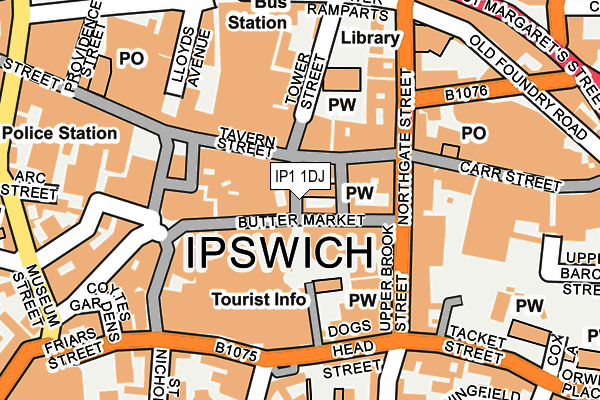
IP1 1DJ is located in the Alexandra electoral ward, within the local authority district of Ipswich and the English Parliamentary constituency of Ipswich. The Sub Integrated Care Board (ICB) Location is NHS Suffolk and North East Essex ICB - 06L and the police force is Suffolk. This postcode has been in use since January 1980.


GetTheData
Source: OS OpenMap – Local (Ordnance Survey)
Source: OS VectorMap District (Ordnance Survey)
Licence: Open Government Licence (requires attribution)
| Easting | 616376 |
| Northing | 244577 |
| Latitude | 52.057302 |
| Longitude | 1.154760 |
GetTheData
Source: Open Postcode Geo
Licence: Open Government Licence
| Country | England |
| Postcode District | IP1 |
➜ See where IP1 is on a map ➜ Where is Ipswich? | |
GetTheData
Source: Land Registry Price Paid Data
Licence: Open Government Licence
Elevation or altitude of IP1 1DJ as distance above sea level:
| Metres | Feet | |
|---|---|---|
| Elevation | 10m | 33ft |
Elevation is measured from the approximate centre of the postcode, to the nearest point on an OS contour line from OS Terrain 50, which has contour spacing of ten vertical metres.
➜ How high above sea level am I? Find the elevation of your current position using your device's GPS.
GetTheData
Source: Open Postcode Elevation
Licence: Open Government Licence
| Ward | Alexandra |
| Constituency | Ipswich |
GetTheData
Source: ONS Postcode Database
Licence: Open Government Licence
| Buttermarket | Ipswich | 100m |
| Cafe Nero | Ipswich | 102m |
| Revolution (Old Cattle Market (Dogs Head Street)) | Ipswich | 146m |
| Northgate Street (Great Colman Street) | Ipswich | 182m |
| Library (Northgate Street) | Ipswich | 197m |
| Ipswich Station | 1km |
| Derby Road (Ipswich) Station | 2.1km |
| Westerfield Station | 2.7km |
GetTheData
Source: NaPTAN
Licence: Open Government Licence
GetTheData
Source: ONS Postcode Database
Licence: Open Government Licence


➜ Get more ratings from the Food Standards Agency
GetTheData
Source: Food Standards Agency
Licence: FSA terms & conditions
| Last Collection | |||
|---|---|---|---|
| Location | Mon-Fri | Sat | Distance |
| 9 Upper Brook Street | 18:30 | 12:15 | 108m |
| Lloyds Avenue | 18:30 | 158m | |
| Cornhill | 18:30 | 12:30 | 160m |
GetTheData
Source: Dracos
Licence: Creative Commons Attribution-ShareAlike
The below table lists the International Territorial Level (ITL) codes (formerly Nomenclature of Territorial Units for Statistics (NUTS) codes) and Local Administrative Units (LAU) codes for IP1 1DJ:
| ITL 1 Code | Name |
|---|---|
| TLH | East |
| ITL 2 Code | Name |
| TLH1 | East Anglia |
| ITL 3 Code | Name |
| TLH14 | Suffolk CC |
| LAU 1 Code | Name |
| E07000202 | Ipswich |
GetTheData
Source: ONS Postcode Directory
Licence: Open Government Licence
The below table lists the Census Output Area (OA), Lower Layer Super Output Area (LSOA), and Middle Layer Super Output Area (MSOA) for IP1 1DJ:
| Code | Name | |
|---|---|---|
| OA | E00152699 | |
| LSOA | E01033129 | Ipswich 007H |
| MSOA | E02006251 | Ipswich 007 |
GetTheData
Source: ONS Postcode Directory
Licence: Open Government Licence
| IP1 1DL | Dial Lane | 15m |
| IP1 1BP | Butter Market | 46m |
| IP1 1BQ | Butter Market | 48m |
| IP1 3AD | Tavern Street | 52m |
| IP1 1BJ | Butter Market | 62m |
| IP1 3BW | Tower Churchyard | 86m |
| IP1 1BB | Butter Market | 105m |
| IP4 1EB | Upper Brook Street | 108m |
| IP4 1EG | Upper Brook Street | 118m |
| IP1 3BZ | Northgate Street | 135m |
GetTheData
Source: Open Postcode Geo; Land Registry Price Paid Data
Licence: Open Government Licence