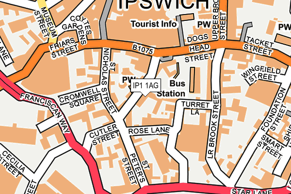
IP1 1AG is located in the Alexandra electoral ward, within the local authority district of Ipswich and the English Parliamentary constituency of Ipswich. The Sub Integrated Care Board (ICB) Location is NHS Suffolk and North East Essex ICB - 06L and the police force is Suffolk. This postcode has been in use since August 1993.


GetTheData
Source: OS OpenMap – Local (Ordnance Survey)
Source: OS VectorMap District (Ordnance Survey)
Licence: Open Government Licence (requires attribution)
| Easting | 616318 |
| Northing | 244327 |
| Latitude | 52.055081 |
| Longitude | 1.153757 |
GetTheData
Source: Open Postcode Geo
Licence: Open Government Licence
| Country | England |
| Postcode District | IP1 |
➜ See where IP1 is on a map ➜ Where is Ipswich? | |
GetTheData
Source: Land Registry Price Paid Data
Licence: Open Government Licence
Elevation or altitude of IP1 1AG as distance above sea level:
| Metres | Feet | |
|---|---|---|
| Elevation | 10m | 33ft |
Elevation is measured from the approximate centre of the postcode, to the nearest point on an OS contour line from OS Terrain 50, which has contour spacing of ten vertical metres.
➜ How high above sea level am I? Find the elevation of your current position using your device's GPS.
GetTheData
Source: Open Postcode Elevation
Licence: Open Government Licence
| Ward | Alexandra |
| Constituency | Ipswich |
GetTheData
Source: ONS Postcode Database
Licence: Open Government Licence
| Revolution (Old Cattle Market (Dogs Head Street)) | Ipswich | 121m |
| St Peter's Hall (St. Peter's Street) | Ipswich | 143m |
| Willis Building | Ipswich | 175m |
| Willis Building (Friars Street) | Ipswich | 197m |
| Willis Building (Princes Street) | Ipswich | 237m |
| Ipswich Station | 0.8km |
| Derby Road (Ipswich) Station | 2km |
| Westerfield Station | 3km |
GetTheData
Source: NaPTAN
Licence: Open Government Licence
| Percentage of properties with Next Generation Access | 100.0% |
| Percentage of properties with Superfast Broadband | 100.0% |
| Percentage of properties with Ultrafast Broadband | 100.0% |
| Percentage of properties with Full Fibre Broadband | 100.0% |
Superfast Broadband is between 30Mbps and 300Mbps
Ultrafast Broadband is > 300Mbps
| Median download speed | 80.0Mbps |
| Average download speed | 102.9Mbps |
| Maximum download speed | 350.00Mbps |
| Median upload speed | 10.0Mbps |
| Average upload speed | 11.4Mbps |
| Maximum upload speed | 20.00Mbps |
| Percentage of properties unable to receive 2Mbps | 0.0% |
| Percentage of properties unable to receive 5Mbps | 0.0% |
| Percentage of properties unable to receive 10Mbps | 0.0% |
| Percentage of properties unable to receive 30Mbps | 0.0% |
GetTheData
Source: Ofcom
Licence: Ofcom Terms of Use (requires attribution)
Estimated total energy consumption in IP1 1AG by fuel type, 2015.
| Consumption (kWh) | 187,281 |
|---|---|
| Meter count | 37 |
| Mean (kWh/meter) | 5,062 |
| Median (kWh/meter) | 4,723 |
GetTheData
Source: Postcode level gas estimates: 2015 (experimental)
Source: Postcode level electricity estimates: 2015 (experimental)
Licence: Open Government Licence
GetTheData
Source: ONS Postcode Database
Licence: Open Government Licence


➜ Get more ratings from the Food Standards Agency
GetTheData
Source: Food Standards Agency
Licence: FSA terms & conditions
| Last Collection | |||
|---|---|---|---|
| Location | Mon-Fri | Sat | Distance |
| St Peter's Street | 18:30 | 12:00 | 62m |
| 2 St. Peters Street | 18:30 | 12:00 | 89m |
| Old Cattle Market | 18:30 | 12:00 | 91m |
GetTheData
Source: Dracos
Licence: Creative Commons Attribution-ShareAlike
The below table lists the International Territorial Level (ITL) codes (formerly Nomenclature of Territorial Units for Statistics (NUTS) codes) and Local Administrative Units (LAU) codes for IP1 1AG:
| ITL 1 Code | Name |
|---|---|
| TLH | East |
| ITL 2 Code | Name |
| TLH1 | East Anglia |
| ITL 3 Code | Name |
| TLH14 | Suffolk CC |
| LAU 1 Code | Name |
| E07000202 | Ipswich |
GetTheData
Source: ONS Postcode Directory
Licence: Open Government Licence
The below table lists the Census Output Area (OA), Lower Layer Super Output Area (LSOA), and Middle Layer Super Output Area (MSOA) for IP1 1AG:
| Code | Name | |
|---|---|---|
| OA | E00170846 | |
| LSOA | E01033124 | Ipswich 007F |
| MSOA | E02006251 | Ipswich 007 |
GetTheData
Source: ONS Postcode Directory
Licence: Open Government Licence
| IP1 1TF | Silent Street | 41m |
| IP1 1XE | Rose Lane | 61m |
| IP1 1TW | St Nicholas Street | 71m |
| IP4 1DL | Turret Close | 73m |
| IP4 1DT | Turret Lane | 90m |
| IP1 1XF | St Peters Street | 92m |
| IP1 1SL | Falcon Street | 97m |
| IP1 1TH | St Nicholas Street | 105m |
| IP4 1RA | Lower Brook Mews | 111m |
| IP1 1XB | St Peters Street | 114m |
GetTheData
Source: Open Postcode Geo; Land Registry Price Paid Data
Licence: Open Government Licence