HX3 9XL maps, stats, and open data
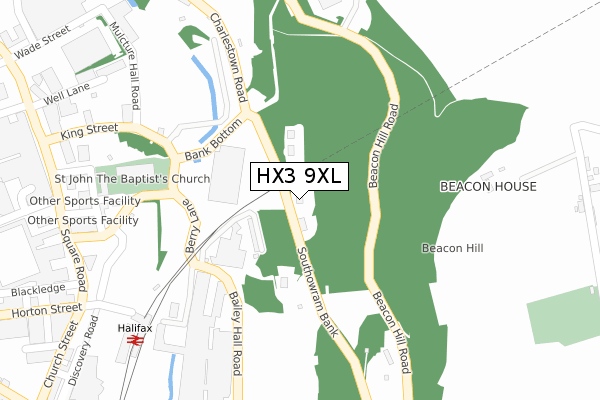
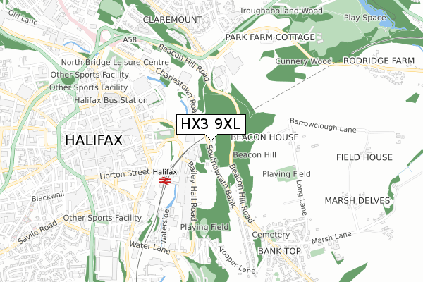
HX3 9XL lies on Southowram Bank in Halifax. HX3 9XL is located in the Town electoral ward, within the metropolitan district of Calderdale and the English Parliamentary constituency of Halifax. The Sub Integrated Care Board (ICB) Location is NHS West Yorkshire ICB - 02T and the police force is West Yorkshire. This postcode has been in use since August 1992.
HX3 9XL maps


Licence: Open Government Licence (requires attribution)
Attribution: Contains OS data © Crown copyright and database right 2025
Source: Open Postcode Geo
Licence: Open Government Licence (requires attribution)
Attribution: Contains OS data © Crown copyright and database right 2025; Contains Royal Mail data © Royal Mail copyright and database right 2025; Source: Office for National Statistics licensed under the Open Government Licence v.3.0
HX3 9XL geodata
| Easting | 410027 |
| Northing | 425181 |
| Latitude | 53.722955 |
| Longitude | -1.849523 |
Where is HX3 9XL?
| Street | Southowram Bank |
| Town/City | Halifax |
| Country | England |
| Postcode District | HX3 |
HX3 9XL Elevation
Elevation or altitude of HX3 9XL as distance above sea level:
| Metres | Feet | |
|---|---|---|
| Elevation | 140m | 459ft |
Elevation is measured from the approximate centre of the postcode, to the nearest point on an OS contour line from OS Terrain 50, which has contour spacing of ten vertical metres.
➜ How high above sea level am I? Find the elevation of your current position using your device's GPS.
Politics
| Ward | Town |
|---|---|
| Constituency | Halifax |
House Prices
Sales of detached houses in HX3 9XL
THE OLD SMITHY, 75 - 79, SOUTHOWRAM BANK, HALIFAX, HX3 9XL 2021 9 AUG £870,000 |
THE OLD SMITHY, 77, SOUTHOWRAM BANK, HALIFAX, HX3 9XL 2014 4 APR £350,000 |
79, SOUTHOWRAM BANK, HALIFAX, HX3 9XL 2002 17 MAY £45,000 |
Licence: Contains HM Land Registry data © Crown copyright and database right 2025. This data is licensed under the Open Government Licence v3.0.
Transport
Nearest bus stops to HX3 9XL
| Beacon Hill Road Godley Branch Rd (Beacon Hill Road) | Claremount | 301m |
| Railway Station (Halifax Railway Station (Forecourt)) | Halifax Town Centre | 360m |
| Beacon Hill Road Godley Branch Rd (Beacon Hill Road) | Claremount | 384m |
| Beacon Hill Rd Southowram Bank (Beacon Hill Road) | Halifax Town Centre | 394m |
| Beacon Hill Rd Southowram Bank (Beacon Hill Road) | Halifax Town Centre | 405m |
Nearest railway stations to HX3 9XL
| Halifax Station | 0.3km |
| Sowerby Bridge Station | 4.1km |
| Brighouse Station | 5.4km |
Broadband
Broadband access in HX3 9XL (2020 data)
| Percentage of properties with Next Generation Access | 100.0% |
| Percentage of properties with Superfast Broadband | 100.0% |
| Percentage of properties with Ultrafast Broadband | 0.0% |
| Percentage of properties with Full Fibre Broadband | 0.0% |
Superfast Broadband is between 30Mbps and 300Mbps
Ultrafast Broadband is > 300Mbps
Broadband limitations in HX3 9XL (2020 data)
| Percentage of properties unable to receive 2Mbps | 0.0% |
| Percentage of properties unable to receive 5Mbps | 0.0% |
| Percentage of properties unable to receive 10Mbps | 0.0% |
| Percentage of properties unable to receive 30Mbps | 0.0% |
Deprivation
51.7% of English postcodes are less deprived than HX3 9XL:Food Standards Agency
Three nearest food hygiene ratings to HX3 9XL (metres)


➜ Get more ratings from the Food Standards Agency
Nearest post box to HX3 9XL
| Last Collection | |||
|---|---|---|---|
| Location | Mon-Fri | Sat | Distance |
| Halifax Railway Station | 18:30 | 12:30 | 366m |
| Halifax Delivery Office | 19:30 | 12:30 | 538m |
| 27 Union Street | 18:30 | 11:45 | 602m |
HX3 9XL ITL and HX3 9XL LAU
The below table lists the International Territorial Level (ITL) codes (formerly Nomenclature of Territorial Units for Statistics (NUTS) codes) and Local Administrative Units (LAU) codes for HX3 9XL:
| ITL 1 Code | Name |
|---|---|
| TLE | Yorkshire and The Humber |
| ITL 2 Code | Name |
| TLE4 | West Yorkshire |
| ITL 3 Code | Name |
| TLE44 | Calderdale and Kirklees |
| LAU 1 Code | Name |
| E08000033 | Calderdale |
HX3 9XL census areas
The below table lists the Census Output Area (OA), Lower Layer Super Output Area (LSOA), and Middle Layer Super Output Area (MSOA) for HX3 9XL:
| Code | Name | |
|---|---|---|
| OA | E00055410 | |
| LSOA | E01010991 | Calderdale 018C |
| MSOA | E02002261 | Calderdale 018 |
Nearest postcodes to HX3 9XL
| HX3 9XP | Baldwin Terrace | 117m |
| HX3 9XW | Bailey Hall View | 161m |
| HX1 1QS | Upper Kirkgate | 309m |
| HX3 9PZ | Beacon Hill Road | 309m |
| HX1 1SP | Mulcture Hall Road | 317m |
| HX1 1QR | Dispensary Walk | 337m |
| HX1 1QH | Berwick Street | 371m |
| HX1 1SR | King Street | 380m |
| HX3 6AJ | 461m | |
| HX1 1SJ | Winding Road | 483m |