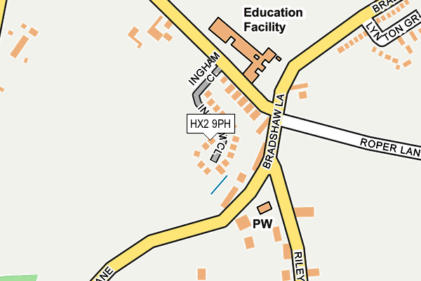
HX2 9PH is located in the Illingworth and Mixenden electoral ward, within the metropolitan district of Calderdale and the English Parliamentary constituency of Halifax. The Sub Integrated Care Board (ICB) Location is NHS West Yorkshire ICB - 02T and the police force is West Yorkshire. This postcode has been in use since November 2016.


GetTheData
Source: OS OpenMap – Local (Ordnance Survey)
Source: OS VectorMap District (Ordnance Survey)
Licence: Open Government Licence (requires attribution)
| Easting | 407935 |
| Northing | 431313 |
| Latitude | 53.778105 |
| Longitude | -1.881072 |
GetTheData
Source: Open Postcode Geo
Licence: Open Government Licence
| Country | England |
| Postcode District | HX2 |
➜ See where HX2 is on a map | |
GetTheData
Source: Land Registry Price Paid Data
Licence: Open Government Licence
Elevation or altitude of HX2 9PH as distance above sea level:
| Metres | Feet | |
|---|---|---|
| Elevation | 290m | 951ft |
Elevation is measured from the approximate centre of the postcode, to the nearest point on an OS contour line from OS Terrain 50, which has contour spacing of ten vertical metres.
➜ How high above sea level am I? Find the elevation of your current position using your device's GPS.
GetTheData
Source: Open Postcode Elevation
Licence: Open Government Licence
| Ward | Illingworth And Mixenden |
| Constituency | Halifax |
GetTheData
Source: ONS Postcode Database
Licence: Open Government Licence
| Green Ln Taylor Lane (Green Lane) | Bradshaw | 660m |
| Green Ln Taylor Lane (Green Lane) | Bradshaw | 664m |
| Bradshaw Lane Upper Fold Farm (Bradshaw Lane) | Bradshaw | 805m |
| Bradshaw Lane Upper Fold Farm (Bradshaw Lane) | Bradshaw | 820m |
| Green Lane Roper Ln (Green Lane) | Queensbury | 823m |
GetTheData
Source: NaPTAN
Licence: Open Government Licence
GetTheData
Source: ONS Postcode Database
Licence: Open Government Licence


➜ Get more ratings from the Food Standards Agency
GetTheData
Source: Food Standards Agency
Licence: FSA terms & conditions
| Last Collection | |||
|---|---|---|---|
| Location | Mon-Fri | Sat | Distance |
| 2 Park Lane Queensbury | 17:45 | 12:00 | 3,188m |
| Fieldhead Estate | 17:00 | 12:00 | 3,214m |
| Baldwin Lane | 17:15 | 12:00 | 3,497m |
GetTheData
Source: Dracos
Licence: Creative Commons Attribution-ShareAlike
The below table lists the International Territorial Level (ITL) codes (formerly Nomenclature of Territorial Units for Statistics (NUTS) codes) and Local Administrative Units (LAU) codes for HX2 9PH:
| ITL 1 Code | Name |
|---|---|
| TLE | Yorkshire and The Humber |
| ITL 2 Code | Name |
| TLE4 | West Yorkshire |
| ITL 3 Code | Name |
| TLE44 | Calderdale and Kirklees |
| LAU 1 Code | Name |
| E08000033 | Calderdale |
GetTheData
Source: ONS Postcode Directory
Licence: Open Government Licence
The below table lists the Census Output Area (OA), Lower Layer Super Output Area (LSOA), and Middle Layer Super Output Area (MSOA) for HX2 9PH:
| Code | Name | |
|---|---|---|
| OA | E00055010 | |
| LSOA | E01010911 | Calderdale 001A |
| MSOA | E02002244 | Calderdale 001 |
GetTheData
Source: ONS Postcode Directory
Licence: Open Government Licence
| HX2 9NT | Soil Hill | 177m |
| BD13 1LY | Perseverance Road | 414m |
| BD13 1LZ | Hartley Square | 433m |
| BD13 3SS | Brighouse & Denholme Road | 523m |
| HX2 9PD | 673m | |
| HX2 9NS | Soil Hill | 683m |
| BD13 4HF | Brighouse Denholme Road | 720m |
| BD13 1LS | White Castle Court | 722m |
| HX2 9XE | 762m | |
| BD13 3SR | Deep Lane | 763m |
GetTheData
Source: Open Postcode Geo; Land Registry Price Paid Data
Licence: Open Government Licence