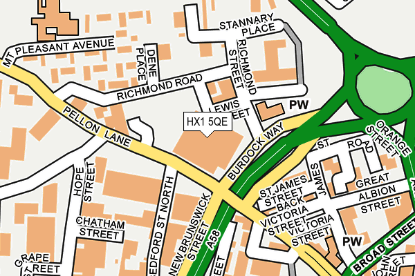
HX1 5QE is located in the Park electoral ward, within the metropolitan district of Calderdale and the English Parliamentary constituency of Halifax. The Sub Integrated Care Board (ICB) Location is NHS West Yorkshire ICB - 02T and the police force is West Yorkshire. This postcode has been in use since November 2012.


GetTheData
Source: OS OpenMap – Local (Ordnance Survey)
Source: OS VectorMap District (Ordnance Survey)
Licence: Open Government Licence (requires attribution)
| Easting | 408918 |
| Northing | 425456 |
| Latitude | 53.725432 |
| Longitude | -1.866320 |
GetTheData
Source: Open Postcode Geo
Licence: Open Government Licence
| Country | England |
| Postcode District | HX1 |
➜ See where HX1 is on a map ➜ Where is Halifax? | |
GetTheData
Source: Land Registry Price Paid Data
Licence: Open Government Licence
Elevation or altitude of HX1 5QE as distance above sea level:
| Metres | Feet | |
|---|---|---|
| Elevation | 170m | 558ft |
Elevation is measured from the approximate centre of the postcode, to the nearest point on an OS contour line from OS Terrain 50, which has contour spacing of ten vertical metres.
➜ How high above sea level am I? Find the elevation of your current position using your device's GPS.
GetTheData
Source: Open Postcode Elevation
Licence: Open Government Licence
| Ward | Park |
| Constituency | Halifax |
GetTheData
Source: ONS Postcode Database
Licence: Open Government Licence
| Pellon Ln Bedford Street North (Pellon Lane) | Pellon | 47m |
| Pellon Ln Hanson Lane (Pellon Lane) | Pellon | 113m |
| New Brunswick Street | King Cross | 145m |
| Hanson Ln Hope Street (Hanson Lane) | Pellon | 185m |
| Pellon Lane Chapel Town (Pellon Lane) | Halifax Town Centre | 212m |
| Halifax Station | 1km |
| Sowerby Bridge Station | 3.3km |
GetTheData
Source: NaPTAN
Licence: Open Government Licence
GetTheData
Source: ONS Postcode Database
Licence: Open Government Licence

➜ Get more ratings from the Food Standards Agency
GetTheData
Source: Food Standards Agency
Licence: FSA terms & conditions
| Last Collection | |||
|---|---|---|---|
| Location | Mon-Fri | Sat | Distance |
| St James Road | 18:30 | 12:00 | 200m |
| King Cross P.o. Box | 17:30 | 12:00 | 222m |
| Town Hall | 18:30 | 11:45 | 395m |
GetTheData
Source: Dracos
Licence: Creative Commons Attribution-ShareAlike
The below table lists the International Territorial Level (ITL) codes (formerly Nomenclature of Territorial Units for Statistics (NUTS) codes) and Local Administrative Units (LAU) codes for HX1 5QE:
| ITL 1 Code | Name |
|---|---|
| TLE | Yorkshire and The Humber |
| ITL 2 Code | Name |
| TLE4 | West Yorkshire |
| ITL 3 Code | Name |
| TLE44 | Calderdale and Kirklees |
| LAU 1 Code | Name |
| E08000033 | Calderdale |
GetTheData
Source: ONS Postcode Directory
Licence: Open Government Licence
The below table lists the Census Output Area (OA), Lower Layer Super Output Area (LSOA), and Middle Layer Super Output Area (MSOA) for HX1 5QE:
| Code | Name | |
|---|---|---|
| OA | E00055408 | |
| LSOA | E01010994 | Calderdale 008E |
| MSOA | E02002251 | Calderdale 008 |
GetTheData
Source: ONS Postcode Directory
Licence: Open Government Licence
| HX1 5SU | St James Street | 156m |
| HX1 5BH | Bedford Street North | 160m |
| HX1 5SZ | Richmond Road | 161m |
| HX1 1YS | St James Road | 178m |
| HX1 5SP | Pellon Lane | 190m |
| HX1 5DW | Hope Street | 196m |
| HX1 5SS | Victoria Street | 198m |
| HX1 5TN | Mount Pleasant Avenue | 212m |
| HX1 1YR | Great Albion Street | 231m |
| HX1 5QN | Pellon Lane | 273m |
GetTheData
Source: Open Postcode Geo; Land Registry Price Paid Data
Licence: Open Government Licence