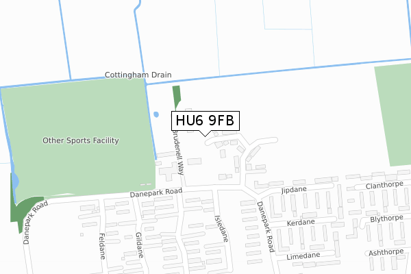
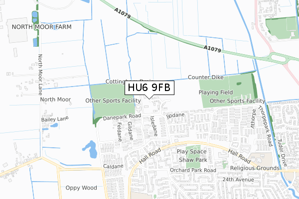
HU6 9FB is located in the Cottingham North electoral ward, within the unitary authority of East Riding of Yorkshire and the English Parliamentary constituency of Haltemprice and Howden. The Sub Integrated Care Board (ICB) Location is NHS Humber and North Yorkshire ICB - 02Y and the police force is Humberside. This postcode has been in use since April 2019.


GetTheData
Source: OS Open Zoomstack (Ordnance Survey)
Licence: Open Government Licence (requires attribution)
Attribution: Contains OS data © Crown copyright and database right 2024
Source: Open Postcode Geo
Licence: Open Government Licence (requires attribution)
Attribution: Contains OS data © Crown copyright and database right 2024; Contains Royal Mail data © Royal Mail copyright and database right 2024; Source: Office for National Statistics licensed under the Open Government Licence v.3.0
| Easting | 506477 |
| Northing | 434109 |
| Latitude | 53.792430 |
| Longitude | -0.385127 |
GetTheData
Source: Open Postcode Geo
Licence: Open Government Licence
| Country | England |
| Postcode District | HU6 |
| ➜ HU6 open data dashboard ➜ See where HU6 is on a map ➜ Where is Kingston upon Hull? | |
GetTheData
Source: Land Registry Price Paid Data
Licence: Open Government Licence
| Ward | Cottingham North |
| Constituency | Haltemprice And Howden |
GetTheData
Source: ONS Postcode Database
Licence: Open Government Licence
18, BROMBY GROVE, HULL, HU6 9FB 2020 28 AUG £136,995 |
1, BROMBY GROVE, HULL, HU6 9FB 2020 13 AUG £134,995 |
16, BROMBY GROVE, HULL, HU6 9FB 2020 27 MAR £144,995 |
17, BROMBY GROVE, HULL, HU6 9FB 2020 20 FEB £169,995 |
4, BROMBY GROVE, HULL, HU6 9FB 2020 21 JAN £139,995 |
➜ Kingston upon Hull house prices
GetTheData
Source: HM Land Registry Price Paid Data
Licence: Contains HM Land Registry data © Crown copyright and database right 2024. This data is licensed under the Open Government Licence v3.0.
| June 2022 | Violence and sexual offences | On or near Brudenell Way | 133m |
| June 2022 | Robbery | On or near Brudenell Way | 133m |
| June 2022 | Anti-social behaviour | On or near Jipdane | 251m |
| ➜ Get more crime data in our Crime section | |||
GetTheData
Source: data.police.uk
Licence: Open Government Licence
| Hall Road | North Hull Estate | 461m |
| The Rampant Horse Ph (Hall Road) | North Hull Estate | 516m |
| Hall Road | North Hull Estate | 526m |
| Bradshaw (Orchard Park Road) | North Hull Estate | 580m |
| Quillcourt (Orchard Park Road) | North Hull Estate | 581m |
| Cottingham Station | 1.8km |
GetTheData
Source: NaPTAN
Licence: Open Government Licence
GetTheData
Source: ONS Postcode Database
Licence: Open Government Licence


➜ Get more ratings from the Food Standards Agency
GetTheData
Source: Food Standards Agency
Licence: FSA terms & conditions
| Last Collection | |||
|---|---|---|---|
| Location | Mon-Fri | Sat | Distance |
| Orchard Park Post Office | 17:00 | 11:30 | 739m |
| Courtland Road Hull | 16:45 | 11:30 | 1,023m |
| Downfield Avenue Hull | 17:15 | 10:30 | 1,268m |
GetTheData
Source: Dracos
Licence: Creative Commons Attribution-ShareAlike
| Facility | Distance |
|---|---|
| Dane Park Playing Fields Danepark Road, Hull Grass Pitches | 341m |
| Danepark Primary School (Closed) Danepark Road, Orchard Park Estate, Hull Grass Pitches | 449m |
| Sir Henry Cooper Park Thorpepark Road, Hull Grass Pitches | 570m |
GetTheData
Source: Active Places
Licence: Open Government Licence
| School | Phase of Education | Distance |
|---|---|---|
| The Parks Primary Academy Courtway Road, Hull, HU6 9TA | Primary | 876m |
| St Anthony's Voluntary Catholic Academy Dane Park Road, Hull, HU6 9AA | Primary | 926m |
| Thorpepark Academy Laxthorpe, Orchard Park Estate, Hull, HU6 9EG | Primary | 993m |
GetTheData
Source: Edubase
Licence: Open Government Licence
| Risk of HU6 9FB flooding from rivers and sea | Medium |
| ➜ HU6 9FB flood map | |
GetTheData
Source: Open Flood Risk by Postcode
Licence: Open Government Licence
The below table lists the International Territorial Level (ITL) codes (formerly Nomenclature of Territorial Units for Statistics (NUTS) codes) and Local Administrative Units (LAU) codes for HU6 9FB:
| ITL 1 Code | Name |
|---|---|
| TLE | Yorkshire and The Humber |
| ITL 2 Code | Name |
| TLE1 | East Yorkshire and Northern Lincolnshire |
| ITL 3 Code | Name |
| TLE12 | East Riding of Yorkshire |
| LAU 1 Code | Name |
| E06000011 | East Riding of Yorkshire |
GetTheData
Source: ONS Postcode Directory
Licence: Open Government Licence
The below table lists the Census Output Area (OA), Lower Layer Super Output Area (LSOA), and Middle Layer Super Output Area (MSOA) for HU6 9FB:
| Code | Name | |
|---|---|---|
| OA | E00065346 | |
| LSOA | E01012953 | East Riding of Yorkshire 023A |
| MSOA | E02002706 | East Riding of Yorkshire 023 |
GetTheData
Source: ONS Postcode Directory
Licence: Open Government Licence
| HU6 9BD | 199m | |
| HU6 9DZ | Isledane | 218m |
| HU6 9EE | Jipdane | 243m |
| HU6 9BA | Gildane | 258m |
| HU6 9BG | Hardane | 260m |
| HU6 9AF | Dane Park Road | 268m |
| HU6 9ED | Jipdane | 289m |
| HU6 9EB | Kerdane | 343m |
| HU6 9BE | Hardane | 346m |
| HU6 9AT | Feldane | 359m |
GetTheData
Source: Open Postcode Geo; Land Registry Price Paid Data
Licence: Open Government Licence