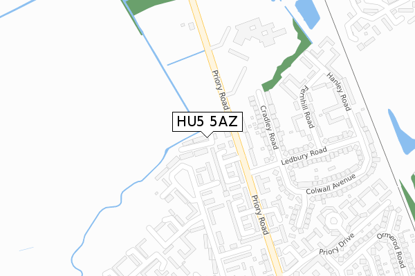
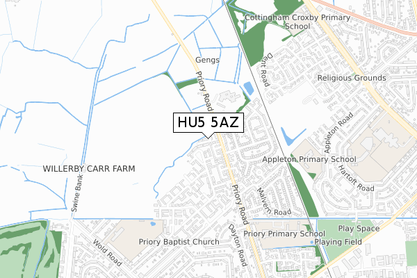
HU5 5AZ is located in the Derringham electoral ward, within the unitary authority of Kingston upon Hull, City of and the English Parliamentary constituency of Kingston upon Hull West and Hessle. The Sub Integrated Care Board (ICB) Location is NHS Humber and North Yorkshire ICB - 03F and the police force is Humberside. This postcode has been in use since December 2019.


GetTheData
Source: OS Open Zoomstack (Ordnance Survey)
Licence: Open Government Licence (requires attribution)
Attribution: Contains OS data © Crown copyright and database right 2024
Source: Open Postcode Geo
Licence: Open Government Licence (requires attribution)
Attribution: Contains OS data © Crown copyright and database right 2024; Contains Royal Mail data © Royal Mail copyright and database right 2024; Source: Office for National Statistics licensed under the Open Government Licence v.3.0
| Easting | 505340 |
| Northing | 431005 |
| Latitude | 53.764774 |
| Longitude | -0.403438 |
GetTheData
Source: Open Postcode Geo
Licence: Open Government Licence
| Country | England |
| Postcode District | HU5 |
| ➜ HU5 open data dashboard ➜ See where HU5 is on a map ➜ Where is Kingston upon Hull? | |
GetTheData
Source: Land Registry Price Paid Data
Licence: Open Government Licence
| Ward | Derringham |
| Constituency | Kingston Upon Hull West And Hessle |
GetTheData
Source: ONS Postcode Database
Licence: Open Government Licence
10, TEASDALE CLOSE, HULL, HU5 5AZ 2020 7 MAY £150,000 |
5, TEASDALE CLOSE, HULL, HU5 5AZ 2019 20 DEC £215,000 |
➜ Kingston upon Hull house prices
GetTheData
Source: HM Land Registry Price Paid Data
Licence: Contains HM Land Registry data © Crown copyright and database right 2024. This data is licensed under the Open Government Licence v3.0.
| January 2024 | Criminal damage and arson | On or near Kilnwick Avenue | 229m |
| December 2023 | Robbery | On or near Kilnwick Avenue | 229m |
| October 2023 | Violence and sexual offences | On or near Kilnwick Avenue | 229m |
| ➜ Get more crime data in our Crime section | |||
GetTheData
Source: data.police.uk
Licence: Open Government Licence
| Easby Court (Priory Road) | Setting Dyke | 89m |
| Priory Road (Ledbury Road) | Setting Dyke | 160m |
| Ledbury Road (Priory Road) | Setting Dyke | 161m |
| Cottingham Priory Road (Priory Road) | Cottingham | 203m |
| Arden Court (Priory Road) | Setting Dyke | 294m |
| Cottingham Station | 1.9km |
| Hull Station | 4.4km |
GetTheData
Source: NaPTAN
Licence: Open Government Licence
GetTheData
Source: ONS Postcode Database
Licence: Open Government Licence


➜ Get more ratings from the Food Standards Agency
GetTheData
Source: Food Standards Agency
Licence: FSA terms & conditions
| Last Collection | |||
|---|---|---|---|
| Location | Mon-Fri | Sat | Distance |
| Priory Raod | 16:30 | 11:30 | 67m |
| Priory Road Post Office | 16:30 | 11:30 | 401m |
| Appleton Road Hull | 17:15 | 12:15 | 770m |
GetTheData
Source: Dracos
Licence: Creative Commons Attribution-ShareAlike
| Facility | Distance |
|---|---|
| Appleton Primary School Appleton Road, Hull Grass Pitches | 621m |
| Priory Primary School Priory Road, Hull Grass Pitches | 663m |
| Kelvin Hall School Sports Field Bishop Alcock Road, Kingston Upon Hull Grass Pitches | 693m |
GetTheData
Source: Active Places
Licence: Open Government Licence
| School | Phase of Education | Distance |
|---|---|---|
| Appleton Primary School Appleton Road, Hull, HU5 4PG | Primary | 612m |
| Priory Primary School Priory Road, Hull, HU5 5RU | Primary | 691m |
| Wold Academy Wold Road, Hull, HU5 5QG | Primary | 875m |
GetTheData
Source: Edubase
Licence: Open Government Licence
| Risk of HU5 5AZ flooding from rivers and sea | Low |
| ➜ HU5 5AZ flood map | |
GetTheData
Source: Open Flood Risk by Postcode
Licence: Open Government Licence
The below table lists the International Territorial Level (ITL) codes (formerly Nomenclature of Territorial Units for Statistics (NUTS) codes) and Local Administrative Units (LAU) codes for HU5 5AZ:
| ITL 1 Code | Name |
|---|---|
| TLE | Yorkshire and The Humber |
| ITL 2 Code | Name |
| TLE1 | East Yorkshire and Northern Lincolnshire |
| ITL 3 Code | Name |
| TLE11 | Kingston upon Hull, City of |
| LAU 1 Code | Name |
| E06000010 | Kingston upon Hull, City of |
GetTheData
Source: ONS Postcode Directory
Licence: Open Government Licence
The below table lists the Census Output Area (OA), Lower Layer Super Output Area (LSOA), and Middle Layer Super Output Area (MSOA) for HU5 5AZ:
| Code | Name | |
|---|---|---|
| OA | E00064576 | |
| LSOA | E01012798 | Kingston upon Hull 019D |
| MSOA | E02002670 | Kingston upon Hull 019 |
GetTheData
Source: ONS Postcode Directory
Licence: Open Government Licence
| HU5 5RG | Priory Road | 61m |
| HU5 5RE | Coronation Road North | 82m |
| HU5 5SG | Priory Road | 112m |
| HU5 5SL | Cradley Road | 145m |
| HU5 5SB | Priory Road | 162m |
| HU5 5RA | Kilnwick Avenue | 242m |
| HU5 5RD | Coronation Road North | 249m |
| HU5 5SX | Priory Road | 258m |
| HU5 5SH | Ledbury Road | 263m |
| HU5 5SE | Priory Road | 267m |
GetTheData
Source: Open Postcode Geo; Land Registry Price Paid Data
Licence: Open Government Licence