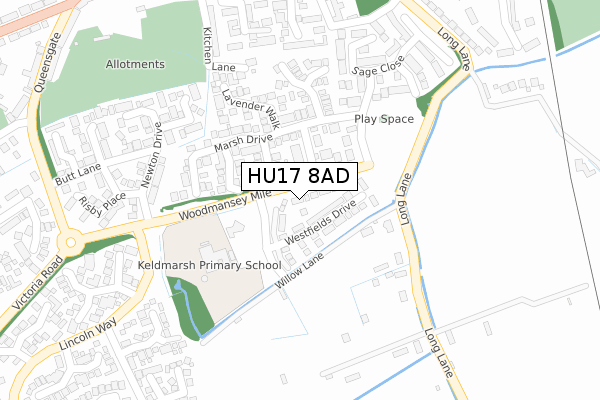
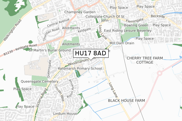
HU17 8AD is located in the Minster and Woodmansey electoral ward, within the unitary authority of East Riding of Yorkshire and the English Parliamentary constituency of Beverley and Holderness. The Sub Integrated Care Board (ICB) Location is NHS Humber and North Yorkshire ICB - 02Y and the police force is Humberside. This postcode has been in use since November 2019.


GetTheData
Source: OS Open Zoomstack (Ordnance Survey)
Licence: Open Government Licence (requires attribution)
Attribution: Contains OS data © Crown copyright and database right 2024
Source: Open Postcode Geo
Licence: Open Government Licence (requires attribution)
Attribution: Contains OS data © Crown copyright and database right 2024; Contains Royal Mail data © Royal Mail copyright and database right 2024; Source: Office for National Statistics licensed under the Open Government Licence v.3.0
| Easting | 503553 |
| Northing | 438654 |
| Latitude | 53.833853 |
| Longitude | -0.427970 |
GetTheData
Source: Open Postcode Geo
Licence: Open Government Licence
| Country | England |
| Postcode District | HU17 |
| ➜ HU17 open data dashboard ➜ See where HU17 is on a map ➜ Where is Beverley? | |
GetTheData
Source: Land Registry Price Paid Data
Licence: Open Government Licence
| Ward | Minster And Woodmansey |
| Constituency | Beverley And Holderness |
GetTheData
Source: ONS Postcode Database
Licence: Open Government Licence
2023 18 OCT £315,000 |
2023 9 MAY £440,000 |
4, GRANARY CROFT, BEVERLEY, HU17 8AD 2020 24 JAN £324,995 |
5, GRANARY CROFT, BEVERLEY, HU17 8AD 2019 17 DEC £319,995 |
2019 13 DEC £354,995 |
2019 13 DEC £299,995 |
GetTheData
Source: HM Land Registry Price Paid Data
Licence: Contains HM Land Registry data © Crown copyright and database right 2024. This data is licensed under the Open Government Licence v3.0.
| December 2023 | Other theft | On or near Balmoral Drive | 493m |
| October 2023 | Violence and sexual offences | On or near Balmoral Drive | 493m |
| June 2022 | Public order | On or near Sage Close | 307m |
| ➜ Get more crime data in our Crime section | |||
GetTheData
Source: data.police.uk
Licence: Open Government Licence
| Beverley Admiral Walker Rd (Admiral Walker Road) | Beverley | 528m |
| Beverley Cartwright Lane (Cartwright Lane) | Beverley | 532m |
| Beverley Minster Yard Sth (Minster Yard South) | Beverley Minster | 608m |
| Beverley Grammar Sch (Queensgate) | Beverley | 615m |
| Beverley Minster Yard Sth (Minster Yard South) | Beverley Minster | 616m |
| Beverley Station | 1km |
GetTheData
Source: NaPTAN
Licence: Open Government Licence
| Percentage of properties with Next Generation Access | 100.0% |
| Percentage of properties with Superfast Broadband | 100.0% |
| Percentage of properties with Ultrafast Broadband | 100.0% |
| Percentage of properties with Full Fibre Broadband | 100.0% |
Superfast Broadband is between 30Mbps and 300Mbps
Ultrafast Broadband is > 300Mbps
| Percentage of properties unable to receive 2Mbps | 0.0% |
| Percentage of properties unable to receive 5Mbps | 0.0% |
| Percentage of properties unable to receive 10Mbps | 0.0% |
| Percentage of properties unable to receive 30Mbps | 0.0% |
GetTheData
Source: Ofcom
Licence: Ofcom Terms of Use (requires attribution)
GetTheData
Source: ONS Postcode Database
Licence: Open Government Licence


➜ Get more ratings from the Food Standards Agency
GetTheData
Source: Food Standards Agency
Licence: FSA terms & conditions
| Last Collection | |||
|---|---|---|---|
| Location | Mon-Fri | Sat | Distance |
| Queensgate | 17:30 | 11:45 | 476m |
| Lincoln Way Post Office | 17:30 | 12:00 | 623m |
| Minster Yard North | 17:15 | 11:45 | 685m |
GetTheData
Source: Dracos
Licence: Creative Commons Attribution-ShareAlike
| Facility | Distance |
|---|---|
| Keldmarsh Primary School And Playing Field Woodmansey Mile, Beverley Grass Pitches, Sports Hall | 191m |
| East Riding Leisure Beverley Flemingate, Beverley Sports Hall, Swimming Pool, Health and Fitness Gym, Grass Pitches, Studio, Artificial Grass Pitch | 617m |
| Anytime Fitness (Beverley) Flemingate, Beverley Health and Fitness Gym | 749m |
GetTheData
Source: Active Places
Licence: Open Government Licence
| School | Phase of Education | Distance |
|---|---|---|
| Keldmarsh Primary School Woodmansey Mile, Address - First Line, Beverley, HU17 8FF | Primary | 173m |
| Beverley Grammar School Queensgate, Beverley, HU17 8NF | Secondary | 774m |
| Beverley Minster Church of England Voluntary Controlled Primary School St Giles Croft, Beverley, HU17 8LA | Primary | 885m |
GetTheData
Source: Edubase
Licence: Open Government Licence
| Risk of HU17 8AD flooding from rivers and sea | Low |
| ➜ HU17 8AD flood map | |
GetTheData
Source: Open Flood Risk by Postcode
Licence: Open Government Licence
The below table lists the International Territorial Level (ITL) codes (formerly Nomenclature of Territorial Units for Statistics (NUTS) codes) and Local Administrative Units (LAU) codes for HU17 8AD:
| ITL 1 Code | Name |
|---|---|
| TLE | Yorkshire and The Humber |
| ITL 2 Code | Name |
| TLE1 | East Yorkshire and Northern Lincolnshire |
| ITL 3 Code | Name |
| TLE12 | East Riding of Yorkshire |
| LAU 1 Code | Name |
| E06000011 | East Riding of Yorkshire |
GetTheData
Source: ONS Postcode Directory
Licence: Open Government Licence
The below table lists the Census Output Area (OA), Lower Layer Super Output Area (LSOA), and Middle Layer Super Output Area (MSOA) for HU17 8AD:
| Code | Name | |
|---|---|---|
| OA | E00065789 | |
| LSOA | E01013039 | East Riding of Yorkshire 020C |
| MSOA | E02002703 | East Riding of Yorkshire 020 |
GetTheData
Source: ONS Postcode Directory
Licence: Open Government Licence
| HU17 8WF | Basil Drive | 71m |
| HU17 8WA | Mint Walk | 79m |
| HU17 8WD | Marsh Drive | 122m |
| HU17 8WG | Coriander Close | 141m |
| HU17 8WE | Lavender Walk | 175m |
| HU17 8YP | Mace View | 197m |
| HU17 8WB | Figham Springs Way | 241m |
| HU17 8NY | Shorthill Croft | 243m |
| HU17 8WJ | Dill Drive | 257m |
| HU17 8WH | Sage Close | 272m |
GetTheData
Source: Open Postcode Geo; Land Registry Price Paid Data
Licence: Open Government Licence