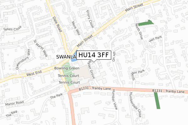
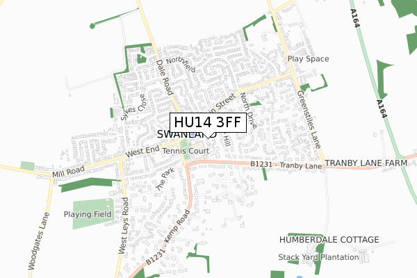
HU14 3FF is located in the South Hunsley electoral ward, within the unitary authority of East Riding of Yorkshire and the English Parliamentary constituency of Haltemprice and Howden. The Sub Integrated Care Board (ICB) Location is NHS Humber and North Yorkshire ICB - 02Y and the police force is Humberside. This postcode has been in use since December 2018.


GetTheData
Source: OS Open Zoomstack (Ordnance Survey)
Licence: Open Government Licence (requires attribution)
Attribution: Contains OS data © Crown copyright and database right 2024
Source: Open Postcode Geo
Licence: Open Government Licence (requires attribution)
Attribution: Contains OS data © Crown copyright and database right 2024; Contains Royal Mail data © Royal Mail copyright and database right 2024; Source: Office for National Statistics licensed under the Open Government Licence v.3.0
| Easting | 499733 |
| Northing | 427947 |
| Latitude | 53.738399 |
| Longitude | -0.489450 |
GetTheData
Source: Open Postcode Geo
Licence: Open Government Licence
| Country | England |
| Postcode District | HU14 |
| ➜ HU14 open data dashboard ➜ See where HU14 is on a map ➜ Where is Swanland? | |
GetTheData
Source: Land Registry Price Paid Data
Licence: Open Government Licence
| Ward | South Hunsley |
| Constituency | Haltemprice And Howden |
GetTheData
Source: ONS Postcode Database
Licence: Open Government Licence
2022 21 NOV £750,000 |
5, WALLER GROVE, SWANLAND, NORTH FERRIBY, HU14 3FF 2019 25 OCT £600,000 |
6, WALLER GROVE, SWANLAND, NORTH FERRIBY, HU14 3FF 2019 23 AUG £560,000 |
1, WALLER GROVE, SWANLAND, NORTH FERRIBY, HU14 3FF 2019 16 JUL £750,000 |
7, WALLER GROVE, SWANLAND, NORTH FERRIBY, HU14 3FF 2019 7 JUN £649,999 |
8, WALLER GROVE, SWANLAND, NORTH FERRIBY, HU14 3FF 2019 31 MAY £649,999 |
9, WALLER GROVE, SWANLAND, NORTH FERRIBY, HU14 3FF 2019 17 MAY £734,999 |
4, WALLER GROVE, SWANLAND, NORTH FERRIBY, HU14 3FF 2018 21 DEC £649,999 |
2018 20 DEC £649,999 |
2, WALLER GROVE, SWANLAND, NORTH FERRIBY, HU14 3FF 2018 14 DEC £734,999 |
GetTheData
Source: HM Land Registry Price Paid Data
Licence: Contains HM Land Registry data © Crown copyright and database right 2024. This data is licensed under the Open Government Licence v3.0.
| June 2022 | Criminal damage and arson | On or near The Spinney | 382m |
| June 2022 | Criminal damage and arson | On or near Beech Grove | 426m |
| June 2022 | Anti-social behaviour | On or near Beech Grove | 426m |
| ➜ Get more crime data in our Crime section | |||
GetTheData
Source: data.police.uk
Licence: Open Government Licence
| Swanland Main Street (West End) | Swanland | 119m |
| Swanland Main Street (Main Street) | Swanland | 129m |
| Swanland Kemp Road (Kemp Road) | Swanland | 185m |
| Swanland Tranby Lane (Tranby Lane) | Swanland | 258m |
| Swanland Main Street (Main Street) | Swanland | 344m |
| Ferriby Station | 2.7km |
| Hessle Station | 3.9km |
GetTheData
Source: NaPTAN
Licence: Open Government Licence
| Percentage of properties with Next Generation Access | 100.0% |
| Percentage of properties with Superfast Broadband | 100.0% |
| Percentage of properties with Ultrafast Broadband | 100.0% |
| Percentage of properties with Full Fibre Broadband | 100.0% |
Superfast Broadband is between 30Mbps and 300Mbps
Ultrafast Broadband is > 300Mbps
| Percentage of properties unable to receive 2Mbps | 0.0% |
| Percentage of properties unable to receive 5Mbps | 0.0% |
| Percentage of properties unable to receive 10Mbps | 0.0% |
| Percentage of properties unable to receive 30Mbps | 0.0% |
GetTheData
Source: Ofcom
Licence: Ofcom Terms of Use (requires attribution)
GetTheData
Source: ONS Postcode Database
Licence: Open Government Licence


➜ Get more ratings from the Food Standards Agency
GetTheData
Source: Food Standards Agency
Licence: FSA terms & conditions
| Last Collection | |||
|---|---|---|---|
| Location | Mon-Fri | Sat | Distance |
| Swanland Post Office | 16:30 | 11:00 | 200m |
| Hall Park | 16:15 | 10:45 | 454m |
| East End | 16:15 | 10:45 | 509m |
GetTheData
Source: Dracos
Licence: Creative Commons Attribution-ShareAlike
| Facility | Distance |
|---|---|
| Swanland Lawn Tennis Club Kemp Road, Swanland, North Ferriby Outdoor Tennis Courts | 168m |
| Swanland Playing Fields West Wold, West Leys Road, Swanland, North Ferriby Grass Pitches | 726m |
| Ferriby Hall Squash & Racketball Club High Street, North Ferriby Squash Courts | 2km |
GetTheData
Source: Active Places
Licence: Open Government Licence
| School | Phase of Education | Distance |
|---|---|---|
| Swanland Primary School Tranby Lane, Swanland, North Ferriby, HU14 3NE | Primary | 119m |
| North Ferriby Church of England Voluntary Controlled Primary School Church Road, North Ferriby, HU14 3BZ | Primary | 2.2km |
| Tranby Tranby Croft, Anlaby, Hull, HU10 7EH | Not applicable | 2.7km |
GetTheData
Source: Edubase
Licence: Open Government Licence
The below table lists the International Territorial Level (ITL) codes (formerly Nomenclature of Territorial Units for Statistics (NUTS) codes) and Local Administrative Units (LAU) codes for HU14 3FF:
| ITL 1 Code | Name |
|---|---|
| TLE | Yorkshire and The Humber |
| ITL 2 Code | Name |
| TLE1 | East Yorkshire and Northern Lincolnshire |
| ITL 3 Code | Name |
| TLE12 | East Riding of Yorkshire |
| LAU 1 Code | Name |
| E06000011 | East Riding of Yorkshire |
GetTheData
Source: ONS Postcode Directory
Licence: Open Government Licence
The below table lists the Census Output Area (OA), Lower Layer Super Output Area (LSOA), and Middle Layer Super Output Area (MSOA) for HU14 3FF:
| Code | Name | |
|---|---|---|
| OA | E00066055 | |
| LSOA | E01013093 | East Riding of Yorkshire 035E |
| MSOA | E02002718 | East Riding of Yorkshire 035 |
GetTheData
Source: ONS Postcode Directory
Licence: Open Government Licence
| HU14 3QX | Holgate Place | 63m |
| HU14 3PD | Mere Flats | 104m |
| HU14 3NQ | On Hill | 143m |
| HU14 3NR | St Michaels Mount | 176m |
| HU14 3LT | Kemp Road | 197m |
| HU14 3QN | Dale Flats | 198m |
| HU14 3NY | Kemp Road | 202m |
| HU14 3QB | Mere Way | 218m |
| HU14 3QS | Priory Close | 231m |
| HU14 3QR | Main Street | 233m |
GetTheData
Source: Open Postcode Geo; Land Registry Price Paid Data
Licence: Open Government Licence