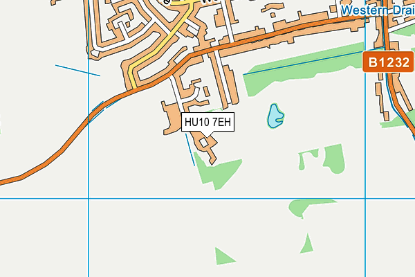
Tranby is located in Anlaby, Hull and falls under the local authority of East Riding of Yorkshire. The school's religious denomination is Christian. This mixed-sex school has 519 pupils, with a capacity of 864, aged from three up to eighteen, and the type of establishment is other independent school.
| Address | Tranby Tranby Croft Anlaby Hull HU10 7EH |
| Website | https://www.tranby.org.uk |
| Headteacher | Mrs Alex Wilson |
GetTheData
Source: Get Information About Schools
Licence: Open Government Licence
| Phase of Education | Not applicable |
| Type of Establishment | Other independent school |
| Admissions Policy | Selective |
| Statutory Low Age | 3 |
| Statutory High Age | 18 |
| Boarders | No boarders |
| Boarding Establishment | Does not have boarders |
| Official Sixth Form | Has a sixth form |
| Gender | Mixed |
| Religious Character | Christian |
| Diocese | Not applicable |
| Special Classes | No Special Classes |
GetTheData
Source: Get Information About Schools
Licence: Open Government Licence
| Census Date | 20th January 2022 | |
| School Capacity | 864 | |
| Number of Pupils | 519 | 60% capacity |
| Number of Boys | 251 | 48% |
| Number of Girls | 268 | 52% |
| Free School Meals (%) | 0.0% |
GetTheData
Source: Get Information About Schools
Licence: Open Government Licence
| Street Address | Tranby Croft |
| Locality | Anlaby |
| Town | Hull |
| Postcode | HU10 7EH |
| ➜ More HU10 7EH open data | |
GetTheData
Source: Get Information About Schools
Licence: Open Government Licence

GetTheData
Source: OS VectorMap District (Ordnance Survey)
Licence: Open Government Licence (requires attribution)
| Ofsted Special Measures | Not applicable |
GetTheData
Source: Get Information About Schools
Licence: Open Government Licence
| Establishment Name | Tranby |
| Establishment Number | 6000 |
| Previous Establishment Number | 6010 |
| Unique Reference Number | 118126 |
| Local Authority | East Riding of Yorkshire |
| Local Authority Code | 811 |
| Previous Local Authority | Pre LGR (1996) Humberside |
| Previous Local Authority Code | 920 |
| Government Statistical Service Local Authority Code | E06000011 |
| Government Office Region | Yorkshire and the Humber |
| District | East Riding of Yorkshire |
| District Code | E06000011 |
| Ward | Tranby |
| Parliamentary Constituency | Haltemprice and Howden |
| Urban/Rural Description | (England/Wales) Urban city and town |
| Middle Super Output Area | East Riding of Yorkshire 028 |
| Lower Super Output Area | East Riding of Yorkshire 028A |
GetTheData
Source: Get Information About Schools
Licence: Open Government Licence
| Establishment Status | Open |
| Last Changed Date | 28th November 2023 |
| Reason Establishment Opened | Not applicable |
| Open Date | 1st January 1918 |
| Reason Establishment Closed | Not applicable |
GetTheData
Source: Get Information About Schools
Licence: Open Government Licence
| Teenage Mothers | Not applicable |
| Child Care Facilities | Not applicable |
| Special Educational Needs (SEN) Provision in Primary Care Unit | Not applicable |
| Pupil Referral Unit (PRU) Provides for Educational and Behavioural Difficulties (EBD) | Not applicable |
| Pupil Referral Unit (PRU) Offers Tuition by Another Provider | Not applicable |
GetTheData
Source: Get Information About Schools
Licence: Open Government Licence
| Section 41 Approved | Not approved |
GetTheData
Source: Get Information About Schools
Licence: Open Government Licence
| Trust flag | Not applicable |
| School Sponsor flag | Not applicable |
GetTheData
Source: Get Information About Schools
Licence: Open Government Licence
| Federation flag | Not applicable |
GetTheData
Source: Get Information About Schools
Licence: Open Government Licence
| UK Provider Reference Number | 10007947 |
| Further Education Type | Not applicable |
GetTheData
Source: Get Information About Schools
Licence: Open Government Licence
| Easting | 502430 |
| Northing | 428212 |
| Latitude | 53.74023 |
| Longitude | -0.44849 |
GetTheData
Source: Get Information About Schools
Licence: Open Government Licence
| School | Phase of Education | Distance |
|---|---|---|
| Kirk Ella St Andrew's Community Primary School West Ella Road, Kirk Ella, Hull, HU10 7QL | Primary | 1.2km |
| Springhead Primary School Forty Steps, Anlaby, Hull, HU10 6TW | Primary | 1.6km |
| Anlaby Primary School First Lane, Anlaby, HULL, HU10 6UE | Primary | 1.7km |
| Hessle High School and Penshurst Primary School Tranby House, Heads Lane, Hessle, HU13 0JQ | All-through | 1.7km |
| St Thomas More Voluntary Catholic Academy St Thomas More Road, Hull, HU4 7NP | Primary | 1.9km |
| All Saints Church of England Junior Academy Northolme Road, Hessle, HU13 9JD | Primary | 2km |
| All Saints Church of England Infant Academy Northolme Road, Hessle, HU13 9JD | Primary | 2km |
| Wolfreton School and Sixth Form College Wolfreton School and Sixth Form College, Well Lane, Willerby, Hull, HU10 6HB | Secondary | 2.1km |
| Willerby Carr Lane Primary School Carr Lane, Willerby, Hull, HU10 6JT | Primary | 2.2km |
| The Hub School Springhead Lane, Anlaby Common, Hull, HU5 5YJ | Not applicable | 2.2km |
GetTheData
Source: Get Information About Schools
Licence: Open Government Licence