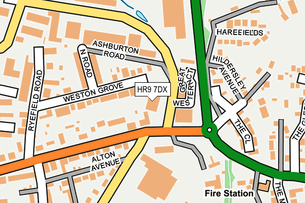
HR9 7DX is located in the Ross East electoral ward, within the unitary authority of Herefordshire, County of and the English Parliamentary constituency of Hereford and South Herefordshire. The Sub Integrated Care Board (ICB) Location is NHS Herefordshire and Worcestershire ICB - 18C and the police force is West Mercia. This postcode has been in use since May 1994.


GetTheData
Source: OS OpenMap – Local (Ordnance Survey)
Source: OS VectorMap District (Ordnance Survey)
Licence: Open Government Licence (requires attribution)
| Easting | 360791 |
| Northing | 224216 |
| Latitude | 51.915083 |
| Longitude | -2.571454 |
GetTheData
Source: Open Postcode Geo
Licence: Open Government Licence
| Country | England |
| Postcode District | HR9 |
➜ See where HR9 is on a map ➜ Where is Ross-on-Wye? | |
GetTheData
Source: Land Registry Price Paid Data
Licence: Open Government Licence
Elevation or altitude of HR9 7DX as distance above sea level:
| Metres | Feet | |
|---|---|---|
| Elevation | 40m | 131ft |
Elevation is measured from the approximate centre of the postcode, to the nearest point on an OS contour line from OS Terrain 50, which has contour spacing of ten vertical metres.
➜ How high above sea level am I? Find the elevation of your current position using your device's GPS.
GetTheData
Source: Open Postcode Elevation
Licence: Open Government Licence
| Ward | Ross East |
| Constituency | Hereford And South Herefordshire |
GetTheData
Source: ONS Postcode Database
Licence: Open Government Licence
| Wolf Business Park (Alton Road) | Ross-on-wye | 163m |
| Camp Road (Gloucester Road) | Ross-on-wye | 197m |
| Camp Road (Gloucester Road) | Ross-on-wye | 235m |
| Fire Station (A40) | Hildersley | 264m |
| Fire Station (A40) | Hildersley | 298m |
GetTheData
Source: NaPTAN
Licence: Open Government Licence
GetTheData
Source: ONS Postcode Database
Licence: Open Government Licence


➜ Get more ratings from the Food Standards Agency
GetTheData
Source: Food Standards Agency
Licence: FSA terms & conditions
| Last Collection | |||
|---|---|---|---|
| Location | Mon-Fri | Sat | Distance |
| Ross On Wye Sorting Office | 18:00 | 11:45 | 348m |
| Smallbrook Road | 17:00 | 11:00 | 480m |
| Alton Road | 16:30 | 11:00 | 639m |
GetTheData
Source: Dracos
Licence: Creative Commons Attribution-ShareAlike
The below table lists the International Territorial Level (ITL) codes (formerly Nomenclature of Territorial Units for Statistics (NUTS) codes) and Local Administrative Units (LAU) codes for HR9 7DX:
| ITL 1 Code | Name |
|---|---|
| TLG | West Midlands (England) |
| ITL 2 Code | Name |
| TLG1 | Herefordshire, Worcestershire and Warwickshire |
| ITL 3 Code | Name |
| TLG11 | Herefordshire, County of |
| LAU 1 Code | Name |
| E06000019 | Herefordshire, County of |
GetTheData
Source: ONS Postcode Directory
Licence: Open Government Licence
The below table lists the Census Output Area (OA), Lower Layer Super Output Area (LSOA), and Middle Layer Super Output Area (MSOA) for HR9 7DX:
| Code | Name | |
|---|---|---|
| OA | E00071003 | |
| LSOA | E01014062 | Herefordshire 022B |
| MSOA | E02002926 | Herefordshire 022 |
GetTheData
Source: ONS Postcode Directory
Licence: Open Government Licence
| HR9 5PW | Gloucester Road | 74m |
| HR9 5LY | Mablethorpe Place | 87m |
| HR9 5LU | Weston Grove | 112m |
| HR9 5LZ | North Road | 152m |
| HR9 5NA | Gloucester Road | 163m |
| HR9 7NQ | Hildersley Avenue | 173m |
| HR9 5LX | Penyard Villas | 182m |
| HR9 7AF | The Close | 187m |
| HR9 5NQ | Alton Avenue | 188m |
| HR9 7NL | Harefields | 206m |
GetTheData
Source: Open Postcode Geo; Land Registry Price Paid Data
Licence: Open Government Licence