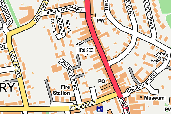
HR8 2BZ is located in the Ledbury North electoral ward, within the unitary authority of Herefordshire, County of and the English Parliamentary constituency of North Herefordshire. The Sub Integrated Care Board (ICB) Location is NHS Herefordshire and Worcestershire ICB - 18C and the police force is West Mercia. This postcode has been in use since January 1983.


GetTheData
Source: OS OpenMap – Local (Ordnance Survey)
Source: OS VectorMap District (Ordnance Survey)
Licence: Open Government Licence (requires attribution)
| Easting | 370962 |
| Northing | 237855 |
| Latitude | 52.038330 |
| Longitude | -2.424745 |
GetTheData
Source: Open Postcode Geo
Licence: Open Government Licence
| Country | England |
| Postcode District | HR8 |
➜ See where HR8 is on a map ➜ Where is Ledbury? | |
GetTheData
Source: Land Registry Price Paid Data
Licence: Open Government Licence
Elevation or altitude of HR8 2BZ as distance above sea level:
| Metres | Feet | |
|---|---|---|
| Elevation | 70m | 230ft |
Elevation is measured from the approximate centre of the postcode, to the nearest point on an OS contour line from OS Terrain 50, which has contour spacing of ten vertical metres.
➜ How high above sea level am I? Find the elevation of your current position using your device's GPS.
GetTheData
Source: Open Postcode Elevation
Licence: Open Government Licence
| Ward | Ledbury North |
| Constituency | North Herefordshire |
GetTheData
Source: ONS Postcode Database
Licence: Open Government Licence
| Old Hospital (The Homend) | Ledbury | 145m |
| Bye Street | Ledbury | 180m |
| Bye Street | Ledbury | 191m |
| Market House (High Street) | Ledbury | 205m |
| Memorial (High Street) | Ledbury | 210m |
| Ledbury Station | 0.8km |
| Colwall Station | 6.6km |
GetTheData
Source: NaPTAN
Licence: Open Government Licence
| Percentage of properties with Next Generation Access | 100.0% |
| Percentage of properties with Superfast Broadband | 100.0% |
| Percentage of properties with Ultrafast Broadband | 0.0% |
| Percentage of properties with Full Fibre Broadband | 0.0% |
Superfast Broadband is between 30Mbps and 300Mbps
Ultrafast Broadband is > 300Mbps
| Percentage of properties unable to receive 2Mbps | 0.0% |
| Percentage of properties unable to receive 5Mbps | 0.0% |
| Percentage of properties unable to receive 10Mbps | 0.0% |
| Percentage of properties unable to receive 30Mbps | 0.0% |
GetTheData
Source: Ofcom
Licence: Ofcom Terms of Use (requires attribution)
GetTheData
Source: ONS Postcode Database
Licence: Open Government Licence


➜ Get more ratings from the Food Standards Agency
GetTheData
Source: Food Standards Agency
Licence: FSA terms & conditions
| Last Collection | |||
|---|---|---|---|
| Location | Mon-Fri | Sat | Distance |
| Ledbury Post Office | 17:30 | 12:00 | 115m |
| High Street | 17:30 | 11:00 | 242m |
| New Street | 17:00 | 11:00 | 321m |
GetTheData
Source: Dracos
Licence: Creative Commons Attribution-ShareAlike
The below table lists the International Territorial Level (ITL) codes (formerly Nomenclature of Territorial Units for Statistics (NUTS) codes) and Local Administrative Units (LAU) codes for HR8 2BZ:
| ITL 1 Code | Name |
|---|---|
| TLG | West Midlands (England) |
| ITL 2 Code | Name |
| TLG1 | Herefordshire, Worcestershire and Warwickshire |
| ITL 3 Code | Name |
| TLG11 | Herefordshire, County of |
| LAU 1 Code | Name |
| E06000019 | Herefordshire, County of |
GetTheData
Source: ONS Postcode Directory
Licence: Open Government Licence
The below table lists the Census Output Area (OA), Lower Layer Super Output Area (LSOA), and Middle Layer Super Output Area (MSOA) for HR8 2BZ:
| Code | Name | |
|---|---|---|
| OA | E00070891 | |
| LSOA | E01014035 | Herefordshire 019A |
| MSOA | E02002923 | Herefordshire 019 |
GetTheData
Source: ONS Postcode Directory
Licence: Open Government Licence
| HR8 1BT | The Homend | 51m |
| HR8 2GQ | Fox Lane | 62m |
| HR8 2AD | Masefield Close | 80m |
| HR8 1BX | The Homend | 91m |
| HR8 1EZ | Plough Yard | 95m |
| HR8 1BP | The Homend | 98m |
| HR8 2AF | Belle Orchard Close | 108m |
| HR8 1AA | Bank Crescent | 132m |
| HR8 1BN | The Homend | 140m |
| HR8 1DB | The Homend | 148m |
GetTheData
Source: Open Postcode Geo; Land Registry Price Paid Data
Licence: Open Government Licence