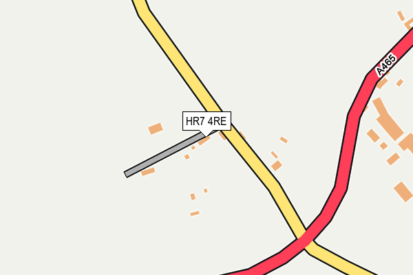
HR7 4RE is in Stoke Lacy, Bromyard. HR7 4RE is located in the Three Crosses electoral ward, within the unitary authority of Herefordshire, County of and the English Parliamentary constituency of North Herefordshire. The Sub Integrated Care Board (ICB) Location is NHS Herefordshire and Worcestershire ICB - 18C and the police force is West Mercia. This postcode has been in use since January 1980.


GetTheData
Source: OS OpenMap – Local (Ordnance Survey)
Source: OS VectorMap District (Ordnance Survey)
Licence: Open Government Licence (requires attribution)
| Easting | 361448 |
| Northing | 249094 |
| Latitude | 52.138799 |
| Longitude | -2.564712 |
GetTheData
Source: Open Postcode Geo
Licence: Open Government Licence
| Locality | Stoke Lacy |
| Town/City | Bromyard |
| Country | England |
| Postcode District | HR7 |
➜ See where HR7 is on a map ➜ Where is Stoke Lacy? | |
GetTheData
Source: Land Registry Price Paid Data
Licence: Open Government Licence
Elevation or altitude of HR7 4RE as distance above sea level:
| Metres | Feet | |
|---|---|---|
| Elevation | 120m | 394ft |
Elevation is measured from the approximate centre of the postcode, to the nearest point on an OS contour line from OS Terrain 50, which has contour spacing of ten vertical metres.
➜ How high above sea level am I? Find the elevation of your current position using your device's GPS.
GetTheData
Source: Open Postcode Elevation
Licence: Open Government Licence
| Ward | Three Crosses |
| Constituency | North Herefordshire |
GetTheData
Source: ONS Postcode Database
Licence: Open Government Licence
| Plough Inn (A465 Bromyard Road) | Stoke Lacy | 1,511m |
| Plough Inn (A465 Bromyard Road) | Stoke Lacy | 1,539m |
GetTheData
Source: NaPTAN
Licence: Open Government Licence
| Percentage of properties with Next Generation Access | 100.0% |
| Percentage of properties with Superfast Broadband | 100.0% |
| Percentage of properties with Ultrafast Broadband | 100.0% |
| Percentage of properties with Full Fibre Broadband | 100.0% |
Superfast Broadband is between 30Mbps and 300Mbps
Ultrafast Broadband is > 300Mbps
| Percentage of properties unable to receive 2Mbps | 0.0% |
| Percentage of properties unable to receive 5Mbps | 0.0% |
| Percentage of properties unable to receive 10Mbps | 0.0% |
| Percentage of properties unable to receive 30Mbps | 0.0% |
GetTheData
Source: Ofcom
Licence: Ofcom Terms of Use (requires attribution)
Estimated total energy consumption in HR7 4RE by fuel type, 2015.
| Consumption (kWh) | 37,295 |
|---|---|
| Meter count | 6 |
| Mean (kWh/meter) | 6,216 |
| Median (kWh/meter) | 4,481 |
GetTheData
Source: Postcode level gas estimates: 2015 (experimental)
Source: Postcode level electricity estimates: 2015 (experimental)
Licence: Open Government Licence
GetTheData
Source: ONS Postcode Database
Licence: Open Government Licence

➜ Get more ratings from the Food Standards Agency
GetTheData
Source: Food Standards Agency
Licence: FSA terms & conditions
| Last Collection | |||
|---|---|---|---|
| Location | Mon-Fri | Sat | Distance |
| Much Cowarne | 09:15 | 09:15 | 1,995m |
| Little Cowarne | 09:00 | 09:00 | 2,050m |
| Burley Gate P.o. | 16:00 | 12:30 | 2,449m |
GetTheData
Source: Dracos
Licence: Creative Commons Attribution-ShareAlike
The below table lists the International Territorial Level (ITL) codes (formerly Nomenclature of Territorial Units for Statistics (NUTS) codes) and Local Administrative Units (LAU) codes for HR7 4RE:
| ITL 1 Code | Name |
|---|---|
| TLG | West Midlands (England) |
| ITL 2 Code | Name |
| TLG1 | Herefordshire, Worcestershire and Warwickshire |
| ITL 3 Code | Name |
| TLG11 | Herefordshire, County of |
| LAU 1 Code | Name |
| E06000019 | Herefordshire, County of |
GetTheData
Source: ONS Postcode Directory
Licence: Open Government Licence
The below table lists the Census Output Area (OA), Lower Layer Super Output Area (LSOA), and Middle Layer Super Output Area (MSOA) for HR7 4RE:
| Code | Name | |
|---|---|---|
| OA | E00070695 | |
| LSOA | E01014004 | Herefordshire 005E |
| MSOA | E02002909 | Herefordshire 005 |
GetTheData
Source: ONS Postcode Directory
Licence: Open Government Licence
| HR7 4RA | 267m | |
| HR7 4HJ | 621m | |
| HR7 4RB | 647m | |
| HR7 4HH | 704m | |
| HR7 4RF | 869m | |
| HR1 3QY | Brickyard Cottages | 1265m |
| HR7 4HQ | 1430m | |
| HR7 4RG | 1448m | |
| HR7 4JE | Tan House Court | 1462m |
| HR7 4HG | 1490m |
GetTheData
Source: Open Postcode Geo; Land Registry Price Paid Data
Licence: Open Government Licence