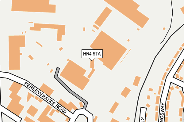
HR4 9TA lies on Holmer Road in Hereford. HR4 9TA is located in the Widemarsh electoral ward, within the unitary authority of Herefordshire, County of and the English Parliamentary constituency of Hereford and South Herefordshire. The Sub Integrated Care Board (ICB) Location is NHS Herefordshire and Worcestershire ICB - 18C and the police force is West Mercia. This postcode has been in use since July 1986.


GetTheData
Source: OS OpenMap – Local (Ordnance Survey)
Source: OS VectorMap District (Ordnance Survey)
Licence: Open Government Licence (requires attribution)
| Easting | 350919 |
| Northing | 241458 |
| Latitude | 52.069304 |
| Longitude | -2.717442 |
GetTheData
Source: Open Postcode Geo
Licence: Open Government Licence
| Street | Holmer Road |
| Town/City | Hereford |
| Country | England |
| Postcode District | HR4 |
➜ See where HR4 is on a map ➜ Where is Hereford? | |
GetTheData
Source: Land Registry Price Paid Data
Licence: Open Government Licence
Elevation or altitude of HR4 9TA as distance above sea level:
| Metres | Feet | |
|---|---|---|
| Elevation | 60m | 197ft |
Elevation is measured from the approximate centre of the postcode, to the nearest point on an OS contour line from OS Terrain 50, which has contour spacing of ten vertical metres.
➜ How high above sea level am I? Find the elevation of your current position using your device's GPS.
GetTheData
Source: Open Postcode Elevation
Licence: Open Government Licence
| Ward | Widemarsh |
| Constituency | Hereford And South Herefordshire |
GetTheData
Source: ONS Postcode Database
Licence: Open Government Licence
MORTIMER HOUSE, HOLMER ROAD, HEREFORD, HR4 9TA 2000 28 APR £275,000 |
GetTheData
Source: HM Land Registry Price Paid Data
Licence: Contains HM Land Registry data © Crown copyright and database right 2025. This data is licensed under the Open Government Licence v3.0.
| Kingsway | College Green | 264m |
| Holmer Primary School (Holmer Road) | Hereford | 339m |
| Holmer Primary School (Holmer Road. Hereford) | Hereford | 350m |
| Leisure Centre (Holmer Road) | Hereford | 369m |
| Post Office (College Green) | College Green | 396m |
| Hereford Station | 1.1km |
GetTheData
Source: NaPTAN
Licence: Open Government Licence
GetTheData
Source: ONS Postcode Database
Licence: Open Government Licence


➜ Get more ratings from the Food Standards Agency
GetTheData
Source: Food Standards Agency
Licence: FSA terms & conditions
| Last Collection | |||
|---|---|---|---|
| Location | Mon-Fri | Sat | Distance |
| Commercial Road | 18:30 | 12:00 | 1,292m |
| Commercial Street | 18:30 | 11:30 | 1,345m |
| Kempton Avenue | 18:15 | 11:45 | 1,395m |
GetTheData
Source: Dracos
Licence: Creative Commons Attribution-ShareAlike
The below table lists the International Territorial Level (ITL) codes (formerly Nomenclature of Territorial Units for Statistics (NUTS) codes) and Local Administrative Units (LAU) codes for HR4 9TA:
| ITL 1 Code | Name |
|---|---|
| TLG | West Midlands (England) |
| ITL 2 Code | Name |
| TLG1 | Herefordshire, Worcestershire and Warwickshire |
| ITL 3 Code | Name |
| TLG11 | Herefordshire, County of |
| LAU 1 Code | Name |
| E06000019 | Herefordshire, County of |
GetTheData
Source: ONS Postcode Directory
Licence: Open Government Licence
The below table lists the Census Output Area (OA), Lower Layer Super Output Area (LSOA), and Middle Layer Super Output Area (MSOA) for HR4 9TA:
| Code | Name | |
|---|---|---|
| OA | E00071139 | |
| LSOA | E01014084 | Herefordshire 010B |
| MSOA | E02002914 | Herefordshire 010 |
GetTheData
Source: ONS Postcode Directory
Licence: Open Government Licence
| HR4 9SN | Perseverance Road | 247m |
| HR1 1HD | Kingsway | 251m |
| HR4 9SP | Mortimer Road | 261m |
| HR1 1HP | College Green | 293m |
| HR1 1GY | Kings Crescent | 296m |
| HR4 9SB | Holmer Road | 302m |
| HR1 1HE | Kingsway | 337m |
| HR4 9LW | Burcott Road | 345m |
| HR1 1HB | Kingsway | 390m |
| HR1 1HJ | Princess Avenue | 391m |
GetTheData
Source: Open Postcode Geo; Land Registry Price Paid Data
Licence: Open Government Licence