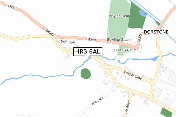
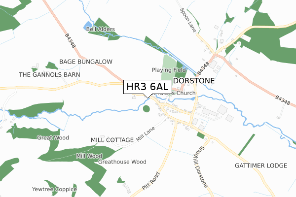
HR3 6AL is located in the Castle electoral ward, within the unitary authority of Herefordshire, County of and the English Parliamentary constituency of North Herefordshire. The Sub Integrated Care Board (ICB) Location is NHS Herefordshire and Worcestershire ICB - 18C and the police force is West Mercia. This postcode has been in use since March 2019.


GetTheData
Source: OS Open Zoomstack (Ordnance Survey)
Licence: Open Government Licence (requires attribution)
Attribution: Contains OS data © Crown copyright and database right 2024
Source: Open Postcode Geo
Licence: Open Government Licence (requires attribution)
Attribution: Contains OS data © Crown copyright and database right 2024; Contains Royal Mail data © Royal Mail copyright and database right 2024; Source: Office for National Statistics licensed under the Open Government Licence v.3.0
| Easting | 329765 |
| Northing | 247089 |
| Latitude | 52.117647 |
| Longitude | -3.027174 |
GetTheData
Source: Open Postcode Geo
Licence: Open Government Licence
| Country | England |
| Postcode District | HR3 |
| ➜ HR3 open data dashboard ➜ See where HR3 is on a map ➜ Where is Winforton? | |
GetTheData
Source: Land Registry Price Paid Data
Licence: Open Government Licence
| Ward | Castle |
| Constituency | North Herefordshire |
GetTheData
Source: ONS Postcode Database
Licence: Open Government Licence
2023 31 MAR £375,000 |
2022 23 JUN £405,000 |
2020 25 SEP £395,000 |
GetTheData
Source: HM Land Registry Price Paid Data
Licence: Contains HM Land Registry data © Crown copyright and database right 2024. This data is licensed under the Open Government Licence v3.0.
| April 2022 | Violence and sexual offences | On or near Winforton Common Road | 361m |
| March 2022 | Other theft | On or near The Vineyards | 269m |
| February 2022 | Public order | On or near The Vineyards | 269m |
| ➜ Get more crime data in our Crime section | |||
GetTheData
Source: data.police.uk
Licence: Open Government Licence
| Sun Inn (A438) | Winforton | 56m |
| Sun Inn (A438) | Winforton | 84m |
GetTheData
Source: NaPTAN
Licence: Open Government Licence
GetTheData
Source: ONS Postcode Database
Licence: Open Government Licence


➜ Get more ratings from the Food Standards Agency
GetTheData
Source: Food Standards Agency
Licence: FSA terms & conditions
| Last Collection | |||
|---|---|---|---|
| Location | Mon-Fri | Sat | Distance |
| Bedwardine P.o. | 14:45 | 10:00 | 4,232m |
| Aberllynfi | 10:00 | 10:00 | 5,339m |
GetTheData
Source: Dracos
Licence: Creative Commons Attribution-ShareAlike
| Facility | Distance |
|---|---|
| Eardisley Tennis Club Eardisley, Hereford Outdoor Tennis Courts | 2.3km |
| Eardisley C Of E Primary School Eardisley, Hereford Grass Pitches | 2.6km |
| Cilfford Primary School Hardwicke, Y Gelli Gandryll, Hereford Grass Pitches | 4km |
GetTheData
Source: Active Places
Licence: Open Government Licence
| School | Phase of Education | Distance |
|---|---|---|
| Eardisley CofE Primary School Eardisley, Hereford, HR3 6NS | Primary | 2.6km |
| Clifford Primary School Hardwicke, Hay-on-Wye, Clifford, HR3 5HA | Primary | 3.9km |
| Almeley Primary School Almeley, Hereford, HR3 6LH | Primary | 5.9km |
GetTheData
Source: Edubase
Licence: Open Government Licence
| Risk of HR3 6AL flooding from rivers and sea | High |
| ➜ HR3 6AL flood map | |
GetTheData
Source: Open Flood Risk by Postcode
Licence: Open Government Licence
The below table lists the International Territorial Level (ITL) codes (formerly Nomenclature of Territorial Units for Statistics (NUTS) codes) and Local Administrative Units (LAU) codes for HR3 6AL:
| ITL 1 Code | Name |
|---|---|
| TLG | West Midlands (England) |
| ITL 2 Code | Name |
| TLG1 | Herefordshire, Worcestershire and Warwickshire |
| ITL 3 Code | Name |
| TLG11 | Herefordshire, County of |
| LAU 1 Code | Name |
| E06000019 | Herefordshire, County of |
GetTheData
Source: ONS Postcode Directory
Licence: Open Government Licence
The below table lists the Census Output Area (OA), Lower Layer Super Output Area (LSOA), and Middle Layer Super Output Area (MSOA) for HR3 6AL:
| Code | Name | |
|---|---|---|
| OA | E00070719 | |
| LSOA | E01014009 | Herefordshire 006B |
| MSOA | E02002910 | Herefordshire 006 |
GetTheData
Source: ONS Postcode Directory
Licence: Open Government Licence
| HR3 6EA | 115m | |
| HR3 6EF | Courtlands | 251m |
| HR3 6EB | 432m | |
| HR3 6EJ | 1555m | |
| HR3 6EE | 1688m | |
| HR3 6DE | 1772m | |
| HR3 5HB | 1851m | |
| HR3 6NT | 2092m | |
| HR3 6LZ | 2169m | |
| HR3 6HY | 2269m |
GetTheData
Source: Open Postcode Geo; Land Registry Price Paid Data
Licence: Open Government Licence