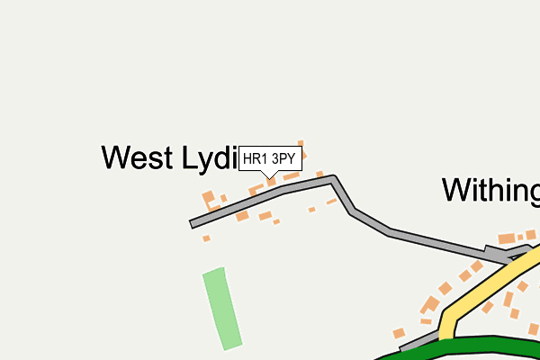
HR1 3PY is in Withington, Hereford. HR1 3PY is located in the Hagley electoral ward, within the unitary authority of Herefordshire, County of and the English Parliamentary constituency of North Herefordshire. The Sub Integrated Care Board (ICB) Location is NHS Herefordshire and Worcestershire ICB - 18C and the police force is West Mercia. This postcode has been in use since January 1980.


GetTheData
Source: OS OpenMap – Local (Ordnance Survey)
Source: OS VectorMap District (Ordnance Survey)
Licence: Open Government Licence (requires attribution)
| Easting | 355786 |
| Northing | 243042 |
| Latitude | 52.083955 |
| Longitude | -2.646650 |
GetTheData
Source: Open Postcode Geo
Licence: Open Government Licence
| Locality | Withington |
| Town/City | Hereford |
| Country | England |
| Postcode District | HR1 |
➜ See where HR1 is on a map ➜ Where is West Lydiatt? | |
GetTheData
Source: Land Registry Price Paid Data
Licence: Open Government Licence
Elevation or altitude of HR1 3PY as distance above sea level:
| Metres | Feet | |
|---|---|---|
| Elevation | 70m | 230ft |
Elevation is measured from the approximate centre of the postcode, to the nearest point on an OS contour line from OS Terrain 50, which has contour spacing of ten vertical metres.
➜ How high above sea level am I? Find the elevation of your current position using your device's GPS.
GetTheData
Source: Open Postcode Elevation
Licence: Open Government Licence
| Ward | Hagley |
| Constituency | North Herefordshire |
GetTheData
Source: ONS Postcode Database
Licence: Open Government Licence
| Village Hall (Withies Road) | Withington | 425m |
| Village Hall (Withies Road) | Withington | 509m |
| Southbank (Whitestone To Withington Road) | Withington | 661m |
| Southbank (Whitestone To Withington Road) | Withington | 673m |
| Crossroads (Withington Road) | White Stone | 719m |
| Hereford Station | 4.9km |
GetTheData
Source: NaPTAN
Licence: Open Government Licence
| Percentage of properties with Next Generation Access | 87.5% |
| Percentage of properties with Superfast Broadband | 87.5% |
| Percentage of properties with Ultrafast Broadband | 87.5% |
| Percentage of properties with Full Fibre Broadband | 87.5% |
Superfast Broadband is between 30Mbps and 300Mbps
Ultrafast Broadband is > 300Mbps
| Percentage of properties unable to receive 2Mbps | 0.0% |
| Percentage of properties unable to receive 5Mbps | 0.0% |
| Percentage of properties unable to receive 10Mbps | 12.5% |
| Percentage of properties unable to receive 30Mbps | 12.5% |
GetTheData
Source: Ofcom
Licence: Ofcom Terms of Use (requires attribution)
Estimated total energy consumption in HR1 3PY by fuel type, 2015.
| Consumption (kWh) | 26,690 |
|---|---|
| Meter count | 7 |
| Mean (kWh/meter) | 3,813 |
| Median (kWh/meter) | 3,192 |
GetTheData
Source: Postcode level gas estimates: 2015 (experimental)
Source: Postcode level electricity estimates: 2015 (experimental)
Licence: Open Government Licence
GetTheData
Source: ONS Postcode Database
Licence: Open Government Licence


➜ Get more ratings from the Food Standards Agency
GetTheData
Source: Food Standards Agency
Licence: FSA terms & conditions
| Last Collection | |||
|---|---|---|---|
| Location | Mon-Fri | Sat | Distance |
| Withington P.o. | 16:30 | 11:00 | 433m |
| Nunnington | 14:00 | 11:00 | 783m |
| Withington Church | 12:00 | 08:00 | 785m |
GetTheData
Source: Dracos
Licence: Creative Commons Attribution-ShareAlike
The below table lists the International Territorial Level (ITL) codes (formerly Nomenclature of Territorial Units for Statistics (NUTS) codes) and Local Administrative Units (LAU) codes for HR1 3PY:
| ITL 1 Code | Name |
|---|---|
| TLG | West Midlands (England) |
| ITL 2 Code | Name |
| TLG1 | Herefordshire, Worcestershire and Warwickshire |
| ITL 3 Code | Name |
| TLG11 | Herefordshire, County of |
| LAU 1 Code | Name |
| E06000019 | Herefordshire, County of |
GetTheData
Source: ONS Postcode Directory
Licence: Open Government Licence
The below table lists the Census Output Area (OA), Lower Layer Super Output Area (LSOA), and Middle Layer Super Output Area (MSOA) for HR1 3PY:
| Code | Name | |
|---|---|---|
| OA | E00070801 | |
| LSOA | E01014023 | Herefordshire 008B |
| MSOA | E02002912 | Herefordshire 008 |
GetTheData
Source: ONS Postcode Directory
Licence: Open Government Licence
| HR1 3PX | 338m | |
| HR1 3RT | Willowfields | 356m |
| HR1 3RX | 357m | |
| HR1 3PP | Coppice Close | 422m |
| HR1 3RY | 430m | |
| HR1 3RU | Springfield Road | 460m |
| HR1 3PU | Farndon Rise | 478m |
| HR1 3RR | Meadow Close | 492m |
| HR1 3RP | Hill View Avenue | 506m |
| HR1 3RW | Bankfield Drive | 513m |
GetTheData
Source: Open Postcode Geo; Land Registry Price Paid Data
Licence: Open Government Licence