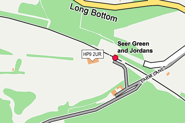
HP9 2UR is located in the Chalfont St Giles electoral ward, within the unitary authority of Buckinghamshire and the English Parliamentary constituency of Chesham and Amersham. The Sub Integrated Care Board (ICB) Location is NHS Buckinghamshire, Oxfordshire and Berkshire West ICB - 14Y and the police force is Thames Valley. This postcode has been in use since January 1980.


GetTheData
Source: OS OpenMap – Local (Ordnance Survey)
Source: OS VectorMap District (Ordnance Survey)
Licence: Open Government Licence (requires attribution)
| Easting | 496436 |
| Northing | 191006 |
| Latitude | 51.609641 |
| Longitude | -0.608729 |
GetTheData
Source: Open Postcode Geo
Licence: Open Government Licence
| Country | England |
| Postcode District | HP9 |
➜ See where HP9 is on a map | |
GetTheData
Source: Land Registry Price Paid Data
Licence: Open Government Licence
Elevation or altitude of HP9 2UR as distance above sea level:
| Metres | Feet | |
|---|---|---|
| Elevation | 90m | 295ft |
Elevation is measured from the approximate centre of the postcode, to the nearest point on an OS contour line from OS Terrain 50, which has contour spacing of ten vertical metres.
➜ How high above sea level am I? Find the elevation of your current position using your device's GPS.
GetTheData
Source: Open Postcode Elevation
Licence: Open Government Licence
| Ward | Chalfont St Giles |
| Constituency | Chesham And Amersham |
GetTheData
Source: ONS Postcode Database
Licence: Open Government Licence
| Railway Station (Longbottom Lane) | Seer Green | 191m |
| Railway Station (Longbottom Lane) | Seer Green | 196m |
| Stable Lane (School Lane) | Seer Green | 619m |
| Bottom Lane (Longbottom Lane) | Seer Green | 654m |
| Stable Lane (School Lane) | Seer Green | 687m |
| Seer Green Station | 0.1km |
| Beaconsfield Station | 2.4km |
| Gerrards Cross Station | 4.4km |
GetTheData
Source: NaPTAN
Licence: Open Government Licence
GetTheData
Source: ONS Postcode Database
Licence: Open Government Licence


➜ Get more ratings from the Food Standards Agency
GetTheData
Source: Food Standards Agency
Licence: FSA terms & conditions
| Last Collection | |||
|---|---|---|---|
| Location | Mon-Fri | Sat | Distance |
| Longbottom | 17:00 | 09:30 | 682m |
| Seer Green P.o. | 18:00 | 09:30 | 991m |
| Jordans Village P.o. | 18:00 | 09:30 | 998m |
GetTheData
Source: Dracos
Licence: Creative Commons Attribution-ShareAlike
The below table lists the International Territorial Level (ITL) codes (formerly Nomenclature of Territorial Units for Statistics (NUTS) codes) and Local Administrative Units (LAU) codes for HP9 2UR:
| ITL 1 Code | Name |
|---|---|
| TLJ | South East (England) |
| ITL 2 Code | Name |
| TLJ1 | Berkshire, Buckinghamshire and Oxfordshire |
| ITL 3 Code | Name |
| TLJ13 | Buckinghamshire |
| LAU 1 Code | Name |
| E06000060 | Buckinghamshire |
GetTheData
Source: ONS Postcode Directory
Licence: Open Government Licence
The below table lists the Census Output Area (OA), Lower Layer Super Output Area (LSOA), and Middle Layer Super Output Area (MSOA) for HP9 2UR:
| Code | Name | |
|---|---|---|
| OA | E00089784 | |
| LSOA | E01017794 | Chiltern 010D |
| MSOA | E02003685 | Chiltern 010 |
GetTheData
Source: ONS Postcode Directory
Licence: Open Government Licence
| HP9 2UL | Long Bottom Lane | 264m |
| HP9 2QQ | Bayne Hill Close | 340m |
| HP9 2UU | Dean Wood Road | 399m |
| HP9 2QG | Vicarage Close | 469m |
| HP9 2QJ | School Lane | 496m |
| HP9 2UW | Wilton Lane | 509m |
| HP9 2QH | Long Grove | 519m |
| HP9 2QL | Seer Mead | 555m |
| HP9 2SZ | Beech Lane | 633m |
| HP9 2YR | Coat Wicks | 655m |
GetTheData
Source: Open Postcode Geo; Land Registry Price Paid Data
Licence: Open Government Licence