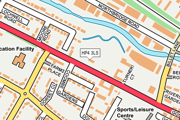
HP4 3LS is located in the Berkhamsted West electoral ward, within the local authority district of Dacorum and the English Parliamentary constituency of South West Hertfordshire. The Sub Integrated Care Board (ICB) Location is NHS Hertfordshire and West Essex ICB - 06N and the police force is Hertfordshire. This postcode has been in use since January 1980.


GetTheData
Source: OS OpenMap – Local (Ordnance Survey)
Source: OS VectorMap District (Ordnance Survey)
Licence: Open Government Licence (requires attribution)
| Easting | 497967 |
| Northing | 208467 |
| Latitude | 51.766328 |
| Longitude | -0.581727 |
GetTheData
Source: Open Postcode Geo
Licence: Open Government Licence
| Country | England |
| Postcode District | HP4 |
➜ See where HP4 is on a map ➜ Where is Berkhamsted? | |
GetTheData
Source: Land Registry Price Paid Data
Licence: Open Government Licence
Elevation or altitude of HP4 3LS as distance above sea level:
| Metres | Feet | |
|---|---|---|
| Elevation | 110m | 361ft |
Elevation is measured from the approximate centre of the postcode, to the nearest point on an OS contour line from OS Terrain 50, which has contour spacing of ten vertical metres.
➜ How high above sea level am I? Find the elevation of your current position using your device's GPS.
GetTheData
Source: Open Postcode Elevation
Licence: Open Government Licence
| Ward | Berkhamsted West |
| Constituency | South West Hertfordshire |
GetTheData
Source: ONS Postcode Database
Licence: Open Government Licence
| Durrants Lane (High Street) | Northchurch | 76m |
| Durrants Lane (High Street) | Northchurch | 112m |
| Westfield School (Durrants Lane) | Northchurch | 173m |
| Bourne Road (Durrants Lane) | Shootersway | 232m |
| Bourne Road (Durrants Road) | Shootersway | 234m |
| Berkhamsted Station | 1.4km |
| Tring Station | 4.7km |
GetTheData
Source: NaPTAN
Licence: Open Government Licence
GetTheData
Source: ONS Postcode Database
Licence: Open Government Licence


➜ Get more ratings from the Food Standards Agency
GetTheData
Source: Food Standards Agency
Licence: FSA terms & conditions
| Last Collection | |||
|---|---|---|---|
| Location | Mon-Fri | Sat | Distance |
| Lagley House | 17:30 | 11:30 | 51m |
| Durrants Road | 17:15 | 10:45 | 241m |
| Northbridge Road | 18:30 | 251m | |
GetTheData
Source: Dracos
Licence: Creative Commons Attribution-ShareAlike
The below table lists the International Territorial Level (ITL) codes (formerly Nomenclature of Territorial Units for Statistics (NUTS) codes) and Local Administrative Units (LAU) codes for HP4 3LS:
| ITL 1 Code | Name |
|---|---|
| TLH | East |
| ITL 2 Code | Name |
| TLH2 | Bedfordshire and Hertfordshire |
| ITL 3 Code | Name |
| TLH23 | Hertfordshire CC |
| LAU 1 Code | Name |
| E07000096 | Dacorum |
GetTheData
Source: ONS Postcode Directory
Licence: Open Government Licence
The below table lists the Census Output Area (OA), Lower Layer Super Output Area (LSOA), and Middle Layer Super Output Area (MSOA) for HP4 3LS:
| Code | Name | |
|---|---|---|
| OA | E00118730 | |
| LSOA | E01023370 | Dacorum 012B |
| MSOA | E02004867 | Dacorum 012 |
GetTheData
Source: ONS Postcode Directory
Licence: Open Government Licence
| HP4 3QA | Bulbourne Close | 74m |
| HP4 3ZE | High Street | 93m |
| HP4 3PA | Coombe Gardens | 127m |
| HP4 3PY | Valley Road | 142m |
| HP4 3PE | Douglas Gardens | 152m |
| HP4 3PJ | Durrants Lane | 178m |
| HP4 3PG | Durrants Road | 205m |
| HP4 1EH | Northbridge Road | 210m |
| HP4 3PX | Moore Road | 212m |
| HP4 1DP | Billet Lane | 227m |
GetTheData
Source: Open Postcode Geo; Land Registry Price Paid Data
Licence: Open Government Licence