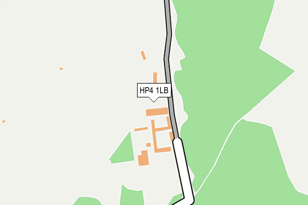
HP4 1LB is in Northchurch, Berkhamsted. HP4 1LB is located in the Northchurch electoral ward, within the local authority district of Dacorum and the English Parliamentary constituency of South West Hertfordshire. The Sub Integrated Care Board (ICB) Location is NHS Hertfordshire and West Essex ICB - 06N and the police force is Hertfordshire. This postcode has been in use since January 1980.


GetTheData
Source: OS OpenMap – Local (Ordnance Survey)
Source: OS VectorMap District (Ordnance Survey)
Licence: Open Government Licence (requires attribution)
| Easting | 496916 |
| Northing | 210593 |
| Latitude | 51.785621 |
| Longitude | -0.596360 |
GetTheData
Source: Open Postcode Geo
Licence: Open Government Licence
| Locality | Northchurch |
| Town/City | Berkhamsted |
| Country | England |
| Postcode District | HP4 |
➜ See where HP4 is on a map ➜ Where is Norcott Hill? | |
GetTheData
Source: Land Registry Price Paid Data
Licence: Open Government Licence
Elevation or altitude of HP4 1LB as distance above sea level:
| Metres | Feet | |
|---|---|---|
| Elevation | 180m | 591ft |
Elevation is measured from the approximate centre of the postcode, to the nearest point on an OS contour line from OS Terrain 50, which has contour spacing of ten vertical metres.
➜ How high above sea level am I? Find the elevation of your current position using your device's GPS.
GetTheData
Source: Open Postcode Elevation
Licence: Open Government Licence
| Ward | Northchurch |
| Constituency | South West Hertfordshire |
GetTheData
Source: ONS Postcode Database
Licence: Open Government Licence
| The Cow Roast Inn (Tring Road) | Cow Roast | 1,142m |
| Hamberlins Lane (Tring Road) | Dudswell | 1,185m |
| Hamberlins Lane (Tring Road) | Dudswell | 1,192m |
| The Cow Roast Inn (Tring Road) | Cow Roast | 1,202m |
| Dudswell Lane (Tring Road) | Dudswell | 1,297m |
| Tring Station | 2.5km |
| Berkhamsted Station | 3.4km |
GetTheData
Source: NaPTAN
Licence: Open Government Licence
| Percentage of properties with Next Generation Access | 100.0% |
| Percentage of properties with Superfast Broadband | 0.0% |
| Percentage of properties with Ultrafast Broadband | 0.0% |
| Percentage of properties with Full Fibre Broadband | 0.0% |
Superfast Broadband is between 30Mbps and 300Mbps
Ultrafast Broadband is > 300Mbps
| Percentage of properties unable to receive 2Mbps | 0.0% |
| Percentage of properties unable to receive 5Mbps | 0.0% |
| Percentage of properties unable to receive 10Mbps | 0.0% |
| Percentage of properties unable to receive 30Mbps | 100.0% |
GetTheData
Source: Ofcom
Licence: Ofcom Terms of Use (requires attribution)
Estimated total energy consumption in HP4 1LB by fuel type, 2015.
| Consumption (kWh) | 64,112 |
|---|---|
| Meter count | 7 |
| Mean (kWh/meter) | 9,159 |
| Median (kWh/meter) | 7,380 |
GetTheData
Source: Postcode level gas estimates: 2015 (experimental)
Source: Postcode level electricity estimates: 2015 (experimental)
Licence: Open Government Licence
GetTheData
Source: ONS Postcode Database
Licence: Open Government Licence


➜ Get more ratings from the Food Standards Agency
GetTheData
Source: Food Standards Agency
Licence: FSA terms & conditions
| Last Collection | |||
|---|---|---|---|
| Location | Mon-Fri | Sat | Distance |
| Dudswell | 17:15 | 11:15 | 1,025m |
| Cow Roast | 16:00 | 07:00 | 1,250m |
| Springwood | 17:15 | 11:30 | 1,488m |
GetTheData
Source: Dracos
Licence: Creative Commons Attribution-ShareAlike
The below table lists the International Territorial Level (ITL) codes (formerly Nomenclature of Territorial Units for Statistics (NUTS) codes) and Local Administrative Units (LAU) codes for HP4 1LB:
| ITL 1 Code | Name |
|---|---|
| TLH | East |
| ITL 2 Code | Name |
| TLH2 | Bedfordshire and Hertfordshire |
| ITL 3 Code | Name |
| TLH23 | Hertfordshire CC |
| LAU 1 Code | Name |
| E07000096 | Dacorum |
GetTheData
Source: ONS Postcode Directory
Licence: Open Government Licence
The below table lists the Census Output Area (OA), Lower Layer Super Output Area (LSOA), and Middle Layer Super Output Area (MSOA) for HP4 1LB:
| Code | Name | |
|---|---|---|
| OA | E00118951 | |
| LSOA | E01023416 | Dacorum 006C |
| MSOA | E02004861 | Dacorum 006 |
GetTheData
Source: ONS Postcode Directory
Licence: Open Government Licence
| HP4 1RB | 43m | |
| HP4 3TG | Wharf Lane | 863m |
| HP4 3YA | Dudswell Mill | 887m |
| HP4 3TF | Dudswell Lane | 963m |
| HP23 5SD | Toms Hill | 970m |
| HP4 3TE | Boswick Lane | 1088m |
| HP4 3TH | Boswick Lane | 1113m |
| HP4 3TA | Tring Road | 1119m |
| HP23 5RE | 1121m | |
| HP4 3TQ | Dudswell Lane | 1171m |
GetTheData
Source: Open Postcode Geo; Land Registry Price Paid Data
Licence: Open Government Licence