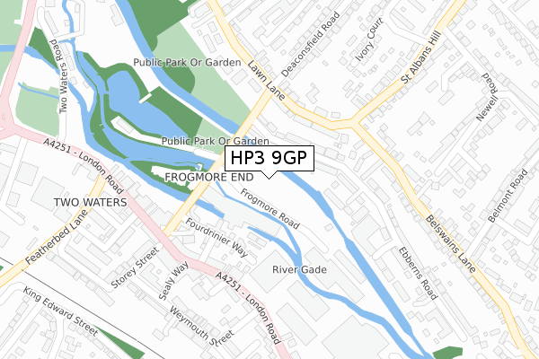
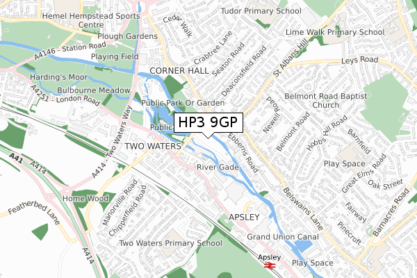
HP3 9GP is located in the Apsley and Corner Hall electoral ward, within the local authority district of Dacorum and the English Parliamentary constituency of Hemel Hempstead. The Sub Integrated Care Board (ICB) Location is NHS Hertfordshire and West Essex ICB - 06N and the police force is Hertfordshire. This postcode has been in use since June 2019.


GetTheData
Source: OS Open Zoomstack (Ordnance Survey)
Licence: Open Government Licence (requires attribution)
Attribution: Contains OS data © Crown copyright and database right 2024
Source: Open Postcode Geo
Licence: Open Government Licence (requires attribution)
Attribution: Contains OS data © Crown copyright and database right 2024; Contains Royal Mail data © Royal Mail copyright and database right 2024; Source: Office for National Statistics licensed under the Open Government Licence v.3.0
| Easting | 505904 |
| Northing | 205598 |
| Latitude | 51.739099 |
| Longitude | -0.467629 |
GetTheData
Source: Open Postcode Geo
Licence: Open Government Licence
| Country | England |
| Postcode District | HP3 |
| ➜ HP3 open data dashboard ➜ See where HP3 is on a map ➜ Where is Hemel Hempstead? | |
GetTheData
Source: Land Registry Price Paid Data
Licence: Open Government Licence
| Ward | Apsley And Corner Hall |
| Constituency | Hemel Hempstead |
GetTheData
Source: ONS Postcode Database
Licence: Open Government Licence
| January 2024 | Violence and sexual offences | On or near Orchard Street | 290m |
| January 2024 | Violence and sexual offences | On or near Orchard Street | 290m |
| January 2024 | Public order | On or near Orchard Street | 290m |
| ➜ Get more crime data in our Crime section | |||
GetTheData
Source: data.police.uk
Licence: Open Government Licence
| Belswains Lane (Lawn Lane) | Frogmore End | 148m |
| Belswains Lane (Lawn Lane) | Frogmore End | 164m |
| Seaton Road (Lawn Lane) | Frogmore End | 226m |
| Durrants Hill Road (London Road) | Two Waters | 245m |
| Durrants Hill Road (London Road) | Two Waters | 290m |
| Apsley Station | 0.8km |
| Hemel Hempstead Station | 1.6km |
| Kings Langley Station | 4.2km |
GetTheData
Source: NaPTAN
Licence: Open Government Licence
GetTheData
Source: ONS Postcode Database
Licence: Open Government Licence


➜ Get more ratings from the Food Standards Agency
GetTheData
Source: Food Standards Agency
Licence: FSA terms & conditions
| Last Collection | |||
|---|---|---|---|
| Location | Mon-Fri | Sat | Distance |
| St Albans Hill P.o. | 17:15 | 12:00 | 215m |
| Apsley P.o. | 18:30 | 12:00 | 265m |
| Woodman Road | 17:30 | 12:00 | 460m |
GetTheData
Source: Dracos
Licence: Creative Commons Attribution-ShareAlike
| Facility | Distance |
|---|---|
| Two Waters Primary School High Ridge Road, Hemel Hempstead Grass Pitches | 679m |
| Hemel Hempstead Town Cricket Club Heath Park, Station Road, Hemel Hempstead Grass Pitches | 755m |
| The Snow Centre Hemel Hempstead St. Albans Hill, Hemel Hempstead Ski Slopes | 934m |
GetTheData
Source: Active Places
Licence: Open Government Licence
| School | Phase of Education | Distance |
|---|---|---|
| Two Waters Primary School High Ridge Close, Apsley, Hemel Hempstead, HP3 0AU | Primary | 679m |
| Tudor Primary School Redwood Drive, Hemel Hempstead, HP3 9ER | Primary | 847m |
| Belswains Primary School Barnfield, Hemel Hempstead, HP3 9QJ | Primary | 934m |
GetTheData
Source: Edubase
Licence: Open Government Licence
| Risk of HP3 9GP flooding from rivers and sea | Medium |
| ➜ HP3 9GP flood map | |
GetTheData
Source: Open Flood Risk by Postcode
Licence: Open Government Licence
The below table lists the International Territorial Level (ITL) codes (formerly Nomenclature of Territorial Units for Statistics (NUTS) codes) and Local Administrative Units (LAU) codes for HP3 9GP:
| ITL 1 Code | Name |
|---|---|
| TLH | East |
| ITL 2 Code | Name |
| TLH2 | Bedfordshire and Hertfordshire |
| ITL 3 Code | Name |
| TLH23 | Hertfordshire CC |
| LAU 1 Code | Name |
| E07000096 | Dacorum |
GetTheData
Source: ONS Postcode Directory
Licence: Open Government Licence
The below table lists the Census Output Area (OA), Lower Layer Super Output Area (LSOA), and Middle Layer Super Output Area (MSOA) for HP3 9GP:
| Code | Name | |
|---|---|---|
| OA | E00118654 | |
| LSOA | E01033023 | Dacorum 018H |
| MSOA | E02004873 | Dacorum 018 |
GetTheData
Source: ONS Postcode Directory
Licence: Open Government Licence
| HP3 9QR | Ebberns Road | 79m |
| HP3 9RP | Fourdrinier Way | 127m |
| HP3 9JF | Lawn Lane | 127m |
| HP3 9BU | Lawn Lane | 156m |
| HP3 9RQ | White Lion Street | 165m |
| HP3 9SB | London Road | 190m |
| HP3 9RG | Mill Street | 191m |
| HP3 9SQ | London Road | 219m |
| HP3 9NE | Oram Place | 227m |
| HP3 9QS | Ebberns Road | 235m |
GetTheData
Source: Open Postcode Geo; Land Registry Price Paid Data
Licence: Open Government Licence