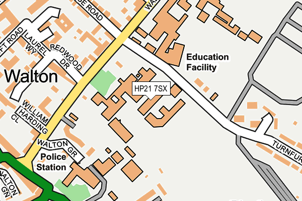
HP21 7SX is located in the Aylesbury South East electoral ward, within the unitary authority of Buckinghamshire and the English Parliamentary constituency of Aylesbury. The Sub Integrated Care Board (ICB) Location is NHS Buckinghamshire, Oxfordshire and Berkshire West ICB - 14Y and the police force is Thames Valley. This postcode has been in use since January 1980.


GetTheData
Source: OS OpenMap – Local (Ordnance Survey)
Source: OS VectorMap District (Ordnance Survey)
Licence: Open Government Licence (requires attribution)
| Easting | 482669 |
| Northing | 213285 |
| Latitude | 51.812095 |
| Longitude | -0.802232 |
GetTheData
Source: Open Postcode Geo
Licence: Open Government Licence
| Country | England |
| Postcode District | HP21 |
➜ See where HP21 is on a map ➜ Where is Aylesbury? | |
GetTheData
Source: Land Registry Price Paid Data
Licence: Open Government Licence
Elevation or altitude of HP21 7SX as distance above sea level:
| Metres | Feet | |
|---|---|---|
| Elevation | 80m | 262ft |
Elevation is measured from the approximate centre of the postcode, to the nearest point on an OS contour line from OS Terrain 50, which has contour spacing of ten vertical metres.
➜ How high above sea level am I? Find the elevation of your current position using your device's GPS.
GetTheData
Source: Open Postcode Elevation
Licence: Open Government Licence
| Ward | Aylesbury South East |
| Constituency | Aylesbury |
GetTheData
Source: ONS Postcode Database
Licence: Open Government Licence
| Grammar School (Walton Road) | Aylesbury | 145m |
| The Pond (Walton Road) | Walton | 203m |
| Police Station (Walton Gyratory) | Aylesbury | 266m |
| Schools Coach Park (Turnfurlong) | Aylesbury | 266m |
| Police Station (Wendover Road) | Aylesbury | 276m |
| Aylesbury Station | 0.9km |
| Stoke Mandeville Station | 3km |
| Aylesbury Vale Parkway Station | 4.5km |
GetTheData
Source: NaPTAN
Licence: Open Government Licence
GetTheData
Source: ONS Postcode Database
Licence: Open Government Licence


➜ Get more ratings from the Food Standards Agency
GetTheData
Source: Food Standards Agency
Licence: FSA terms & conditions
| Last Collection | |||
|---|---|---|---|
| Location | Mon-Fri | Sat | Distance |
| Walton Road | 17:15 | 12:00 | 230m |
| Turnfurlong | 17:30 | 12:00 | 345m |
| Printing Works | 17:00 | 12:00 | 418m |
GetTheData
Source: Dracos
Licence: Creative Commons Attribution-ShareAlike
The below table lists the International Territorial Level (ITL) codes (formerly Nomenclature of Territorial Units for Statistics (NUTS) codes) and Local Administrative Units (LAU) codes for HP21 7SX:
| ITL 1 Code | Name |
|---|---|
| TLJ | South East (England) |
| ITL 2 Code | Name |
| TLJ1 | Berkshire, Buckinghamshire and Oxfordshire |
| ITL 3 Code | Name |
| TLJ13 | Buckinghamshire |
| LAU 1 Code | Name |
| E06000060 | Buckinghamshire |
GetTheData
Source: ONS Postcode Directory
Licence: Open Government Licence
The below table lists the Census Output Area (OA), Lower Layer Super Output Area (LSOA), and Middle Layer Super Output Area (MSOA) for HP21 7SX:
| Code | Name | |
|---|---|---|
| OA | E00089030 | |
| LSOA | E01017637 | Aylesbury Vale 017C |
| MSOA | E02003668 | Aylesbury Vale 017 |
GetTheData
Source: ONS Postcode Directory
Licence: Open Government Licence
| HP21 7SN | Walton Road | 180m |
| HP21 7RU | Walton Road | 183m |
| HP21 7TN | Redwood Drive | 214m |
| HP21 7SR | Walton Road | 246m |
| HP21 7LQ | Walton Dene | 256m |
| HP21 7RW | Walton Road | 258m |
| HP21 7RT | Queens Park | 276m |
| HP21 7TW | Laurel Way | 277m |
| HP21 7RX | Highbridge Road | 282m |
| HP21 7RL | Wynne Jones Business Centre | 290m |
GetTheData
Source: Open Postcode Geo; Land Registry Price Paid Data
Licence: Open Government Licence