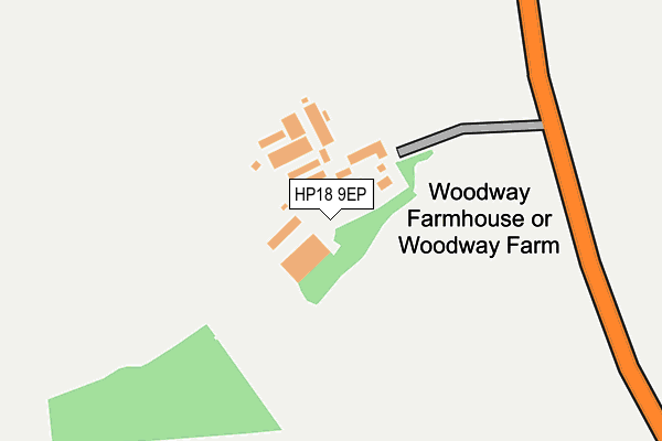
HP18 9EP is located in the Bernwood electoral ward, within the unitary authority of Buckinghamshire and the English Parliamentary constituency of Buckingham. The Sub Integrated Care Board (ICB) Location is NHS Buckinghamshire, Oxfordshire and Berkshire West ICB - 14Y and the police force is Thames Valley. This postcode has been in use since January 1980.


GetTheData
Source: OS OpenMap – Local (Ordnance Survey)
Source: OS VectorMap District (Ordnance Survey)
Licence: Open Government Licence (requires attribution)
| Easting | 467912 |
| Northing | 209904 |
| Latitude | 51.783692 |
| Longitude | -1.016895 |
GetTheData
Source: Open Postcode Geo
Licence: Open Government Licence
| Country | England |
| Postcode District | HP18 |
➜ See where HP18 is on a map | |
GetTheData
Source: Land Registry Price Paid Data
Licence: Open Government Licence
Elevation or altitude of HP18 9EP as distance above sea level:
| Metres | Feet | |
|---|---|---|
| Elevation | 80m | 262ft |
Elevation is measured from the approximate centre of the postcode, to the nearest point on an OS contour line from OS Terrain 50, which has contour spacing of ten vertical metres.
➜ How high above sea level am I? Find the elevation of your current position using your device's GPS.
GetTheData
Source: Open Postcode Elevation
Licence: Open Government Licence
| Ward | Bernwood |
| Constituency | Buckingham |
GetTheData
Source: ONS Postcode Database
Licence: Open Government Licence
| Mole & Chickens (Thame Road) | Easington | 816m |
| Mole & Chickens (Thame Road) | Easington | 876m |
| Carters Lane | Long Crendon | 1,271m |
| Carters Lane | Long Crendon | 1,275m |
| Bonnersfield (Chilton Road) | Long Crendon | 1,502m |
GetTheData
Source: NaPTAN
Licence: Open Government Licence
| Median download speed | 13.7Mbps |
| Average download speed | 13.2Mbps |
| Maximum download speed | 17.65Mbps |
| Median upload speed | 1.1Mbps |
| Average upload speed | 1.1Mbps |
| Maximum upload speed | 1.56Mbps |
GetTheData
Source: Ofcom
Licence: Ofcom Terms of Use (requires attribution)
GetTheData
Source: ONS Postcode Database
Licence: Open Government Licence


➜ Get more ratings from the Food Standards Agency
GetTheData
Source: Food Standards Agency
Licence: FSA terms & conditions
| Last Collection | |||
|---|---|---|---|
| Location | Mon-Fri | Sat | Distance |
| Easington | 16:15 | 07:00 | 823m |
| Carter Lane | 16:30 | 08:30 | 1,299m |
| Chilton | 16:15 | 07:00 | 1,795m |
GetTheData
Source: Dracos
Licence: Creative Commons Attribution-ShareAlike
The below table lists the International Territorial Level (ITL) codes (formerly Nomenclature of Territorial Units for Statistics (NUTS) codes) and Local Administrative Units (LAU) codes for HP18 9EP:
| ITL 1 Code | Name |
|---|---|
| TLJ | South East (England) |
| ITL 2 Code | Name |
| TLJ1 | Berkshire, Buckinghamshire and Oxfordshire |
| ITL 3 Code | Name |
| TLJ13 | Buckinghamshire |
| LAU 1 Code | Name |
| E06000060 | Buckinghamshire |
GetTheData
Source: ONS Postcode Directory
Licence: Open Government Licence
The below table lists the Census Output Area (OA), Lower Layer Super Output Area (LSOA), and Middle Layer Super Output Area (MSOA) for HP18 9EP:
| Code | Name | |
|---|---|---|
| OA | E00089247 | |
| LSOA | E01017681 | Aylesbury Vale 023A |
| MSOA | E02003674 | Aylesbury Vale 023 |
GetTheData
Source: ONS Postcode Directory
Licence: Open Government Licence
| HP18 9EY | Easington Terrace | 832m |
| HP18 9EX | Easington Lane | 840m |
| HP18 9EZ | Easington | 899m |
| HP18 9EW | Westfield Road | 1067m |
| HP18 9DU | Seven Acres | 1069m |
| HP18 9EF | Bicester Road | 1106m |
| HP18 9PP | Pitters Piece | 1126m |
| HP18 9DA | Chilton Road | 1192m |
| HP18 9DE | Carters Lane | 1216m |
| HP18 9LG | Cozens Close | 1295m |
GetTheData
Source: Open Postcode Geo; Land Registry Price Paid Data
Licence: Open Government Licence