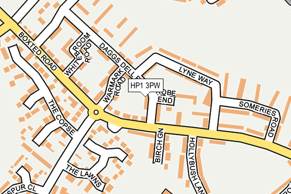
HP1 3PW lies on Daggsdell Road in Hemel Hempstead. HP1 3PW is located in the Chaulden and Warners End electoral ward, within the local authority district of Dacorum and the English Parliamentary constituency of Hemel Hempstead. The Sub Integrated Care Board (ICB) Location is NHS Hertfordshire and West Essex ICB - 06N and the police force is Hertfordshire. This postcode has been in use since January 1980.


GetTheData
Source: OS OpenMap – Local (Ordnance Survey)
Source: OS VectorMap District (Ordnance Survey)
Licence: Open Government Licence (requires attribution)
| Easting | 503536 |
| Northing | 208114 |
| Latitude | 51.762148 |
| Longitude | -0.501184 |
GetTheData
Source: Open Postcode Geo
Licence: Open Government Licence
| Street | Daggsdell Road |
| Town/City | Hemel Hempstead |
| Country | England |
| Postcode District | HP1 |
➜ See where HP1 is on a map ➜ Where is Hemel Hempstead? | |
GetTheData
Source: Land Registry Price Paid Data
Licence: Open Government Licence
Elevation or altitude of HP1 3PW as distance above sea level:
| Metres | Feet | |
|---|---|---|
| Elevation | 140m | 459ft |
Elevation is measured from the approximate centre of the postcode, to the nearest point on an OS contour line from OS Terrain 50, which has contour spacing of ten vertical metres.
➜ How high above sea level am I? Find the elevation of your current position using your device's GPS.
GetTheData
Source: Open Postcode Elevation
Licence: Open Government Licence
| Ward | Chaulden And Warners End |
| Constituency | Hemel Hempstead |
GetTheData
Source: ONS Postcode Database
Licence: Open Government Licence
| The Avenue (Boxted Road) | Warners End | 91m |
| Lyne Way (Boxted Road) | Warners End | 157m |
| Lyne Way (Boxted Road) | Warners End | 187m |
| Sacombe Road (Galley Hill) | Warners End | 333m |
| Sacombe Road (Galley Hill) | Warners End | 337m |
| Hemel Hempstead Station | 2.3km |
| Berkhamsted Station | 4.2km |
| Apsley Station | 4.2km |
GetTheData
Source: NaPTAN
Licence: Open Government Licence
| Percentage of properties with Next Generation Access | 100.0% |
| Percentage of properties with Superfast Broadband | 100.0% |
| Percentage of properties with Ultrafast Broadband | 59.1% |
| Percentage of properties with Full Fibre Broadband | 0.0% |
Superfast Broadband is between 30Mbps and 300Mbps
Ultrafast Broadband is > 300Mbps
| Median download speed | 52.7Mbps |
| Average download speed | 84.4Mbps |
| Maximum download speed | 200.00Mbps |
| Median upload speed | 9.8Mbps |
| Average upload speed | 8.5Mbps |
| Maximum upload speed | 10.00Mbps |
| Percentage of properties unable to receive 2Mbps | 0.0% |
| Percentage of properties unable to receive 5Mbps | 0.0% |
| Percentage of properties unable to receive 10Mbps | 0.0% |
| Percentage of properties unable to receive 30Mbps | 0.0% |
GetTheData
Source: Ofcom
Licence: Ofcom Terms of Use (requires attribution)
Estimated total energy consumption in HP1 3PW by fuel type, 2015.
| Consumption (kWh) | 275,935 |
|---|---|
| Meter count | 22 |
| Mean (kWh/meter) | 12,542 |
| Median (kWh/meter) | 12,510 |
| Consumption (kWh) | 79,654 |
|---|---|
| Meter count | 19 |
| Mean (kWh/meter) | 4,192 |
| Median (kWh/meter) | 3,848 |
GetTheData
Source: Postcode level gas estimates: 2015 (experimental)
Source: Postcode level electricity estimates: 2015 (experimental)
Licence: Open Government Licence
GetTheData
Source: ONS Postcode Database
Licence: Open Government Licence


➜ Get more ratings from the Food Standards Agency
GetTheData
Source: Food Standards Agency
Licence: FSA terms & conditions
| Last Collection | |||
|---|---|---|---|
| Location | Mon-Fri | Sat | Distance |
| Daggsdell Road | 17:15 | 12:00 | 103m |
| Boxted Road | 17:15 | 12:00 | 393m |
| Fields End | 17:15 | 12:00 | 429m |
GetTheData
Source: Dracos
Licence: Creative Commons Attribution-ShareAlike
The below table lists the International Territorial Level (ITL) codes (formerly Nomenclature of Territorial Units for Statistics (NUTS) codes) and Local Administrative Units (LAU) codes for HP1 3PW:
| ITL 1 Code | Name |
|---|---|
| TLH | East |
| ITL 2 Code | Name |
| TLH2 | Bedfordshire and Hertfordshire |
| ITL 3 Code | Name |
| TLH23 | Hertfordshire CC |
| LAU 1 Code | Name |
| E07000096 | Dacorum |
GetTheData
Source: ONS Postcode Directory
Licence: Open Government Licence
The below table lists the Census Output Area (OA), Lower Layer Super Output Area (LSOA), and Middle Layer Super Output Area (MSOA) for HP1 3PW:
| Code | Name | |
|---|---|---|
| OA | E00119009 | |
| LSOA | E01023427 | Dacorum 011B |
| MSOA | E02004866 | Dacorum 011 |
GetTheData
Source: ONS Postcode Directory
Licence: Open Government Licence
| HP1 2QT | Boxted Road | 41m |
| HP1 3PN | Lyne Way | 70m |
| HP1 3PS | Robe End | 78m |
| HP1 3PZ | Warmark Road | 93m |
| HP1 2TE | The Lawns | 112m |
| HP1 2QX | Birch Green | 116m |
| HP1 3PP | Daggsdell Road | 124m |
| HP1 3PY | Maple Green | 131m |
| HP1 3PL | Lyne Way | 135m |
| HP1 2TF | The Lawns | 159m |
GetTheData
Source: Open Postcode Geo; Land Registry Price Paid Data
Licence: Open Government Licence