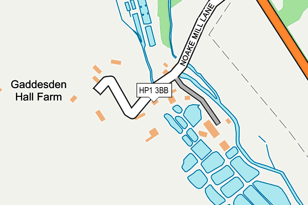
HP1 3BB is in Water End, Hemel Hempstead. HP1 3BB is located in the Watling electoral ward, within the local authority district of Dacorum and the English Parliamentary constituency of Hemel Hempstead. The Sub Integrated Care Board (ICB) Location is NHS Hertfordshire and West Essex ICB - 06N and the police force is Hertfordshire. This postcode has been in use since January 1980.


GetTheData
Source: OS OpenMap – Local (Ordnance Survey)
Source: OS VectorMap District (Ordnance Survey)
Licence: Open Government Licence (requires attribution)
| Easting | 504307 |
| Northing | 209655 |
| Latitude | 51.775855 |
| Longitude | -0.489554 |
GetTheData
Source: Open Postcode Geo
Licence: Open Government Licence
| Locality | Water End |
| Town/City | Hemel Hempstead |
| Country | England |
| Postcode District | HP1 |
➜ See where HP1 is on a map | |
GetTheData
Source: Land Registry Price Paid Data
Licence: Open Government Licence
Elevation or altitude of HP1 3BB as distance above sea level:
| Metres | Feet | |
|---|---|---|
| Elevation | 100m | 328ft |
Elevation is measured from the approximate centre of the postcode, to the nearest point on an OS contour line from OS Terrain 50, which has contour spacing of ten vertical metres.
➜ How high above sea level am I? Find the elevation of your current position using your device's GPS.
GetTheData
Source: Open Postcode Elevation
Licence: Open Government Licence
| Ward | Watling |
| Constituency | Hemel Hempstead |
GetTheData
Source: ONS Postcode Database
Licence: Open Government Licence
| The Red Lion Ph (Leighton Buzzard Road) | Water End | 583m |
| The Red Lion Ph (Leighton Buzzard Road) | Water End | 585m |
| Nettleden Road (Leighton Buzzard Road) | Water End | 895m |
| Piccotts End Farm (Piccotts End Road) | Piccotts End | 908m |
| Nettleden Road (Leighton Buzzard Road) | Water End | 915m |
| Hemel Hempstead Station | 3.7km |
| Apsley Station | 5.2km |
| Berkhamsted Station | 5.2km |
GetTheData
Source: NaPTAN
Licence: Open Government Licence
| Percentage of properties with Next Generation Access | 100.0% |
| Percentage of properties with Superfast Broadband | 0.0% |
| Percentage of properties with Ultrafast Broadband | 0.0% |
| Percentage of properties with Full Fibre Broadband | 0.0% |
Superfast Broadband is between 30Mbps and 300Mbps
Ultrafast Broadband is > 300Mbps
| Median download speed | 8.1Mbps |
| Average download speed | 7.9Mbps |
| Maximum download speed | 12.38Mbps |
| Median upload speed | 1.1Mbps |
| Average upload speed | 1.1Mbps |
| Maximum upload speed | 1.15Mbps |
| Percentage of properties unable to receive 2Mbps | 0.0% |
| Percentage of properties unable to receive 5Mbps | 11.1% |
| Percentage of properties unable to receive 10Mbps | 11.1% |
| Percentage of properties unable to receive 30Mbps | 100.0% |
GetTheData
Source: Ofcom
Licence: Ofcom Terms of Use (requires attribution)
GetTheData
Source: ONS Postcode Database
Licence: Open Government Licence


➜ Get more ratings from the Food Standards Agency
GetTheData
Source: Food Standards Agency
Licence: FSA terms & conditions
| Last Collection | |||
|---|---|---|---|
| Location | Mon-Fri | Sat | Distance |
| Grist House | 15:45 | 07:00 | 303m |
| Waterend Moor | 17:00 | 07:30 | 729m |
| Marlins Turn | 17:00 | 12:00 | 1,154m |
GetTheData
Source: Dracos
Licence: Creative Commons Attribution-ShareAlike
The below table lists the International Territorial Level (ITL) codes (formerly Nomenclature of Territorial Units for Statistics (NUTS) codes) and Local Administrative Units (LAU) codes for HP1 3BB:
| ITL 1 Code | Name |
|---|---|
| TLH | East |
| ITL 2 Code | Name |
| TLH2 | Bedfordshire and Hertfordshire |
| ITL 3 Code | Name |
| TLH23 | Hertfordshire CC |
| LAU 1 Code | Name |
| E07000096 | Dacorum |
GetTheData
Source: ONS Postcode Directory
Licence: Open Government Licence
The below table lists the Census Output Area (OA), Lower Layer Super Output Area (LSOA), and Middle Layer Super Output Area (MSOA) for HP1 3BB:
| Code | Name | |
|---|---|---|
| OA | E00119022 | |
| LSOA | E01023431 | Dacorum 001B |
| MSOA | E02004856 | Dacorum 001 |
GetTheData
Source: ONS Postcode Directory
Licence: Open Government Licence
| HP1 3BD | Leighton Buzzard Road | 362m |
| HP1 3BL | Water End Moor | 656m |
| HP1 3AX | Mill Close | 689m |
| HP1 3SQ | Riverbank | 820m |
| HP1 3SP | Riverbank | 828m |
| HP1 3SG | Riverbank | 832m |
| HP1 3NU | Coulser Close | 937m |
| HP1 3AU | Piccotts End Road | 944m |
| HP1 3DF | Nettleden Road | 947m |
| HP1 3NT | Tollpit End | 976m |
GetTheData
Source: Open Postcode Geo; Land Registry Price Paid Data
Licence: Open Government Licence