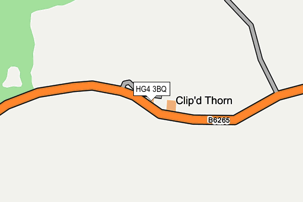
HG4 3BQ is in Aldfield, Ripon. HG4 3BQ is located in the Masham & Fountains electoral ward, within the unitary authority of North Yorkshire and the English Parliamentary constituency of Skipton and Ripon. The Sub Integrated Care Board (ICB) Location is NHS Humber and North Yorkshire ICB - 42D and the police force is North Yorkshire. This postcode has been in use since January 1980.


GetTheData
Source: OS OpenMap – Local (Ordnance Survey)
Source: OS VectorMap District (Ordnance Survey)
Licence: Open Government Licence (requires attribution)
| Easting | 426070 |
| Northing | 469881 |
| Latitude | 54.124133 |
| Longitude | -1.602604 |
GetTheData
Source: Open Postcode Geo
Licence: Open Government Licence
| Locality | Aldfield |
| Town/City | Ripon |
| Country | England |
| Postcode District | HG4 |
➜ See where HG4 is on a map | |
GetTheData
Source: Land Registry Price Paid Data
Licence: Open Government Licence
Elevation or altitude of HG4 3BQ as distance above sea level:
| Metres | Feet | |
|---|---|---|
| Elevation | 150m | 492ft |
Elevation is measured from the approximate centre of the postcode, to the nearest point on an OS contour line from OS Terrain 50, which has contour spacing of ten vertical metres.
➜ How high above sea level am I? Find the elevation of your current position using your device's GPS.
GetTheData
Source: Open Postcode Elevation
Licence: Open Government Licence
| Ward | Masham & Fountains |
| Constituency | Skipton And Ripon |
GetTheData
Source: ONS Postcode Database
Licence: Open Government Licence
| Church House (Moor Lane) | Fountains Abbey | 689m |
| Church House (Moor Lane) | Fountains Abbey | 696m |
| Visitor Centre (N/A) | Fountains Abbey | 1,670m |
| The Countryman (Main Street) | Winksley | 1,726m |
| The Countryman (Main Street) | Winksley | 1,731m |
GetTheData
Source: NaPTAN
Licence: Open Government Licence
| Percentage of properties with Next Generation Access | 0.0% |
| Percentage of properties with Superfast Broadband | 0.0% |
| Percentage of properties with Ultrafast Broadband | 0.0% |
| Percentage of properties with Full Fibre Broadband | 0.0% |
Superfast Broadband is between 30Mbps and 300Mbps
Ultrafast Broadband is > 300Mbps
| Percentage of properties unable to receive 2Mbps | 40.0% |
| Percentage of properties unable to receive 5Mbps | 80.0% |
| Percentage of properties unable to receive 10Mbps | 100.0% |
| Percentage of properties unable to receive 30Mbps | 100.0% |
GetTheData
Source: Ofcom
Licence: Ofcom Terms of Use (requires attribution)
GetTheData
Source: ONS Postcode Database
Licence: Open Government Licence


➜ Get more ratings from the Food Standards Agency
GetTheData
Source: Food Standards Agency
Licence: FSA terms & conditions
| Last Collection | |||
|---|---|---|---|
| Location | Mon-Fri | Sat | Distance |
| Studley Royal | 16:00 | 10:15 | 1,733m |
| Lark Lane P.o. | 17:30 | 12:15 | 4,276m |
| Bishopton | 18:00 | 13:15 | 4,411m |
GetTheData
Source: Dracos
Licence: Creative Commons Attribution-ShareAlike
The below table lists the International Territorial Level (ITL) codes (formerly Nomenclature of Territorial Units for Statistics (NUTS) codes) and Local Administrative Units (LAU) codes for HG4 3BQ:
| ITL 1 Code | Name |
|---|---|
| TLE | Yorkshire and The Humber |
| ITL 2 Code | Name |
| TLE2 | North Yorkshire |
| ITL 3 Code | Name |
| TLE22 | North Yorkshire CC |
| LAU 1 Code | Name |
| E07000165 | Harrogate |
GetTheData
Source: ONS Postcode Directory
Licence: Open Government Licence
The below table lists the Census Output Area (OA), Lower Layer Super Output Area (LSOA), and Middle Layer Super Output Area (MSOA) for HG4 3BQ:
| Code | Name | |
|---|---|---|
| OA | E00140894 | |
| LSOA | E01027666 | Harrogate 001A |
| MSOA | E02005761 | Harrogate 001 |
GetTheData
Source: ONS Postcode Directory
Licence: Open Government Licence
| HG4 3BE | 591m | |
| HG4 3BG | Chapel Row | 594m |
| HG4 3DY | 1652m | |
| HG4 3NR | 1677m | |
| HG4 3EP | 1825m | |
| HG4 3NP | Pine Croft | 1834m |
| HG4 3DZ | 1851m | |
| HG4 3ES | 1956m | |
| HG4 3EA | 2082m | |
| HG4 3EL | Low Gate Lane | 2164m |
GetTheData
Source: Open Postcode Geo; Land Registry Price Paid Data
Licence: Open Government Licence