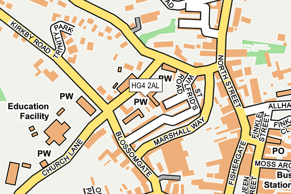
HG4 2AL is located in the Ripon Ure Bank & Spa electoral ward, within the unitary authority of North Yorkshire and the English Parliamentary constituency of Skipton and Ripon. The Sub Integrated Care Board (ICB) Location is NHS Humber and North Yorkshire ICB - 42D and the police force is North Yorkshire. This postcode has been in use since January 1980.


GetTheData
Source: OS OpenMap – Local (Ordnance Survey)
Source: OS VectorMap District (Ordnance Survey)
Licence: Open Government Licence (requires attribution)
| Easting | 430990 |
| Northing | 471513 |
| Latitude | 54.138542 |
| Longitude | -1.527166 |
GetTheData
Source: Open Postcode Geo
Licence: Open Government Licence
| Country | England |
| Postcode District | HG4 |
➜ See where HG4 is on a map ➜ Where is Ripon? | |
GetTheData
Source: Land Registry Price Paid Data
Licence: Open Government Licence
Elevation or altitude of HG4 2AL as distance above sea level:
| Metres | Feet | |
|---|---|---|
| Elevation | 40m | 131ft |
Elevation is measured from the approximate centre of the postcode, to the nearest point on an OS contour line from OS Terrain 50, which has contour spacing of ten vertical metres.
➜ How high above sea level am I? Find the elevation of your current position using your device's GPS.
GetTheData
Source: Open Postcode Elevation
Licence: Open Government Licence
| Ward | Ripon Ure Bank & Spa |
| Constituency | Skipton And Ripon |
GetTheData
Source: ONS Postcode Database
Licence: Open Government Licence
| Holy Trinity Church (Kirkby Road) | Ripon | 97m |
| The White Horse (North Street) | Ripon | 196m |
| White Horse (North Street) | Ripon | 199m |
| Bus Station Stand 1 (Queen Street) | Ripon | 387m |
| The Clock Tower (North Street) | Ure Bank | 399m |
GetTheData
Source: NaPTAN
Licence: Open Government Licence
GetTheData
Source: ONS Postcode Database
Licence: Open Government Licence


➜ Get more ratings from the Food Standards Agency
GetTheData
Source: Food Standards Agency
Licence: FSA terms & conditions
| Last Collection | |||
|---|---|---|---|
| Location | Mon-Fri | Sat | Distance |
| Bondgate P.o. | 18:15 | 12:00 | 918m |
| Lark Lane P.o. | 17:30 | 12:15 | 1,001m |
| Ure Bank Terrace/Top | 17:30 | 12:30 | 1,036m |
GetTheData
Source: Dracos
Licence: Creative Commons Attribution-ShareAlike
The below table lists the International Territorial Level (ITL) codes (formerly Nomenclature of Territorial Units for Statistics (NUTS) codes) and Local Administrative Units (LAU) codes for HG4 2AL:
| ITL 1 Code | Name |
|---|---|
| TLE | Yorkshire and The Humber |
| ITL 2 Code | Name |
| TLE2 | North Yorkshire |
| ITL 3 Code | Name |
| TLE22 | North Yorkshire CC |
| LAU 1 Code | Name |
| E07000165 | Harrogate |
GetTheData
Source: ONS Postcode Directory
Licence: Open Government Licence
The below table lists the Census Output Area (OA), Lower Layer Super Output Area (LSOA), and Middle Layer Super Output Area (MSOA) for HG4 2AL:
| Code | Name | |
|---|---|---|
| OA | E00141140 | |
| LSOA | E01027713 | Harrogate 002B |
| MSOA | E02005762 | Harrogate 002 |
GetTheData
Source: ONS Postcode Directory
Licence: Open Government Licence
| HG4 2ET | Kirkby Road | 60m |
| HG4 2AH | Westbourne Grove | 91m |
| HG4 2AG | Rayner Street | 97m |
| HG4 2AE | College Road | 116m |
| HG4 2AJ | Blossomgate | 122m |
| HG4 2AB | Coltsgate Hill | 123m |
| HG4 2AU | St Wilfrids Mews | 135m |
| HG4 2AQ | St Wilfrids Place | 141m |
| HG4 2AZ | Marshall Way | 148m |
| HG4 2ER | Trinity Park | 149m |
GetTheData
Source: Open Postcode Geo; Land Registry Price Paid Data
Licence: Open Government Licence