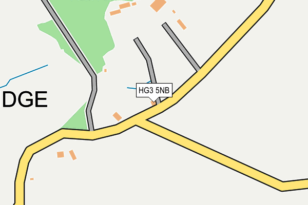
HG3 5NB lies on Old Church Lane in Pateley Bridge, Harrogate. HG3 5NB is located in the Pateley Bridge & Nidderdale electoral ward, within the unitary authority of North Yorkshire and the English Parliamentary constituency of Skipton and Ripon. The Sub Integrated Care Board (ICB) Location is NHS Humber and North Yorkshire ICB - 42D and the police force is North Yorkshire. This postcode has been in use since January 1980.


GetTheData
Source: OS OpenMap – Local (Ordnance Survey)
Source: OS VectorMap District (Ordnance Survey)
Licence: Open Government Licence (requires attribution)
| Easting | 416644 |
| Northing | 465722 |
| Latitude | 54.087158 |
| Longitude | -1.747059 |
GetTheData
Source: Open Postcode Geo
Licence: Open Government Licence
| Street | Old Church Lane |
| Locality | Pateley Bridge |
| Town/City | Harrogate |
| Country | England |
| Postcode District | HG3 |
➜ See where HG3 is on a map | |
GetTheData
Source: Land Registry Price Paid Data
Licence: Open Government Licence
Elevation or altitude of HG3 5NB as distance above sea level:
| Metres | Feet | |
|---|---|---|
| Elevation | 270m | 886ft |
Elevation is measured from the approximate centre of the postcode, to the nearest point on an OS contour line from OS Terrain 50, which has contour spacing of ten vertical metres.
➜ How high above sea level am I? Find the elevation of your current position using your device's GPS.
GetTheData
Source: Open Postcode Elevation
Licence: Open Government Licence
| Ward | Pateley Bridge & Nidderdale |
| Constituency | Skipton And Ripon |
GetTheData
Source: ONS Postcode Database
Licence: Open Government Licence
| Panorama Way (Panorama Walk) | Pateley Bridge | 627m |
| Panorama Way (Panorama Walk) | Pateley Bridge | 637m |
| Panorama Walk (High Street) | Pateley Bridge | 666m |
| Panorama Walk (High Street) | Pateley Bridge | 670m |
| King Street (Back High Street) | Pateley Bridge | 917m |
GetTheData
Source: NaPTAN
Licence: Open Government Licence
| Percentage of properties with Next Generation Access | 100.0% |
| Percentage of properties with Superfast Broadband | 100.0% |
| Percentage of properties with Ultrafast Broadband | 0.0% |
| Percentage of properties with Full Fibre Broadband | 0.0% |
Superfast Broadband is between 30Mbps and 300Mbps
Ultrafast Broadband is > 300Mbps
| Percentage of properties unable to receive 2Mbps | 0.0% |
| Percentage of properties unable to receive 5Mbps | 0.0% |
| Percentage of properties unable to receive 10Mbps | 0.0% |
| Percentage of properties unable to receive 30Mbps | 0.0% |
GetTheData
Source: Ofcom
Licence: Ofcom Terms of Use (requires attribution)
GetTheData
Source: ONS Postcode Database
Licence: Open Government Licence


➜ Get more ratings from the Food Standards Agency
GetTheData
Source: Food Standards Agency
Licence: FSA terms & conditions
| Last Collection | |||
|---|---|---|---|
| Location | Mon-Fri | Sat | Distance |
| Pateley Bridge P.o. | 17:00 | 10:45 | 832m |
| Bridghouse Gate | 16:00 | 12:45 | 1,127m |
| Strawberry Hill | 16:00 | 10:45 | 1,864m |
GetTheData
Source: Dracos
Licence: Creative Commons Attribution-ShareAlike
The below table lists the International Territorial Level (ITL) codes (formerly Nomenclature of Territorial Units for Statistics (NUTS) codes) and Local Administrative Units (LAU) codes for HG3 5NB:
| ITL 1 Code | Name |
|---|---|
| TLE | Yorkshire and The Humber |
| ITL 2 Code | Name |
| TLE2 | North Yorkshire |
| ITL 3 Code | Name |
| TLE22 | North Yorkshire CC |
| LAU 1 Code | Name |
| E07000165 | Harrogate |
GetTheData
Source: ONS Postcode Directory
Licence: Open Government Licence
The below table lists the Census Output Area (OA), Lower Layer Super Output Area (LSOA), and Middle Layer Super Output Area (MSOA) for HG3 5NB:
| Code | Name | |
|---|---|---|
| OA | E00141077 | |
| LSOA | E01027701 | Harrogate 006C |
| MSOA | E02005766 | Harrogate 006 |
GetTheData
Source: ONS Postcode Directory
Licence: Open Government Licence
| HG3 5LZ | Old Church Lane | 352m |
| HG3 5LY | Old Church Lane | 508m |
| HG3 5NX | Panorama Walk | 521m |
| HG3 5NU | High Crest | 562m |
| HG3 5NH | The Knott | 571m |
| HG3 5PA | Springfield Way | 572m |
| HG3 5NT | The Drive | 585m |
| HG3 5NY | Panorama Close | 608m |
| HG3 5NS | The Avenue | 619m |
| HG3 5RE | Forest Court | 623m |
GetTheData
Source: Open Postcode Geo; Land Registry Price Paid Data
Licence: Open Government Licence