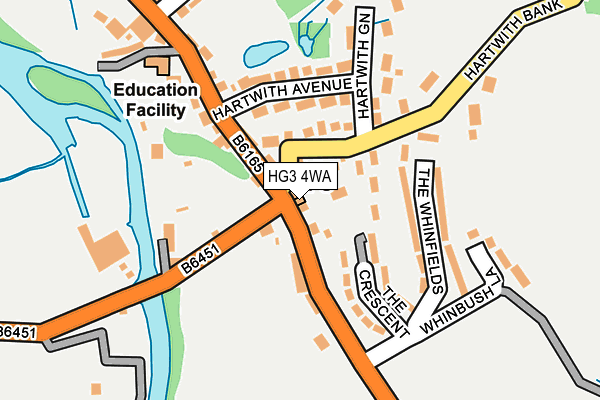
HG3 4WA is located in the Washburn & Birstwith electoral ward, within the unitary authority of North Yorkshire and the English Parliamentary constituency of Skipton and Ripon. The Sub Integrated Care Board (ICB) Location is NHS Humber and North Yorkshire ICB - 42D and the police force is North Yorkshire. This postcode has been in use since September 2009.


GetTheData
Source: OS OpenMap – Local (Ordnance Survey)
Source: OS VectorMap District (Ordnance Survey)
Licence: Open Government Licence (requires attribution)
| Easting | 420191 |
| Northing | 462398 |
| Latitude | 54.057143 |
| Longitude | -1.693052 |
GetTheData
Source: Open Postcode Geo
Licence: Open Government Licence
| Country | England |
| Postcode District | HG3 |
➜ See where HG3 is on a map ➜ Where is Summerbridge? | |
GetTheData
Source: Land Registry Price Paid Data
Licence: Open Government Licence
Elevation or altitude of HG3 4WA as distance above sea level:
| Metres | Feet | |
|---|---|---|
| Elevation | 110m | 361ft |
Elevation is measured from the approximate centre of the postcode, to the nearest point on an OS contour line from OS Terrain 50, which has contour spacing of ten vertical metres.
➜ How high above sea level am I? Find the elevation of your current position using your device's GPS.
GetTheData
Source: Open Postcode Elevation
Licence: Open Government Licence
| Ward | Washburn & Birstwith |
| Constituency | Skipton And Ripon |
GetTheData
Source: ONS Postcode Database
Licence: Open Government Licence
| Flying Dutchman (B6165) | Summerbridge | 61m |
| Flying Dutchman (B6165) | Summerbridge | 71m |
| The Whinfields | Summerbridge | 159m |
| The Whinfields | Summerbridge | 185m |
| Church Avenue (B6141) | Dacre Banks | 376m |
GetTheData
Source: NaPTAN
Licence: Open Government Licence
GetTheData
Source: ONS Postcode Database
Licence: Open Government Licence


➜ Get more ratings from the Food Standards Agency
GetTheData
Source: Food Standards Agency
Licence: FSA terms & conditions
| Last Collection | |||
|---|---|---|---|
| Location | Mon-Fri | Sat | Distance |
| Dacre Hill | 16:15 | 12:00 | 1,763m |
| Moorhouse Hill/Padside Green | 16:30 | 11:45 | 4,899m |
| Pateley Bridge P.o. | 17:00 | 10:45 | 5,432m |
GetTheData
Source: Dracos
Licence: Creative Commons Attribution-ShareAlike
The below table lists the International Territorial Level (ITL) codes (formerly Nomenclature of Territorial Units for Statistics (NUTS) codes) and Local Administrative Units (LAU) codes for HG3 4WA:
| ITL 1 Code | Name |
|---|---|
| TLE | Yorkshire and The Humber |
| ITL 2 Code | Name |
| TLE2 | North Yorkshire |
| ITL 3 Code | Name |
| TLE22 | North Yorkshire CC |
| LAU 1 Code | Name |
| E07000165 | Harrogate |
GetTheData
Source: ONS Postcode Directory
Licence: Open Government Licence
The below table lists the Census Output Area (OA), Lower Layer Super Output Area (LSOA), and Middle Layer Super Output Area (MSOA) for HG3 4WA:
| Code | Name | |
|---|---|---|
| OA | E00140985 | |
| LSOA | E01027681 | Harrogate 006A |
| MSOA | E02005766 | Harrogate 006 |
GetTheData
Source: ONS Postcode Directory
Licence: Open Government Licence
| HG3 4HP | 10m | |
| HG3 4HS | 80m | |
| HG3 4HZ | East View | 89m |
| HG3 4JA | The Crescent | 122m |
| HG3 4HT | Hartwith Avenue | 127m |
| HG3 4JP | Riverside Lane | 134m |
| HG3 4HY | Hartwith Bank | 139m |
| HG3 4JE | The Whinfields | 140m |
| HG3 4JF | 179m | |
| HG3 4HX | Hartwith Green | 192m |
GetTheData
Source: Open Postcode Geo; Land Registry Price Paid Data
Licence: Open Government Licence