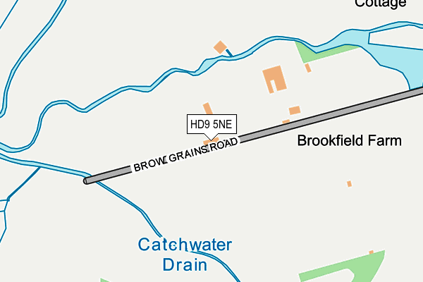
HD9 5NE is located in the Holme Valley North electoral ward, within the metropolitan district of Kirklees and the English Parliamentary constituency of Colne Valley. The Sub Integrated Care Board (ICB) Location is NHS West Yorkshire ICB - X2C4Y and the police force is West Yorkshire. This postcode has been in use since June 2001.


GetTheData
Source: OS OpenMap – Local (Ordnance Survey)
Source: OS VectorMap District (Ordnance Survey)
Licence: Open Government Licence (requires attribution)
| Easting | 408502 |
| Northing | 410501 |
| Latitude | 53.591036 |
| Longitude | -1.873028 |
GetTheData
Source: Open Postcode Geo
Licence: Open Government Licence
| Country | England |
| Postcode District | HD9 |
➜ See where HD9 is on a map | |
GetTheData
Source: Land Registry Price Paid Data
Licence: Open Government Licence
Elevation or altitude of HD9 5NE as distance above sea level:
| Metres | Feet | |
|---|---|---|
| Elevation | 250m | 820ft |
Elevation is measured from the approximate centre of the postcode, to the nearest point on an OS contour line from OS Terrain 50, which has contour spacing of ten vertical metres.
➜ How high above sea level am I? Find the elevation of your current position using your device's GPS.
GetTheData
Source: Open Postcode Elevation
Licence: Open Government Licence
| Ward | Holme Valley North |
| Constituency | Colne Valley |
GetTheData
Source: ONS Postcode Database
Licence: Open Government Licence
| Leygards Lane | Meltham | 585m |
| Mill Moor Road | Meltham | 725m |
| Matthew Grove | Meltham | 888m |
| Hanson Road | Meltham | 893m |
| Mill Moor Road | Meltham | 922m |
| Slaithwaite Station | 3.7km |
| Marsden Station | 4.1km |
| Lockwood Station | 6.8km |
GetTheData
Source: NaPTAN
Licence: Open Government Licence
GetTheData
Source: ONS Postcode Database
Licence: Open Government Licence


➜ Get more ratings from the Food Standards Agency
GetTheData
Source: Food Standards Agency
Licence: FSA terms & conditions
| Last Collection | |||
|---|---|---|---|
| Location | Mon-Fri | Sat | Distance |
| 40 Red Lane, Meltham | 17:00 | 10:15 | 911m |
| Meltham P.o. Box | 17:30 | 11:15 | 1,504m |
| 10 Broadlands Meltham | 17:00 | 10:15 | 1,518m |
GetTheData
Source: Dracos
Licence: Creative Commons Attribution-ShareAlike
The below table lists the International Territorial Level (ITL) codes (formerly Nomenclature of Territorial Units for Statistics (NUTS) codes) and Local Administrative Units (LAU) codes for HD9 5NE:
| ITL 1 Code | Name |
|---|---|
| TLE | Yorkshire and The Humber |
| ITL 2 Code | Name |
| TLE4 | West Yorkshire |
| ITL 3 Code | Name |
| TLE44 | Calderdale and Kirklees |
| LAU 1 Code | Name |
| E08000034 | Kirklees |
GetTheData
Source: ONS Postcode Directory
Licence: Open Government Licence
The below table lists the Census Output Area (OA), Lower Layer Super Output Area (LSOA), and Middle Layer Super Output Area (MSOA) for HD9 5NE:
| Code | Name | |
|---|---|---|
| OA | E00056315 | |
| LSOA | E01011177 | Kirklees 055D |
| MSOA | E02002325 | Kirklees 055 |
GetTheData
Source: ONS Postcode Directory
Licence: Open Government Licence
| HD9 5LN | Mill Moor Road | 120m |
| HD9 5JE | New Bridge Road | 341m |
| HD9 5ND | Red Lane | 387m |
| HD9 5AA | Upper Sunny Bank Mews | 691m |
| HD9 5AB | Upper Mills View | 697m |
| HD9 5LW | Mill Moor Road | 745m |
| HD9 5LL | Sunny Bank Road | 760m |
| HD9 5AD | Lower Mill Mews | 768m |
| HD9 5AE | Lower Sunny Bank Court | 802m |
| HD9 4HJ | Leygards Lane | 819m |
GetTheData
Source: Open Postcode Geo; Land Registry Price Paid Data
Licence: Open Government Licence