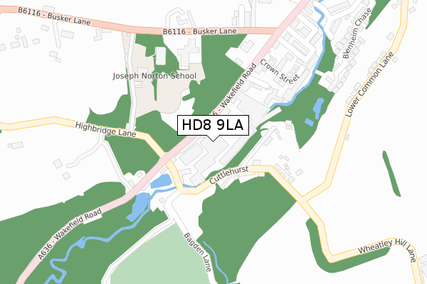
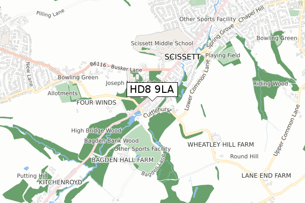
HD8 9LA is located in the Denby Dale electoral ward, within the metropolitan district of Kirklees and the English Parliamentary constituency of Dewsbury. The Sub Integrated Care Board (ICB) Location is NHS West Yorkshire ICB - X2C4Y and the police force is West Yorkshire. This postcode has been in use since December 1994.


GetTheData
Source: OS Open Zoomstack (Ordnance Survey)
Licence: Open Government Licence (requires attribution)
Attribution: Contains OS data © Crown copyright and database right 2025
Source: Open Postcode Geo
Licence: Open Government Licence (requires attribution)
Attribution: Contains OS data © Crown copyright and database right 2025; Contains Royal Mail data © Royal Mail copyright and database right 2025; Source: Office for National Statistics licensed under the Open Government Licence v.3.0
| Easting | 424718 |
| Northing | 410089 |
| Latitude | 53.586808 |
| Longitude | -1.628082 |
GetTheData
Source: Open Postcode Geo
Licence: Open Government Licence
| Country | England |
| Postcode District | HD8 |
➜ See where HD8 is on a map ➜ Where is Scissett? | |
GetTheData
Source: Land Registry Price Paid Data
Licence: Open Government Licence
Elevation or altitude of HD8 9LA as distance above sea level:
| Metres | Feet | |
|---|---|---|
| Elevation | 120m | 394ft |
Elevation is measured from the approximate centre of the postcode, to the nearest point on an OS contour line from OS Terrain 50, which has contour spacing of ten vertical metres.
➜ How high above sea level am I? Find the elevation of your current position using your device's GPS.
GetTheData
Source: Open Postcode Elevation
Licence: Open Government Licence
| Ward | Denby Dale |
| Constituency | Dewsbury |
GetTheData
Source: ONS Postcode Database
Licence: Open Government Licence
| Wakefield Rd Highbridge Lane (Wakefield Road) | Scissett | 58m |
| Wakefield Rd Bagden Lane (Wakefield Road) | Scissett | 82m |
| Church Wakefield Road (Wakefield Road) | Scissett | 216m |
| Wakefield Road Church (Wakefield Road) | Scissett | 246m |
| Busker Lane Wakefield Rd (Busker Lane) | Scissett | 269m |
| Denby Dale Station | 2.8km |
GetTheData
Source: NaPTAN
Licence: Open Government Licence
| Median download speed | 21.5Mbps |
| Average download speed | 24.3Mbps |
| Maximum download speed | 80.00Mbps |
| Median upload speed | 1.1Mbps |
| Average upload speed | 2.6Mbps |
| Maximum upload speed | 20.00Mbps |
GetTheData
Source: Ofcom
Licence: Ofcom Terms of Use (requires attribution)
Estimated total energy consumption in HD8 9LA by fuel type, 2015.
| Consumption (kWh) | 205,688 |
|---|---|
| Meter count | 20 |
| Mean (kWh/meter) | 10,284 |
| Median (kWh/meter) | 2,561 |
GetTheData
Source: Postcode level gas estimates: 2015 (experimental)
Source: Postcode level electricity estimates: 2015 (experimental)
Licence: Open Government Licence
GetTheData
Source: ONS Postcode Database
Licence: Open Government Licence


➜ Get more ratings from the Food Standards Agency
GetTheData
Source: Food Standards Agency
Licence: FSA terms & conditions
| Last Collection | |||
|---|---|---|---|
| Location | Mon-Fri | Sat | Distance |
| Cuttlehurst | 17:00 | 11:15 | 125m |
| 163 Wakefield Road | 17:00 | 11:45 | 384m |
| Sunnymead | 16:30 | 11:00 | 768m |
GetTheData
Source: Dracos
Licence: Creative Commons Attribution-ShareAlike
The below table lists the International Territorial Level (ITL) codes (formerly Nomenclature of Territorial Units for Statistics (NUTS) codes) and Local Administrative Units (LAU) codes for HD8 9LA:
| ITL 1 Code | Name |
|---|---|
| TLE | Yorkshire and The Humber |
| ITL 2 Code | Name |
| TLE4 | West Yorkshire |
| ITL 3 Code | Name |
| TLE44 | Calderdale and Kirklees |
| LAU 1 Code | Name |
| E08000034 | Kirklees |
GetTheData
Source: ONS Postcode Directory
Licence: Open Government Licence
The below table lists the Census Output Area (OA), Lower Layer Super Output Area (LSOA), and Middle Layer Super Output Area (MSOA) for HD8 9LA:
| Code | Name | |
|---|---|---|
| OA | E00055997 | |
| LSOA | E01011110 | Kirklees 057A |
| MSOA | E02002327 | Kirklees 057 |
GetTheData
Source: ONS Postcode Directory
Licence: Open Government Licence
| HD8 9LF | Cuttlehurst | 113m |
| HD8 9LB | Highbridge | 127m |
| HD8 9JP | New Street | 164m |
| HD8 9JZ | Wakefield Road | 193m |
| HD8 9JL | Stanhope Street | 202m |
| HD8 9JN | Crown Street | 239m |
| HD8 9JW | Crown Villas | 244m |
| HD8 9JJ | Fleet Street | 300m |
| HD8 9JT | Church Terrace | 301m |
| HD8 9JU | Busker Lane | 305m |
GetTheData
Source: Open Postcode Geo; Land Registry Price Paid Data
Licence: Open Government Licence