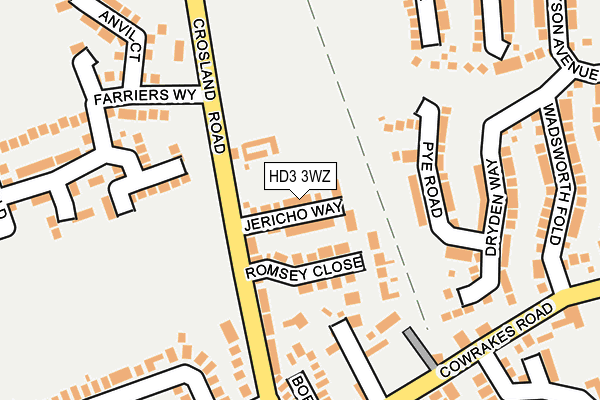
HD3 3WZ is located in the Lindley electoral ward, within the metropolitan district of Kirklees and the English Parliamentary constituency of Colne Valley. The Sub Integrated Care Board (ICB) Location is NHS West Yorkshire ICB - X2C4Y and the police force is West Yorkshire. This postcode has been in use since July 2016.


GetTheData
Source: OS OpenMap – Local (Ordnance Survey)
Source: OS VectorMap District (Ordnance Survey)
Licence: Open Government Licence (requires attribution)
| Easting | 410885 |
| Northing | 418491 |
| Latitude | 53.662808 |
| Longitude | -1.836752 |
GetTheData
Source: Open Postcode Geo
Licence: Open Government Licence
| Country | England |
| Postcode District | HD3 |
➜ See where HD3 is on a map ➜ Where is Huddersfield? | |
GetTheData
Source: Land Registry Price Paid Data
Licence: Open Government Licence
Elevation or altitude of HD3 3WZ as distance above sea level:
| Metres | Feet | |
|---|---|---|
| Elevation | 250m | 820ft |
Elevation is measured from the approximate centre of the postcode, to the nearest point on an OS contour line from OS Terrain 50, which has contour spacing of ten vertical metres.
➜ How high above sea level am I? Find the elevation of your current position using your device's GPS.
GetTheData
Source: Open Postcode Elevation
Licence: Open Government Licence
| Ward | Lindley |
| Constituency | Colne Valley |
GetTheData
Source: ONS Postcode Database
Licence: Open Government Licence
2024 29 NOV £280,000 |
2023 31 JAN £280,000 |
2020 21 DEC £288,000 |
2020 18 DEC £295,000 |
11, JERICHO WAY, OAKES, HUDDERSFIELD, HD3 3WZ 2020 9 OCT £225,000 |
2019 14 JUN £224,000 |
2017 27 OCT £244,950 |
22, JERICHO WAY, OAKES, HUDDERSFIELD, HD3 3WZ 2017 13 OCT £209,950 |
12, JERICHO WAY, OAKES, HUDDERSFIELD, HD3 3WZ 2017 15 AUG £249,950 |
19, JERICHO WAY, OAKES, HUDDERSFIELD, HD3 3WZ 2017 30 JUN £219,950 |
GetTheData
Source: HM Land Registry Price Paid Data
Licence: Contains HM Land Registry data © Crown copyright and database right 2025. This data is licensed under the Open Government Licence v3.0.
| Cowrakes Rd Gatesgarth Crescent (Cowrakes Road) | Lindley | 218m |
| Cowrakes Rd Gatesgarth Crescent (Cowrakes Road) | Lindley | 228m |
| Crosland Road Low Hills Ln (Crosland Road) | Lindley | 308m |
| Crosland Road Low Hills Ln (Crosland Road) | Lindley | 357m |
| Weather Hill Rd Briarlyn Avenue (Weather Hill Road) | Lindley | 385m |
| Huddersfield Station | 3.8km |
| Lockwood Station | 3.9km |
| Slaithwaite Station | 5.3km |
GetTheData
Source: NaPTAN
Licence: Open Government Licence
| Percentage of properties with Next Generation Access | 100.0% |
| Percentage of properties with Superfast Broadband | 100.0% |
| Percentage of properties with Ultrafast Broadband | 100.0% |
| Percentage of properties with Full Fibre Broadband | 0.0% |
Superfast Broadband is between 30Mbps and 300Mbps
Ultrafast Broadband is > 300Mbps
| Median download speed | 100.0Mbps |
| Average download speed | 119.4Mbps |
| Maximum download speed | 350.00Mbps |
| Median upload speed | 0.8Mbps |
| Average upload speed | 0.8Mbps |
| Maximum upload speed | 1.07Mbps |
| Percentage of properties unable to receive 2Mbps | 0.0% |
| Percentage of properties unable to receive 5Mbps | 0.0% |
| Percentage of properties unable to receive 10Mbps | 0.0% |
| Percentage of properties unable to receive 30Mbps | 0.0% |
GetTheData
Source: Ofcom
Licence: Ofcom Terms of Use (requires attribution)
GetTheData
Source: ONS Postcode Database
Licence: Open Government Licence


➜ Get more ratings from the Food Standards Agency
GetTheData
Source: Food Standards Agency
Licence: FSA terms & conditions
| Last Collection | |||
|---|---|---|---|
| Location | Mon-Fri | Sat | Distance |
| Thornhill Road | 17:30 | 12:15 | 1,119m |
| Blackley | 17:15 | 08:00 | 1,221m |
| New Hey Road Business Box | 18:30 | 1,269m | |
GetTheData
Source: Dracos
Licence: Creative Commons Attribution-ShareAlike
The below table lists the International Territorial Level (ITL) codes (formerly Nomenclature of Territorial Units for Statistics (NUTS) codes) and Local Administrative Units (LAU) codes for HD3 3WZ:
| ITL 1 Code | Name |
|---|---|
| TLE | Yorkshire and The Humber |
| ITL 2 Code | Name |
| TLE4 | West Yorkshire |
| ITL 3 Code | Name |
| TLE44 | Calderdale and Kirklees |
| LAU 1 Code | Name |
| E08000034 | Kirklees |
GetTheData
Source: ONS Postcode Directory
Licence: Open Government Licence
The below table lists the Census Output Area (OA), Lower Layer Super Output Area (LSOA), and Middle Layer Super Output Area (MSOA) for HD3 3WZ:
| Code | Name | |
|---|---|---|
| OA | E00056463 | |
| LSOA | E01011209 | Kirklees 030C |
| MSOA | E02002300 | Kirklees 030 |
GetTheData
Source: ONS Postcode Directory
Licence: Open Government Licence
| HD3 3GU | Romsey Close | 88m |
| HD3 3SU | Crosland Road | 123m |
| HD3 3ST | Cowrakes Road | 164m |
| HD3 3GR | Border Close | 176m |
| HD3 3TW | Crosland Road | 184m |
| HD3 3GW | Cowrakes Court | 212m |
| HD3 3YF | Dryden Way | 212m |
| HD3 3SS | Cowrakes Road | 243m |
| HD3 3NB | Wadsworth Fold | 248m |
| HD3 3ZW | Warton Avenue | 252m |
GetTheData
Source: Open Postcode Geo; Land Registry Price Paid Data
Licence: Open Government Licence