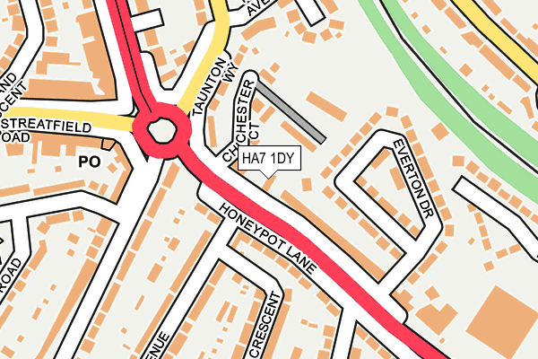
HA7 1DY lies on Honeypot Lane in Stanmore. HA7 1DY is located in the Kenton East electoral ward, within the London borough of Harrow and the English Parliamentary constituency of Harrow East. The Sub Integrated Care Board (ICB) Location is NHS North West London ICB - W2U3Z and the police force is Metropolitan Police. This postcode has been in use since January 1980.


GetTheData
Source: OS OpenMap – Local (Ordnance Survey)
Source: OS VectorMap District (Ordnance Survey)
Licence: Open Government Licence (requires attribution)
| Easting | 518376 |
| Northing | 189843 |
| Latitude | 51.595008 |
| Longitude | -0.292416 |
GetTheData
Source: Open Postcode Geo
Licence: Open Government Licence
| Street | Honeypot Lane |
| Town/City | Stanmore |
| Country | England |
| Postcode District | HA7 |
➜ See where HA7 is on a map ➜ Where is London? | |
GetTheData
Source: Land Registry Price Paid Data
Licence: Open Government Licence
Elevation or altitude of HA7 1DY as distance above sea level:
| Metres | Feet | |
|---|---|---|
| Elevation | 50m | 164ft |
Elevation is measured from the approximate centre of the postcode, to the nearest point on an OS contour line from OS Terrain 50, which has contour spacing of ten vertical metres.
➜ How high above sea level am I? Find the elevation of your current position using your device's GPS.
GetTheData
Source: Open Postcode Elevation
Licence: Open Government Licence
| Ward | Kenton East |
| Constituency | Harrow East |
GetTheData
Source: ONS Postcode Database
Licence: Open Government Licence
304, HONEYPOT LANE, STANMORE, HA7 1DY 2004 2 JUL £238,000 |
304, HONEYPOT LANE, STANMORE, HA7 1DY 2001 9 JAN £115,000 |
GetTheData
Source: HM Land Registry Price Paid Data
Licence: Contains HM Land Registry data © Crown copyright and database right 2025. This data is licensed under the Open Government Licence v3.0.
| Queensbury Circle (Honeypot Lane) | Queensbury | 38m |
| Queensbury Circle (Honeypot Lane) | Queensbury | 79m |
| The Honeypot | Queensbury | 136m |
| Honeypot Lane (Streatfield Road) | Queensbury | 221m |
| The Honeypot | Queensbury | 238m |
| Queensbury Underground Station | Queensbury | 441m |
| Canons Park Underground Station | Canons Park | 1,421m |
| Kingsbury Underground Station | Kingsbury | 1,474m |
| Kenton Station | 2.2km |
| Harrow & Wealdstone Station | 2.9km |
| South Kenton Station | 3km |
GetTheData
Source: NaPTAN
Licence: Open Government Licence
| Percentage of properties with Next Generation Access | 100.0% |
| Percentage of properties with Superfast Broadband | 100.0% |
| Percentage of properties with Ultrafast Broadband | 50.0% |
| Percentage of properties with Full Fibre Broadband | 0.0% |
Superfast Broadband is between 30Mbps and 300Mbps
Ultrafast Broadband is > 300Mbps
| Percentage of properties unable to receive 2Mbps | 0.0% |
| Percentage of properties unable to receive 5Mbps | 0.0% |
| Percentage of properties unable to receive 10Mbps | 0.0% |
| Percentage of properties unable to receive 30Mbps | 0.0% |
GetTheData
Source: Ofcom
Licence: Ofcom Terms of Use (requires attribution)
GetTheData
Source: ONS Postcode Database
Licence: Open Government Licence


➜ Get more ratings from the Food Standards Agency
GetTheData
Source: Food Standards Agency
Licence: FSA terms & conditions
| Last Collection | |||
|---|---|---|---|
| Location | Mon-Fri | Sat | Distance |
| Queensbury Post Office | 18:30 | 12:15 | 200m |
| Everton Drive | 17:30 | 12:15 | 210m |
| Taunton Way | 17:30 | 12:15 | 446m |
GetTheData
Source: Dracos
Licence: Creative Commons Attribution-ShareAlike
The below table lists the International Territorial Level (ITL) codes (formerly Nomenclature of Territorial Units for Statistics (NUTS) codes) and Local Administrative Units (LAU) codes for HA7 1DY:
| ITL 1 Code | Name |
|---|---|
| TLI | London |
| ITL 2 Code | Name |
| TLI7 | Outer London - West and North West |
| ITL 3 Code | Name |
| TLI74 | Harrow and Hillingdon |
| LAU 1 Code | Name |
| E09000015 | Harrow |
GetTheData
Source: ONS Postcode Directory
Licence: Open Government Licence
The below table lists the Census Output Area (OA), Lower Layer Super Output Area (LSOA), and Middle Layer Super Output Area (MSOA) for HA7 1DY:
| Code | Name | |
|---|---|---|
| OA | E00011015 | |
| LSOA | E01002202 | Harrow 012E |
| MSOA | E02000444 | Harrow 012 |
GetTheData
Source: ONS Postcode Directory
Licence: Open Government Licence
| HA7 1DX | Chichester Court | 67m |
| HA7 1EA | Everton Drive | 78m |
| HA7 1EX | Honeypot Lane | 82m |
| HA7 1DZ | Honeypot Lane | 98m |
| HA7 1EU | Honeypot Lane | 104m |
| HA7 1DQ | Taunton Way | 120m |
| HA7 1ED | Everton Drive | 142m |
| HA3 9HH | Queensbury Circle Parade | 163m |
| HA7 1EY | Queensbury Circle Parade | 168m |
| HA7 1DH | Taunton Way | 169m |
GetTheData
Source: Open Postcode Geo; Land Registry Price Paid Data
Licence: Open Government Licence