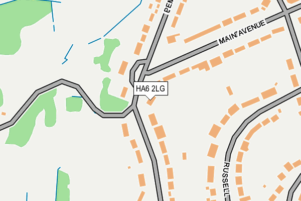
HA6 2LG lies on Pembroke Road in Northwood. HA6 2LG is located in the Moor Park & Eastbury electoral ward, within the local authority district of Three Rivers and the English Parliamentary constituency of South West Hertfordshire. The Sub Integrated Care Board (ICB) Location is NHS Hertfordshire and West Essex ICB - 06N and the police force is Hertfordshire. This postcode has been in use since January 1980.


GetTheData
Source: OS OpenMap – Local (Ordnance Survey)
Source: OS VectorMap District (Ordnance Survey)
Licence: Open Government Licence (requires attribution)
| Easting | 508168 |
| Northing | 193254 |
| Latitude | 51.627714 |
| Longitude | -0.438696 |
GetTheData
Source: Open Postcode Geo
Licence: Open Government Licence
| Street | Pembroke Road |
| Town/City | Northwood |
| Country | England |
| Postcode District | HA6 |
➜ See where HA6 is on a map ➜ Where is Moor Park? | |
GetTheData
Source: Land Registry Price Paid Data
Licence: Open Government Licence
Elevation or altitude of HA6 2LG as distance above sea level:
| Metres | Feet | |
|---|---|---|
| Elevation | 80m | 262ft |
Elevation is measured from the approximate centre of the postcode, to the nearest point on an OS contour line from OS Terrain 50, which has contour spacing of ten vertical metres.
➜ How high above sea level am I? Find the elevation of your current position using your device's GPS.
GetTheData
Source: Open Postcode Elevation
Licence: Open Government Licence
| Ward | Moor Park & Eastbury |
| Constituency | South West Hertfordshire |
GetTheData
Source: ONS Postcode Database
Licence: Open Government Licence
| Moor Park Station (Avenue) | Moor Park | 387m |
| Ye Olde Greene Manne Ph (Batchworth Heath Hill) | Batchworth Heath | 909m |
| Ye Olde Greene Manne Ph (Batchworth Heath Hill) | Batchworth Heath | 928m |
| Mount Vernon Hospital | Northwood | 1,295m |
| Mount Vernon Hospital | Northwood | 1,296m |
| Moor Park Underground Station | Moor Park | 493m |
| Rickmansworth Station | 2.8km |
| Carpenders Park Station | 3.7km |
| Bushey Station | 4.2km |
GetTheData
Source: NaPTAN
Licence: Open Government Licence
| Percentage of properties with Next Generation Access | 100.0% |
| Percentage of properties with Superfast Broadband | 100.0% |
| Percentage of properties with Ultrafast Broadband | 0.0% |
| Percentage of properties with Full Fibre Broadband | 0.0% |
Superfast Broadband is between 30Mbps and 300Mbps
Ultrafast Broadband is > 300Mbps
| Percentage of properties unable to receive 2Mbps | 0.0% |
| Percentage of properties unable to receive 5Mbps | 0.0% |
| Percentage of properties unable to receive 10Mbps | 0.0% |
| Percentage of properties unable to receive 30Mbps | 0.0% |
GetTheData
Source: Ofcom
Licence: Ofcom Terms of Use (requires attribution)
GetTheData
Source: ONS Postcode Database
Licence: Open Government Licence


➜ Get more ratings from the Food Standards Agency
GetTheData
Source: Food Standards Agency
Licence: FSA terms & conditions
| Last Collection | |||
|---|---|---|---|
| Location | Mon-Fri | Sat | Distance |
| Pembroke Road | 16:45 | 12:00 | 55m |
| Bedford Road | 16:45 | 12:00 | 837m |
| Batchworth Heath | 17:30 | 11:30 | 874m |
GetTheData
Source: Dracos
Licence: Creative Commons Attribution-ShareAlike
The below table lists the International Territorial Level (ITL) codes (formerly Nomenclature of Territorial Units for Statistics (NUTS) codes) and Local Administrative Units (LAU) codes for HA6 2LG:
| ITL 1 Code | Name |
|---|---|
| TLH | East |
| ITL 2 Code | Name |
| TLH2 | Bedfordshire and Hertfordshire |
| ITL 3 Code | Name |
| TLH23 | Hertfordshire CC |
| LAU 1 Code | Name |
| E07000102 | Three Rivers |
GetTheData
Source: ONS Postcode Directory
Licence: Open Government Licence
The below table lists the Census Output Area (OA), Lower Layer Super Output Area (LSOA), and Middle Layer Super Output Area (MSOA) for HA6 2LG:
| Code | Name | |
|---|---|---|
| OA | E00121058 | |
| LSOA | E01023841 | Three Rivers 011C |
| MSOA | E02004966 | Three Rivers 011 |
GetTheData
Source: ONS Postcode Directory
Licence: Open Government Licence
| HA6 2LS | Pembroke Road | 55m |
| HA6 2LF | Moor Park Gardens | 89m |
| HA6 2LE | Astons Road | 120m |
| HA6 2LH | Main Avenue | 148m |
| HA6 2LL | Russell Road | 159m |
| HA6 2LJ | Russell Road | 210m |
| HA6 2LQ | Main Avenue | 216m |
| HA6 2HP | Pembroke Road | 240m |
| HA6 2HR | Pembroke Road | 258m |
| HA6 2EP | Wolsey Road | 288m |
GetTheData
Source: Open Postcode Geo; Land Registry Price Paid Data
Licence: Open Government Licence