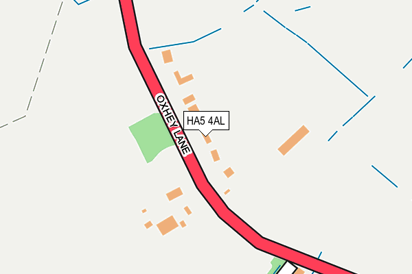
HA5 4AL lies on Oxhey Lane in Pinner. HA5 4AL is located in the Harrow Weald electoral ward, within the London borough of Harrow and the English Parliamentary constituency of Harrow East. The Sub Integrated Care Board (ICB) Location is NHS North West London ICB - W2U3Z and the police force is Metropolitan Police. This postcode has been in use since January 1980.


GetTheData
Source: OS OpenMap – Local (Ordnance Survey)
Source: OS VectorMap District (Ordnance Survey)
Licence: Open Government Licence (requires attribution)
| Easting | 513167 |
| Northing | 192453 |
| Latitude | 51.619533 |
| Longitude | -0.366765 |
GetTheData
Source: Open Postcode Geo
Licence: Open Government Licence
| Street | Oxhey Lane |
| Town/City | Pinner |
| Country | England |
| Postcode District | HA5 |
➜ See where HA5 is on a map ➜ Where is London? | |
GetTheData
Source: Land Registry Price Paid Data
Licence: Open Government Licence
Elevation or altitude of HA5 4AL as distance above sea level:
| Metres | Feet | |
|---|---|---|
| Elevation | 90m | 295ft |
Elevation is measured from the approximate centre of the postcode, to the nearest point on an OS contour line from OS Terrain 50, which has contour spacing of ten vertical metres.
➜ How high above sea level am I? Find the elevation of your current position using your device's GPS.
GetTheData
Source: Open Postcode Elevation
Licence: Open Government Licence
| Ward | Harrow Weald |
| Constituency | Harrow East |
GetTheData
Source: ONS Postcode Database
Licence: Open Government Licence
2018 27 APR £1,700,000 |
UTOPIA, OXHEY LANE, PINNER, HA5 4AL 2017 12 SEP £1,000,000 |
2009 12 NOV £1,062,500 |
2007 20 JUL £1,730,000 |
2006 22 SEP £1,340,000 |
TURNPIDGEONS, OXHEY LANE, PINNER, HA5 4AL 2005 14 OCT £885,000 |
TURNPIDGEONS, OXHEY LANE, PINNER, HA5 4AL 1999 26 MAR £550,000 |
1997 20 MAY £437,500 |
EAGLEWOOD, OXHEY LANE, PINNER, HA5 4AL 1995 1 AUG £402,000 |
GetTheData
Source: HM Land Registry Price Paid Data
Licence: Contains HM Land Registry data © Crown copyright and database right 2025. This data is licensed under the Open Government Licence v3.0.
| Little Oxhey Lane (Harrow Way) | Carpenders Park | 727m |
| Little Oxhey Lane (Harrow Way) | Carpenders Park | 732m |
| Romilly Drive (Harrow Way) | Carpenders Park | 933m |
| Romilly Drive (Harrow Way) | Carpenders Park | 1,060m |
| Lytham Avenue (Little Oxhey Lane) | South Oxhey | 1,109m |
| Hatch End Station | 1.1km |
| Carpenders Park Station | 1.7km |
| Headstone Lane Station | 2km |
GetTheData
Source: NaPTAN
Licence: Open Government Licence
| Percentage of properties with Next Generation Access | 0.0% |
| Percentage of properties with Superfast Broadband | 0.0% |
| Percentage of properties with Ultrafast Broadband | 0.0% |
| Percentage of properties with Full Fibre Broadband | 0.0% |
Superfast Broadband is between 30Mbps and 300Mbps
Ultrafast Broadband is > 300Mbps
| Percentage of properties unable to receive 2Mbps | 0.0% |
| Percentage of properties unable to receive 5Mbps | 0.0% |
| Percentage of properties unable to receive 10Mbps | 71.4% |
| Percentage of properties unable to receive 30Mbps | 100.0% |
GetTheData
Source: Ofcom
Licence: Ofcom Terms of Use (requires attribution)
GetTheData
Source: ONS Postcode Database
Licence: Open Government Licence


➜ Get more ratings from the Food Standards Agency
GetTheData
Source: Food Standards Agency
Licence: FSA terms & conditions
| Last Collection | |||
|---|---|---|---|
| Location | Mon-Fri | Sat | Distance |
| Royston Park Road | 18:30 | 12:45 | 504m |
| Highbanks Road | 18:30 | 13:00 | 528m |
| Harrow Way | 17:30 | 11:30 | 699m |
GetTheData
Source: Dracos
Licence: Creative Commons Attribution-ShareAlike
The below table lists the International Territorial Level (ITL) codes (formerly Nomenclature of Territorial Units for Statistics (NUTS) codes) and Local Administrative Units (LAU) codes for HA5 4AL:
| ITL 1 Code | Name |
|---|---|
| TLI | London |
| ITL 2 Code | Name |
| TLI7 | Outer London - West and North West |
| ITL 3 Code | Name |
| TLI74 | Harrow and Hillingdon |
| LAU 1 Code | Name |
| E09000015 | Harrow |
GetTheData
Source: ONS Postcode Directory
Licence: Open Government Licence
The below table lists the Census Output Area (OA), Lower Layer Super Output Area (LSOA), and Middle Layer Super Output Area (MSOA) for HA5 4AL:
| Code | Name | |
|---|---|---|
| OA | E00010743 | |
| LSOA | E01002144 | Harrow 004A |
| MSOA | E02000436 | Harrow 004 |
GetTheData
Source: ONS Postcode Directory
Licence: Open Government Licence
| HA5 4AQ | White Craig Close | 266m |
| HA5 4AB | Royston Park Road | 367m |
| HA5 4AN | Oxhey Lane | 394m |
| HA5 4AJ | Oxhey Lane | 402m |
| HA5 4AF | Royston Park Road | 413m |
| HA3 6SL | Old Redding | 463m |
| HA5 4BA | Saddlers Close | 498m |
| HA5 4AE | Royston Park Road | 570m |
| HA5 4AA | Royston Park Road | 580m |
| HA5 4HF | Royston Grove | 591m |
GetTheData
Source: Open Postcode Geo; Land Registry Price Paid Data
Licence: Open Government Licence