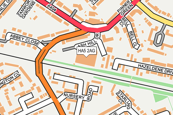
HA5 2AG is located in the Pinner electoral ward, within the London borough of Harrow and the English Parliamentary constituency of Ruislip, Northwood and Pinner. The Sub Integrated Care Board (ICB) Location is NHS North West London ICB - W2U3Z and the police force is Metropolitan Police. This postcode has been in use since August 1993.


GetTheData
Source: OS OpenMap – Local (Ordnance Survey)
Source: OS VectorMap District (Ordnance Survey)
Licence: Open Government Licence (requires attribution)
| Easting | 511238 |
| Northing | 189902 |
| Latitude | 51.596989 |
| Longitude | -0.395425 |
GetTheData
Source: Open Postcode Geo
Licence: Open Government Licence
| Country | England |
| Postcode District | HA5 |
➜ See where HA5 is on a map ➜ Where is Pinner? | |
GetTheData
Source: Land Registry Price Paid Data
Licence: Open Government Licence
Elevation or altitude of HA5 2AG as distance above sea level:
| Metres | Feet | |
|---|---|---|
| Elevation | 60m | 197ft |
Elevation is measured from the approximate centre of the postcode, to the nearest point on an OS contour line from OS Terrain 50, which has contour spacing of ten vertical metres.
➜ How high above sea level am I? Find the elevation of your current position using your device's GPS.
GetTheData
Source: Open Postcode Elevation
Licence: Open Government Licence
| Ward | Pinner |
| Constituency | Ruislip, Northwood And Pinner |
GetTheData
Source: ONS Postcode Database
Licence: Open Government Licence
| Cuckoo Hill | Pinner Green | 132m |
| Cuckoo Hill | Pinner Green | 177m |
| Tudor Road (Ha5) (Pinner Hill Road) | Pinner Green | 272m |
| West End Lane Elm Park Road | Pinner Green | 278m |
| Tudor Road (Ha5) (Pinner Hill Road) | Pinner Green | 288m |
| Northwood Hills Underground Station | Northwood Hills | 1,051m |
| Pinner Underground Station | Pinner | 1,088m |
| Hatch End Station | 2.3km |
| Headstone Lane Station | 2.7km |
| Carpenders Park Station | 3.5km |
GetTheData
Source: NaPTAN
Licence: Open Government Licence
GetTheData
Source: ONS Postcode Database
Licence: Open Government Licence


➜ Get more ratings from the Food Standards Agency
GetTheData
Source: Food Standards Agency
Licence: FSA terms & conditions
| Last Collection | |||
|---|---|---|---|
| Location | Mon-Fri | Sat | Distance |
| Pinner Green Post Office | 18:45 | 12:00 | 217m |
| Elm Park Court | 17:15 | 13:00 | 299m |
| Chamberlain Way | 18:00 | 12:30 | 358m |
GetTheData
Source: Dracos
Licence: Creative Commons Attribution-ShareAlike
The below table lists the International Territorial Level (ITL) codes (formerly Nomenclature of Territorial Units for Statistics (NUTS) codes) and Local Administrative Units (LAU) codes for HA5 2AG:
| ITL 1 Code | Name |
|---|---|
| TLI | London |
| ITL 2 Code | Name |
| TLI7 | Outer London - West and North West |
| ITL 3 Code | Name |
| TLI74 | Harrow and Hillingdon |
| LAU 1 Code | Name |
| E09000015 | Harrow |
GetTheData
Source: ONS Postcode Directory
Licence: Open Government Licence
The below table lists the Census Output Area (OA), Lower Layer Super Output Area (LSOA), and Middle Layer Super Output Area (MSOA) for HA5 2AG:
| Code | Name | |
|---|---|---|
| OA | E00010938 | |
| LSOA | E01002186 | Harrow 009B |
| MSOA | E02000441 | Harrow 009 |
GetTheData
Source: ONS Postcode Directory
Licence: Open Government Licence
| HA5 3NR | Hazeldene Drive | 71m |
| HA5 2AH | Camden Row | 79m |
| HA5 2AF | Pinner Green | 108m |
| HA5 2AP | Nursery Road | 121m |
| HA5 2AR | Nursery Road | 123m |
| HA5 2AB | Pinner Green | 126m |
| HA5 2AJ | Cuckoo Hill | 131m |
| HA5 3NP | Hazeldene Drive | 134m |
| HA5 3NH | Hazeldene Drive | 140m |
| HA5 2AN | Northwold Drive | 163m |
GetTheData
Source: Open Postcode Geo; Land Registry Price Paid Data
Licence: Open Government Licence