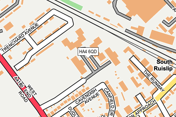
HA4 6QD is located in the South Ruislip electoral ward, within the London borough of Hillingdon and the English Parliamentary constituency of Uxbridge and South Ruislip. The Sub Integrated Care Board (ICB) Location is NHS North West London ICB - W2U3Z and the police force is Metropolitan Police. This postcode has been in use since November 2005.


GetTheData
Source: OS OpenMap – Local (Ordnance Survey)
Source: OS VectorMap District (Ordnance Survey)
Licence: Open Government Licence (requires attribution)
| Easting | 510810 |
| Northing | 185449 |
| Latitude | 51.557051 |
| Longitude | -0.403005 |
GetTheData
Source: Open Postcode Geo
Licence: Open Government Licence
| Country | England |
| Postcode District | HA4 |
➜ See where HA4 is on a map ➜ Where is Ruislip? | |
GetTheData
Source: Land Registry Price Paid Data
Licence: Open Government Licence
Elevation or altitude of HA4 6QD as distance above sea level:
| Metres | Feet | |
|---|---|---|
| Elevation | 40m | 131ft |
Elevation is measured from the approximate centre of the postcode, to the nearest point on an OS contour line from OS Terrain 50, which has contour spacing of ten vertical metres.
➜ How high above sea level am I? Find the elevation of your current position using your device's GPS.
GetTheData
Source: Open Postcode Elevation
Licence: Open Government Licence
| Ward | South Ruislip |
| Constituency | Uxbridge And South Ruislip |
GetTheData
Source: ONS Postcode Database
Licence: Open Government Licence
| South Ruislip (Station Approach) | South Ruislip | 274m |
| South Ruislip (Station Approach) | South Ruislip | 294m |
| Station Approach West End Rd | South Ruislip | 298m |
| Raf Northolt (West End Road) | Ruislip Gardens | 315m |
| Raf Northolt (West End Road) | Ruislip Gardens | 358m |
| South Ruislip Underground Station | South Ruislip | 284m |
| Ruislip Gardens Underground Station | Ruislip Gardens | 673m |
| South Ruislip Station | 0.3km |
| West Ruislip Station | 2.8km |
| Northolt Park Station | 3km |
GetTheData
Source: NaPTAN
Licence: Open Government Licence
GetTheData
Source: ONS Postcode Database
Licence: Open Government Licence


➜ Get more ratings from the Food Standards Agency
GetTheData
Source: Food Standards Agency
Licence: FSA terms & conditions
| Last Collection | |||
|---|---|---|---|
| Location | Mon-Fri | Sat | Distance |
| Station Approach | 18:45 | 12:30 | 303m |
| West End Road(R A F) | 16:45 | 12:30 | 335m |
| Victoria Road | 16:45 | 12:15 | 424m |
GetTheData
Source: Dracos
Licence: Creative Commons Attribution-ShareAlike
The below table lists the International Territorial Level (ITL) codes (formerly Nomenclature of Territorial Units for Statistics (NUTS) codes) and Local Administrative Units (LAU) codes for HA4 6QD:
| ITL 1 Code | Name |
|---|---|
| TLI | London |
| ITL 2 Code | Name |
| TLI7 | Outer London - West and North West |
| ITL 3 Code | Name |
| TLI74 | Harrow and Hillingdon |
| LAU 1 Code | Name |
| E09000017 | Hillingdon |
GetTheData
Source: ONS Postcode Directory
Licence: Open Government Licence
The below table lists the Census Output Area (OA), Lower Layer Super Output Area (LSOA), and Middle Layer Super Output Area (MSOA) for HA4 6QD:
| Code | Name | |
|---|---|---|
| OA | E00012431 | |
| LSOA | E01002495 | Hillingdon 010E |
| MSOA | E02000503 | Hillingdon 010 |
GetTheData
Source: ONS Postcode Directory
Licence: Open Government Licence
| HA4 6QW | Canfield Drive | 150m |
| HA4 6QH | Cavendish Avenue | 156m |
| HA4 6QJ | Cavendish Avenue | 157m |
| HA4 6SE | The Runway | 193m |
| HA4 6QN | Dudley Drive | 200m |
| HA4 6QP | Acol Crescent | 207m |
| HA4 6SW | Bourne Court | 220m |
| HA4 6SL | Station Approach | 250m |
| HA4 6RX | Langham Court | 251m |
| HA4 6RZ | Station Approach | 266m |
GetTheData
Source: Open Postcode Geo; Land Registry Price Paid Data
Licence: Open Government Licence