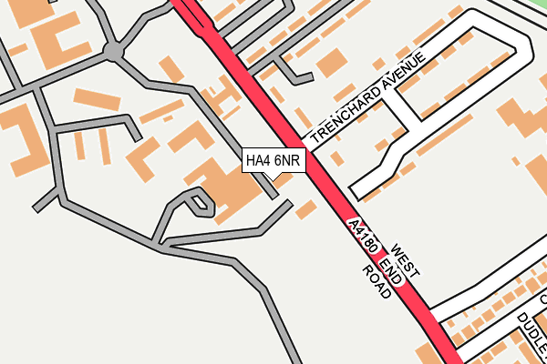
HA4 6NR is located in the South Ruislip electoral ward, within the London borough of Hillingdon and the English Parliamentary constituency of Uxbridge and South Ruislip. The Sub Integrated Care Board (ICB) Location is NHS North West London ICB - W2U3Z and the police force is Metropolitan Police. This postcode has been in use since January 1980.


GetTheData
Source: OS OpenMap – Local (Ordnance Survey)
Source: OS VectorMap District (Ordnance Survey)
Licence: Open Government Licence (requires attribution)
| Easting | 510506 |
| Northing | 185390 |
| Latitude | 51.556581 |
| Longitude | -0.407386 |
GetTheData
Source: Open Postcode Geo
Licence: Open Government Licence
| Country | England |
| Postcode District | HA4 |
➜ See where HA4 is on a map ➜ Where is Ruislip? | |
GetTheData
Source: Land Registry Price Paid Data
Licence: Open Government Licence
Elevation or altitude of HA4 6NR as distance above sea level:
| Metres | Feet | |
|---|---|---|
| Elevation | 40m | 131ft |
Elevation is measured from the approximate centre of the postcode, to the nearest point on an OS contour line from OS Terrain 50, which has contour spacing of ten vertical metres.
➜ How high above sea level am I? Find the elevation of your current position using your device's GPS.
GetTheData
Source: Open Postcode Elevation
Licence: Open Government Licence
| Ward | South Ruislip |
| Constituency | Uxbridge And South Ruislip |
GetTheData
Source: ONS Postcode Database
Licence: Open Government Licence
| Raf Northolt (West End Road) | Ruislip Gardens | 90m |
| Raf Northolt (West End Road) | Ruislip Gardens | 134m |
| Station Approach West End Rd | South Ruislip | 304m |
| Station Approach West End Rd (West End Road) | South Ruislip | 429m |
| Ruislip Gardens (West End Road) | Ruislip Gardens | 473m |
| Ruislip Gardens Underground Station | Ruislip Gardens | 516m |
| South Ruislip Underground Station | South Ruislip | 590m |
| South Ruislip Station | 0.6km |
| West Ruislip Station | 2.6km |
| Northolt Park Station | 3.3km |
GetTheData
Source: NaPTAN
Licence: Open Government Licence
| Percentage of properties with Next Generation Access | 100.0% |
| Percentage of properties with Superfast Broadband | 91.7% |
| Percentage of properties with Ultrafast Broadband | 0.0% |
| Percentage of properties with Full Fibre Broadband | 0.0% |
Superfast Broadband is between 30Mbps and 300Mbps
Ultrafast Broadband is > 300Mbps
| Percentage of properties unable to receive 2Mbps | 0.0% |
| Percentage of properties unable to receive 5Mbps | 0.0% |
| Percentage of properties unable to receive 10Mbps | 0.0% |
| Percentage of properties unable to receive 30Mbps | 8.3% |
GetTheData
Source: Ofcom
Licence: Ofcom Terms of Use (requires attribution)
Estimated total energy consumption in HA4 6NR by fuel type, 2015.
| Consumption (kWh) | 120,414 |
|---|---|
| Meter count | 12 |
| Mean (kWh/meter) | 10,035 |
| Median (kWh/meter) | 10,199 |
| Consumption (kWh) | 50,063 |
|---|---|
| Meter count | 10 |
| Mean (kWh/meter) | 5,006 |
| Median (kWh/meter) | 3,542 |
GetTheData
Source: Postcode level gas estimates: 2015 (experimental)
Source: Postcode level electricity estimates: 2015 (experimental)
Licence: Open Government Licence
GetTheData
Source: ONS Postcode Database
Licence: Open Government Licence


➜ Get more ratings from the Food Standards Agency
GetTheData
Source: Food Standards Agency
Licence: FSA terms & conditions
| Last Collection | |||
|---|---|---|---|
| Location | Mon-Fri | Sat | Distance |
| West End Road(R A F) | 16:45 | 12:30 | 104m |
| Station Approach | 18:45 | 12:30 | 369m |
| Sussex Road | 18:00 | 13:00 | 609m |
GetTheData
Source: Dracos
Licence: Creative Commons Attribution-ShareAlike
The below table lists the International Territorial Level (ITL) codes (formerly Nomenclature of Territorial Units for Statistics (NUTS) codes) and Local Administrative Units (LAU) codes for HA4 6NR:
| ITL 1 Code | Name |
|---|---|
| TLI | London |
| ITL 2 Code | Name |
| TLI7 | Outer London - West and North West |
| ITL 3 Code | Name |
| TLI74 | Harrow and Hillingdon |
| LAU 1 Code | Name |
| E09000017 | Hillingdon |
GetTheData
Source: ONS Postcode Directory
Licence: Open Government Licence
The below table lists the Census Output Area (OA), Lower Layer Super Output Area (LSOA), and Middle Layer Super Output Area (MSOA) for HA4 6NR:
| Code | Name | |
|---|---|---|
| OA | E00012440 | |
| LSOA | E01002499 | Hillingdon 033D |
| MSOA | E02006796 | Hillingdon 033 |
GetTheData
Source: ONS Postcode Directory
Licence: Open Government Licence
| HA4 6QQ | West End Road | 197m |
| HA4 6QJ | Cavendish Avenue | 251m |
| HA4 6QL | West End Road | 281m |
| HA4 6QH | Cavendish Avenue | 305m |
| HA4 6LN | Bridgwater Road | 306m |
| HA4 6QN | Dudley Drive | 315m |
| HA4 6QG | West End Road | 318m |
| HA4 6LQ | Carmichael Close | 323m |
| HA4 6LW | Bridgewater Road | 346m |
| HA4 6RW | Station Approach | 355m |
GetTheData
Source: Open Postcode Geo; Land Registry Price Paid Data
Licence: Open Government Licence