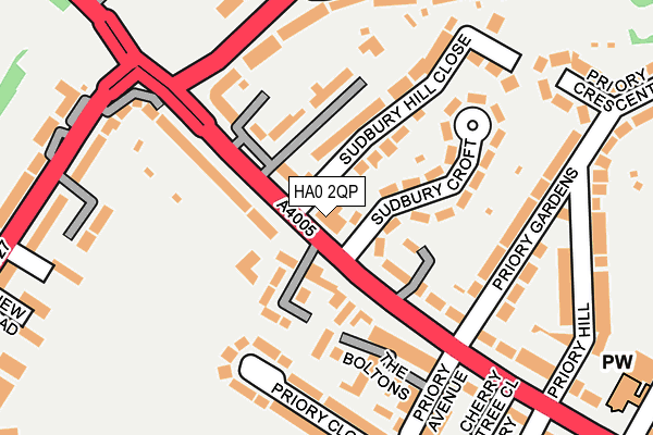
HA0 2QP is located in the Northwick Park electoral ward, within the London borough of Brent and the English Parliamentary constituency of Brent North. The Sub Integrated Care Board (ICB) Location is NHS North West London ICB - W2U3Z and the police force is Metropolitan Police. This postcode has been in use since January 1980.


GetTheData
Source: OS OpenMap – Local (Ordnance Survey)
Source: OS VectorMap District (Ordnance Survey)
Licence: Open Government Licence (requires attribution)
| Easting | 515905 |
| Northing | 185947 |
| Latitude | 51.560504 |
| Longitude | -0.329381 |
GetTheData
Source: Open Postcode Geo
Licence: Open Government Licence
| Country | England |
| Postcode District | HA0 |
➜ See where HA0 is on a map ➜ Where is London? | |
GetTheData
Source: Land Registry Price Paid Data
Licence: Open Government Licence
Elevation or altitude of HA0 2QP as distance above sea level:
| Metres | Feet | |
|---|---|---|
| Elevation | 70m | 230ft |
Elevation is measured from the approximate centre of the postcode, to the nearest point on an OS contour line from OS Terrain 50, which has contour spacing of ten vertical metres.
➜ How high above sea level am I? Find the elevation of your current position using your device's GPS.
GetTheData
Source: Open Postcode Elevation
Licence: Open Government Licence
| Ward | Northwick Park |
| Constituency | Brent North |
GetTheData
Source: ONS Postcode Database
Licence: Open Government Licence
| Sudbury Court Driveharrow Rd (Harrow Road) | Sudbury | 84m |
| Sudbury Court Driveharrow Rd | Sudbury | 107m |
| Priory Avenue Harrow Road | Sudbury | 217m |
| Priory Avenue Harrow Road | Sudbury | 236m |
| Harrow Road (Ha1) (Greenford Road) | Sudbury Hill | 239m |
| Sudbury Hill Underground Station | Sudbury Hill | 629m |
| Sudbury Town Underground Station | Sudbury Town | 1,434m |
| South Kenton Underground Station | South Kenton | 1,811m |
| Sudbury Hill Harrow Station | 0.5km |
| Sudbury & Harrow Road Station | 1.2km |
| North Wembley Station | 1.8km |
GetTheData
Source: NaPTAN
Licence: Open Government Licence
GetTheData
Source: ONS Postcode Database
Licence: Open Government Licence


➜ Get more ratings from the Food Standards Agency
GetTheData
Source: Food Standards Agency
Licence: FSA terms & conditions
| Last Collection | |||
|---|---|---|---|
| Location | Mon-Fri | Sat | Distance |
| 965 Harrow Road | 17:00 | 12:00 | 138m |
| Rosebank Avenue | 18:00 | 12:45 | 457m |
| St Andrews Avenue | 17:00 | 12:00 | 480m |
GetTheData
Source: Dracos
Licence: Creative Commons Attribution-ShareAlike
The below table lists the International Territorial Level (ITL) codes (formerly Nomenclature of Territorial Units for Statistics (NUTS) codes) and Local Administrative Units (LAU) codes for HA0 2QP:
| ITL 1 Code | Name |
|---|---|
| TLI | London |
| ITL 2 Code | Name |
| TLI7 | Outer London - West and North West |
| ITL 3 Code | Name |
| TLI72 | Brent |
| LAU 1 Code | Name |
| E09000005 | Brent |
GetTheData
Source: ONS Postcode Directory
Licence: Open Government Licence
The below table lists the Census Output Area (OA), Lower Layer Super Output Area (LSOA), and Middle Layer Super Output Area (MSOA) for HA0 2QP:
| Code | Name | |
|---|---|---|
| OA | E00002741 | |
| LSOA | E01000567 | Brent 016A |
| MSOA | E02000108 | Brent 016 |
GetTheData
Source: ONS Postcode Directory
Licence: Open Government Licence
| HA0 2QT | Harrow Road | 52m |
| HA0 2QY | Harrow Road | 73m |
| HA0 2SH | Thomas A Beckett Close | 77m |
| HA0 2SF | Harrow Road | 92m |
| HA0 2SJ | Harrow Road | 105m |
| HA0 2QR | Sudbury Hill Close | 110m |
| HA0 2QW | Sudbury Croft | 110m |
| HA0 2QU | Harrow Road | 114m |
| HA0 2SW | Saddlers Mews | 119m |
| HA0 2SL | The Boltons | 133m |
GetTheData
Source: Open Postcode Geo; Land Registry Price Paid Data
Licence: Open Government Licence