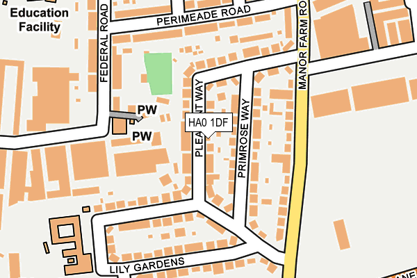
HA0 1DF lies on Pleasant Way in Wembley. HA0 1DF is located in the Perivale electoral ward, within the London borough of Ealing and the English Parliamentary constituency of Ealing North. The Sub Integrated Care Board (ICB) Location is NHS North West London ICB - W2U3Z and the police force is Metropolitan Police. This postcode has been in use since January 1980.


GetTheData
Source: OS OpenMap – Local (Ordnance Survey)
Source: OS VectorMap District (Ordnance Survey)
Licence: Open Government Licence (requires attribution)
| Easting | 517466 |
| Northing | 183247 |
| Latitude | 51.535915 |
| Longitude | -0.307773 |
GetTheData
Source: Open Postcode Geo
Licence: Open Government Licence
| Street | Pleasant Way |
| Town/City | Wembley |
| Country | England |
| Postcode District | HA0 |
➜ See where HA0 is on a map ➜ Where is London? | |
GetTheData
Source: Land Registry Price Paid Data
Licence: Open Government Licence
Elevation or altitude of HA0 1DF as distance above sea level:
| Metres | Feet | |
|---|---|---|
| Elevation | 30m | 98ft |
Elevation is measured from the approximate centre of the postcode, to the nearest point on an OS contour line from OS Terrain 50, which has contour spacing of ten vertical metres.
➜ How high above sea level am I? Find the elevation of your current position using your device's GPS.
GetTheData
Source: Open Postcode Elevation
Licence: Open Government Licence
| Ward | Perivale |
| Constituency | Ealing North |
GetTheData
Source: ONS Postcode Database
Licence: Open Government Licence
| Manor Farm Road | Alperton | 208m |
| Manor Farm Road | Alperton | 323m |
| Brooklands Drive (Bilton Road) | Perivale | 389m |
| Brooklands Drive (Bilton Road) | Perivale | 390m |
| Athlon Road (Glacier Way) | Alperton | 422m |
| Alperton Underground Station | Alperton | 772m |
| Perivale Underground Station | Perivale | 1,091m |
| Hanger Lane Underground Station | Hanger Lane | 1,225m |
| Wembley Central Station | 2km |
| South Greenford Station | 2km |
| Sudbury & Harrow Road Station | 2.1km |
GetTheData
Source: NaPTAN
Licence: Open Government Licence
| Percentage of properties with Next Generation Access | 100.0% |
| Percentage of properties with Superfast Broadband | 100.0% |
| Percentage of properties with Ultrafast Broadband | 100.0% |
| Percentage of properties with Full Fibre Broadband | 0.0% |
Superfast Broadband is between 30Mbps and 300Mbps
Ultrafast Broadband is > 300Mbps
| Median download speed | 55.0Mbps |
| Average download speed | 78.6Mbps |
| Maximum download speed | 350.00Mbps |
| Median upload speed | 10.0Mbps |
| Average upload speed | 9.0Mbps |
| Maximum upload speed | 20.00Mbps |
| Percentage of properties unable to receive 2Mbps | 0.0% |
| Percentage of properties unable to receive 5Mbps | 0.0% |
| Percentage of properties unable to receive 10Mbps | 0.0% |
| Percentage of properties unable to receive 30Mbps | 0.0% |
GetTheData
Source: Ofcom
Licence: Ofcom Terms of Use (requires attribution)
Estimated total energy consumption in HA0 1DF by fuel type, 2015.
| Consumption (kWh) | 423,365 |
|---|---|
| Meter count | 26 |
| Mean (kWh/meter) | 16,283 |
| Median (kWh/meter) | 15,070 |
| Consumption (kWh) | 93,223 |
|---|---|
| Meter count | 26 |
| Mean (kWh/meter) | 3,585 |
| Median (kWh/meter) | 3,468 |
GetTheData
Source: Postcode level gas estimates: 2015 (experimental)
Source: Postcode level electricity estimates: 2015 (experimental)
Licence: Open Government Licence
GetTheData
Source: ONS Postcode Database
Licence: Open Government Licence


➜ Get more ratings from the Food Standards Agency
GetTheData
Source: Food Standards Agency
Licence: FSA terms & conditions
| Last Collection | |||
|---|---|---|---|
| Location | Mon-Fri | Sat | Distance |
| Athlon Road | 18:00 | 12:00 | 162m |
| Pleasant Way | 18:00 | 12:00 | 173m |
| Langdale Gardens | 16:45 | 12:00 | 462m |
GetTheData
Source: Dracos
Licence: Creative Commons Attribution-ShareAlike
The below table lists the International Territorial Level (ITL) codes (formerly Nomenclature of Territorial Units for Statistics (NUTS) codes) and Local Administrative Units (LAU) codes for HA0 1DF:
| ITL 1 Code | Name |
|---|---|
| TLI | London |
| ITL 2 Code | Name |
| TLI7 | Outer London - West and North West |
| ITL 3 Code | Name |
| TLI73 | Ealing |
| LAU 1 Code | Name |
| E09000009 | Ealing |
GetTheData
Source: ONS Postcode Directory
Licence: Open Government Licence
The below table lists the Census Output Area (OA), Lower Layer Super Output Area (LSOA), and Middle Layer Super Output Area (MSOA) for HA0 1DF:
| Code | Name | |
|---|---|---|
| OA | E00006708 | |
| LSOA | E01001345 | Ealing 005D |
| MSOA | E02000242 | Ealing 005 |
GetTheData
Source: ONS Postcode Directory
Licence: Open Government Licence
| HA0 1DS | Primrose Way | 37m |
| HA0 1DG | Pleasant Way | 43m |
| HA0 1DR | Primrose Way | 69m |
| HA0 1DQ | Pleasant Way | 111m |
| HA0 1DD | Manor Farm Road | 120m |
| UB6 7JZ | Wadsworth Road | 133m |
| HA0 1DE | Pleasant Way | 139m |
| HA0 1DP | Lily Gardens | 141m |
| HA0 1DH | Pleasant Way | 151m |
| HA0 1DW | Lily Gardens | 155m |
GetTheData
Source: Open Postcode Geo; Land Registry Price Paid Data
Licence: Open Government Licence