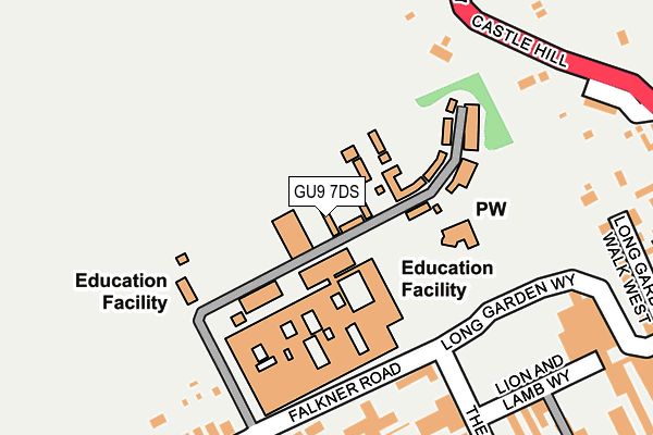
GU9 7DS is located in the Farnham North West electoral ward, within the local authority district of Waverley and the English Parliamentary constituency of South West Surrey. The Sub Integrated Care Board (ICB) Location is NHS Frimley ICB - D4U1Y and the police force is Surrey. This postcode has been in use since January 1980.


GetTheData
Source: OS OpenMap – Local (Ordnance Survey)
Source: OS VectorMap District (Ordnance Survey)
Licence: Open Government Licence (requires attribution)
| Easting | 483493 |
| Northing | 146953 |
| Latitude | 51.215682 |
| Longitude | -0.805956 |
GetTheData
Source: Open Postcode Geo
Licence: Open Government Licence
| Country | England |
| Postcode District | GU9 |
➜ See where GU9 is on a map ➜ Where is Farnham? | |
GetTheData
Source: Land Registry Price Paid Data
Licence: Open Government Licence
Elevation or altitude of GU9 7DS as distance above sea level:
| Metres | Feet | |
|---|---|---|
| Elevation | 80m | 262ft |
Elevation is measured from the approximate centre of the postcode, to the nearest point on an OS contour line from OS Terrain 50, which has contour spacing of ten vertical metres.
➜ How high above sea level am I? Find the elevation of your current position using your device's GPS.
GetTheData
Source: Open Postcode Elevation
Licence: Open Government Licence
| Ward | Farnham North West |
| Constituency | South West Surrey |
GetTheData
Source: ONS Postcode Database
Licence: Open Government Licence
| The Hart (West Street) | Farnham | 330m |
| Mead Lane (West Street) | Farnham | 334m |
| Mead Lane (West Street) | Farnham | 365m |
| The Hart (West Street) | Farnham | 405m |
| Castle Street | Farnham | 431m |
| Farnham Station | 1km |
| Aldershot Station | 4.7km |
| Bentley (Hants) Station | 5.8km |
GetTheData
Source: NaPTAN
Licence: Open Government Licence
GetTheData
Source: ONS Postcode Database
Licence: Open Government Licence


➜ Get more ratings from the Food Standards Agency
GetTheData
Source: Food Standards Agency
Licence: FSA terms & conditions
| Last Collection | |||
|---|---|---|---|
| Location | Mon-Fri | Sat | Distance |
| Farnham Art College | 16:30 | 12:00 | 139m |
| Farnham Post Office | 18:30 | 12:30 | 349m |
| Crondall Lane | 17:30 | 12:00 | 371m |
GetTheData
Source: Dracos
Licence: Creative Commons Attribution-ShareAlike
The below table lists the International Territorial Level (ITL) codes (formerly Nomenclature of Territorial Units for Statistics (NUTS) codes) and Local Administrative Units (LAU) codes for GU9 7DS:
| ITL 1 Code | Name |
|---|---|
| TLJ | South East (England) |
| ITL 2 Code | Name |
| TLJ2 | Surrey, East and West Sussex |
| ITL 3 Code | Name |
| TLJ25 | West Surrey |
| LAU 1 Code | Name |
| E07000216 | Waverley |
GetTheData
Source: ONS Postcode Directory
Licence: Open Government Licence
The below table lists the Census Output Area (OA), Lower Layer Super Output Area (LSOA), and Middle Layer Super Output Area (MSOA) for GU9 7DS:
| Code | Name | |
|---|---|---|
| OA | E00157476 | |
| LSOA | E01030885 | Waverley 003B |
| MSOA | E02006441 | Waverley 003 |
GetTheData
Source: ONS Postcode Directory
Licence: Open Government Licence
| GU9 7HA | The Hart | 140m |
| GU9 7BA | Austins Cottages | 146m |
| GU9 7HZ | The Hart | 167m |
| GU9 7FY | Blenheim Mews | 204m |
| GU9 7EX | Fox Yard | 206m |
| GU9 7HF | West Mead | 215m |
| GU9 7BD | Beavers Road | 226m |
| GU9 7EY | Melville Terrace | 227m |
| GU9 7HE | Timber Close | 233m |
| GU9 7DL | Cobbetts Mews | 246m |
GetTheData
Source: Open Postcode Geo; Land Registry Price Paid Data
Licence: Open Government Licence