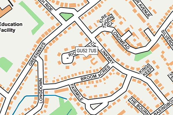
GU52 7US is located in the Crookham East electoral ward, within the local authority district of Hart and the English Parliamentary constituency of North East Hampshire. The Sub Integrated Care Board (ICB) Location is NHS Frimley ICB - D4U1Y and the police force is Hampshire. This postcode has been in use since June 2001.


GetTheData
Source: OS OpenMap – Local (Ordnance Survey)
Source: OS VectorMap District (Ordnance Survey)
Licence: Open Government Licence (requires attribution)
| Easting | 480946 |
| Northing | 152879 |
| Latitude | 51.269325 |
| Longitude | -0.841094 |
GetTheData
Source: Open Postcode Geo
Licence: Open Government Licence
| Country | England |
| Postcode District | GU52 |
➜ See where GU52 is on a map ➜ Where is Fleet? | |
GetTheData
Source: Land Registry Price Paid Data
Licence: Open Government Licence
Elevation or altitude of GU52 7US as distance above sea level:
| Metres | Feet | |
|---|---|---|
| Elevation | 80m | 262ft |
Elevation is measured from the approximate centre of the postcode, to the nearest point on an OS contour line from OS Terrain 50, which has contour spacing of ten vertical metres.
➜ How high above sea level am I? Find the elevation of your current position using your device's GPS.
GetTheData
Source: Open Postcode Elevation
Licence: Open Government Licence
| Ward | Crookham East |
| Constituency | North East Hampshire |
GetTheData
Source: ONS Postcode Database
Licence: Open Government Licence
| Rufford Close (Basingbourne Road) | Church Crookham | 310m |
| Spring Woods | Church Crookham | 351m |
| Haywood Drive (Reading Road South) | Church Crookham | 409m |
| Newlands (Basingbourne Road) | Church Crookham | 446m |
| Haywood Drive (Reading Road South) | Church Crookham | 450m |
| Fleet Station | 2.5km |
| Winchfield Station | 4.9km |
GetTheData
Source: NaPTAN
Licence: Open Government Licence


➜ Get more ratings from the Food Standards Agency
GetTheData
Source: Food Standards Agency
Licence: FSA terms & conditions
| Last Collection | |||
|---|---|---|---|
| Location | Mon-Fri | Sat | Distance |
| Velmead Road | 17:15 | 12:30 | 524m |
| Fleet Delivery Office | 700m | ||
| Rochester Grove | 17:00 | 12:00 | 795m |
GetTheData
Source: Dracos
Licence: Creative Commons Attribution-ShareAlike
The below table lists the International Territorial Level (ITL) codes (formerly Nomenclature of Territorial Units for Statistics (NUTS) codes) and Local Administrative Units (LAU) codes for GU52 7US:
| ITL 1 Code | Name |
|---|---|
| TLJ | South East (England) |
| ITL 2 Code | Name |
| TLJ3 | Hampshire and Isle of Wight |
| ITL 3 Code | Name |
| TLJ37 | North Hampshire |
| LAU 1 Code | Name |
| E07000089 | Hart |
GetTheData
Source: ONS Postcode Directory
Licence: Open Government Licence
The below table lists the Census Output Area (OA), Lower Layer Super Output Area (LSOA), and Middle Layer Super Output Area (MSOA) for GU52 7US:
| Code | Name | |
|---|---|---|
| OA | E00116189 | |
| LSOA | E01022863 | Hart 007B |
| MSOA | E02004757 | Hart 007 |
GetTheData
Source: ONS Postcode Directory
Licence: Open Government Licence
| GU52 7UU | Broom Acres | 49m |
| GU52 7UL | Linkway Parade | 52m |
| GU52 7UJ | Richmond Close | 76m |
| GU52 7UH | Linkway | 82m |
| GU52 7XG | Greenways | 122m |
| GU52 7UN | Linkway | 127m |
| GU52 7UX | Broom Acres | 140m |
| GU52 7UR | Fairmile | 140m |
| GU52 7TX | Long Mead | 154m |
| GU52 7TY | Firethorn Close | 158m |
GetTheData
Source: Open Postcode Geo; Land Registry Price Paid Data
Licence: Open Government Licence