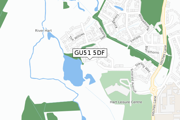
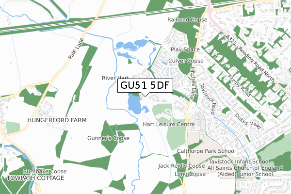
GU51 5DF is located in the Fleet West electoral ward, within the local authority district of Hart and the English Parliamentary constituency of North East Hampshire. The Sub Integrated Care Board (ICB) Location is NHS Frimley ICB - D4U1Y and the police force is Hampshire. This postcode has been in use since March 2019.


GetTheData
Source: OS Open Zoomstack (Ordnance Survey)
Licence: Open Government Licence (requires attribution)
Attribution: Contains OS data © Crown copyright and database right 2024
Source: Open Postcode Geo
Licence: Open Government Licence (requires attribution)
Attribution: Contains OS data © Crown copyright and database right 2024; Contains Royal Mail data © Royal Mail copyright and database right 2024; Source: Office for National Statistics licensed under the Open Government Licence v.3.0
| Easting | 478912 |
| Northing | 154298 |
| Latitude | 51.282366 |
| Longitude | -0.869914 |
GetTheData
Source: Open Postcode Geo
Licence: Open Government Licence
| Country | England |
| Postcode District | GU51 |
| ➜ GU51 open data dashboard ➜ See where GU51 is on a map ➜ Where is Fleet? | |
GetTheData
Source: Land Registry Price Paid Data
Licence: Open Government Licence
| Ward | Fleet West |
| Constituency | North East Hampshire |
GetTheData
Source: ONS Postcode Database
Licence: Open Government Licence
2021 29 NOV £1,062,000 |
2021 28 JUN £780,000 |
12, THE WILLOWS, FLEET, GU51 5DF 2020 7 DEC £775,000 |
18, THE WILLOWS, FLEET, GU51 5DF 2020 16 OCT £715,000 |
17, THE WILLOWS, FLEET, GU51 5DF 2020 30 SEP £699,950 |
13, THE WILLOWS, FLEET, GU51 5DF 2020 3 AUG £799,950 |
21, THE WILLOWS, FLEET, GU51 5DF 2020 24 JUL £985,000 |
14, THE WILLOWS, FLEET, GU51 5DF 2020 20 JUL £743,000 |
16, THE WILLOWS, FLEET, GU51 5DF 2020 6 MAR £775,000 |
25, THE WILLOWS, FLEET, GU51 5DF 2020 30 JAN £565,000 |
GetTheData
Source: HM Land Registry Price Paid Data
Licence: Contains HM Land Registry data © Crown copyright and database right 2024. This data is licensed under the Open Government Licence v3.0.
| Edenbrook (Hitches Lane) | Fleet | 512m |
| Edenbrook (Hitches Lane) | Fleet | 520m |
| Calthorpe Park School (Hitches Lane) | Dogmersfield | 581m |
| Hart Leisure Centre (Hitches Lane) | Dogmersfield | 634m |
| Hart Leisure Centre (Hitches Lane) | Dogmersfield | 641m |
| Winchfield Station | 2.6km |
| Fleet Station | 2.9km |
GetTheData
Source: NaPTAN
Licence: Open Government Licence
| Percentage of properties with Next Generation Access | 100.0% |
| Percentage of properties with Superfast Broadband | 100.0% |
| Percentage of properties with Ultrafast Broadband | 100.0% |
| Percentage of properties with Full Fibre Broadband | 100.0% |
Superfast Broadband is between 30Mbps and 300Mbps
Ultrafast Broadband is > 300Mbps
| Percentage of properties unable to receive 2Mbps | 0.0% |
| Percentage of properties unable to receive 5Mbps | 0.0% |
| Percentage of properties unable to receive 10Mbps | 0.0% |
| Percentage of properties unable to receive 30Mbps | 0.0% |
GetTheData
Source: Ofcom
Licence: Ofcom Terms of Use (requires attribution)
GetTheData
Source: ONS Postcode Database
Licence: Open Government Licence


➜ Get more ratings from the Food Standards Agency
GetTheData
Source: Food Standards Agency
Licence: FSA terms & conditions
| Last Collection | |||
|---|---|---|---|
| Location | Mon-Fri | Sat | Distance |
| Fitzroy Road | 17:15 | 12:30 | 748m |
| Tweeseldown Road | 16:30 | 11:15 | 1,183m |
| Hurst | 16:15 | 07:30 | 1,183m |
GetTheData
Source: Dracos
Licence: Creative Commons Attribution-ShareAlike
| Facility | Distance |
|---|---|
| Hart Leisure Centre Emerald Avenue, Fleet Artificial Grass Pitch, Grass Pitches, Sports Hall, Health and Fitness Gym, Swimming Pool, Studio | 545m |
| Calthorpe Park School Hitches Lane, Fleet Grass Pitches, Sports Hall, Artificial Grass Pitch, Outdoor Tennis Courts | 654m |
| Hart Leisure Centre (Closed) Hitches Lane, Fleet Sports Hall, Swimming Pool, Health and Fitness Gym, Squash Courts, Studio | 706m |
GetTheData
Source: Active Places
Licence: Open Government Licence
| School | Phase of Education | Distance |
|---|---|---|
| Calthorpe Park School Hitches Lane, Fleet, GU51 5JA | Secondary | 655m |
| Tavistock Infant School Broadacres, Calthorpe Park, Fleet, GU51 4EB | Primary | 1.1km |
| All Saints Church of England Aided Junior School Leawood Road, Fleet, GU51 5AJ | Primary | 1.3km |
GetTheData
Source: Edubase
Licence: Open Government Licence
The below table lists the International Territorial Level (ITL) codes (formerly Nomenclature of Territorial Units for Statistics (NUTS) codes) and Local Administrative Units (LAU) codes for GU51 5DF:
| ITL 1 Code | Name |
|---|---|
| TLJ | South East (England) |
| ITL 2 Code | Name |
| TLJ3 | Hampshire and Isle of Wight |
| ITL 3 Code | Name |
| TLJ37 | North Hampshire |
| LAU 1 Code | Name |
| E07000089 | Hart |
GetTheData
Source: ONS Postcode Directory
Licence: Open Government Licence
The below table lists the Census Output Area (OA), Lower Layer Super Output Area (LSOA), and Middle Layer Super Output Area (MSOA) for GU51 5DF:
| Code | Name | |
|---|---|---|
| OA | E00116225 | |
| LSOA | E01022873 | Hart 008D |
| MSOA | E02004758 | Hart 008 |
GetTheData
Source: ONS Postcode Directory
Licence: Open Government Licence
| GU51 5BT | Lapwings | 198m |
| GU51 5BU | Moorhens | 229m |
| GU51 5BS | Kingfishers | 256m |
| GU51 5BQ | Bulrushes | 291m |
| GU51 5BH | Pennyroyal | 316m |
| GU51 5AE | Foxtails | 340m |
| GU51 5AB | Willowbourne | 379m |
| GU51 5BE | Alder Court | 451m |
| GU51 5BD | Alder Court | 453m |
| GU51 5AD | Blackthorns | 462m |
GetTheData
Source: Open Postcode Geo; Land Registry Price Paid Data
Licence: Open Government Licence