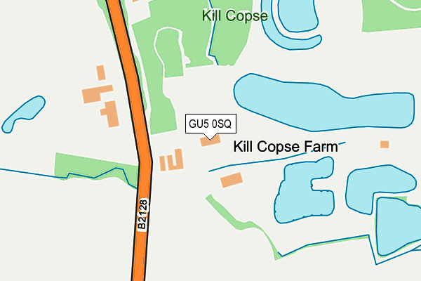
GU5 0SQ is located in the Bramley & Wonersh electoral ward, within the local authority district of Waverley and the English Parliamentary constituency of Guildford. The Sub Integrated Care Board (ICB) Location is NHS Surrey Heartlands ICB - 92A and the police force is Surrey. This postcode has been in use since August 1993.


GetTheData
Source: OS OpenMap – Local (Ordnance Survey)
Source: OS VectorMap District (Ordnance Survey)
Licence: Open Government Licence (requires attribution)
| Easting | 504297 |
| Northing | 142159 |
| Latitude | 51.169174 |
| Longitude | -0.509601 |
GetTheData
Source: Open Postcode Geo
Licence: Open Government Licence
| Country | England |
| Postcode District | GU5 |
➜ See where GU5 is on a map | |
GetTheData
Source: Land Registry Price Paid Data
Licence: Open Government Licence
Elevation or altitude of GU5 0SQ as distance above sea level:
| Metres | Feet | |
|---|---|---|
| Elevation | 60m | 197ft |
Elevation is measured from the approximate centre of the postcode, to the nearest point on an OS contour line from OS Terrain 50, which has contour spacing of ten vertical metres.
➜ How high above sea level am I? Find the elevation of your current position using your device's GPS.
GetTheData
Source: Open Postcode Elevation
Licence: Open Government Licence
| Ward | Bramley & Wonersh |
| Constituency | Guildford |
GetTheData
Source: ONS Postcode Database
Licence: Open Government Licence
| Gaston Gate (Guildford Road) | Rowly | 553m |
| Gaston Gate (Guildford Road) | Rowly | 579m |
| Stroud Common (Guildford Road) | Shamley Green | 618m |
| Stroud Common (Guildford Road) | Shamley Green | 624m |
| Rowly Drive (Guildford Road) | Rowly | 1,249m |
| Shalford (Surrey) Station | 6.4km |
GetTheData
Source: NaPTAN
Licence: Open Government Licence
GetTheData
Source: ONS Postcode Database
Licence: Open Government Licence


➜ Get more ratings from the Food Standards Agency
GetTheData
Source: Food Standards Agency
Licence: FSA terms & conditions
| Last Collection | |||
|---|---|---|---|
| Location | Mon-Fri | Sat | Distance |
| Stroud Common | 17:00 | 08:00 | 685m |
| Pittance Hill | 17:00 | 08:00 | 1,214m |
| Rowley Post Office | 17:00 | 11:45 | 1,275m |
GetTheData
Source: Dracos
Licence: Creative Commons Attribution-ShareAlike
The below table lists the International Territorial Level (ITL) codes (formerly Nomenclature of Territorial Units for Statistics (NUTS) codes) and Local Administrative Units (LAU) codes for GU5 0SQ:
| ITL 1 Code | Name |
|---|---|
| TLJ | South East (England) |
| ITL 2 Code | Name |
| TLJ2 | Surrey, East and West Sussex |
| ITL 3 Code | Name |
| TLJ25 | West Surrey |
| LAU 1 Code | Name |
| E07000216 | Waverley |
GetTheData
Source: ONS Postcode Directory
Licence: Open Government Licence
The below table lists the Census Output Area (OA), Lower Layer Super Output Area (LSOA), and Middle Layer Super Output Area (MSOA) for GU5 0SQ:
| Code | Name | |
|---|---|---|
| OA | E00157736 | |
| LSOA | E01030940 | Waverley 008D |
| MSOA | E02006446 | Waverley 008 |
GetTheData
Source: ONS Postcode Directory
Licence: Open Government Licence
| GU5 0SX | Upper House Lane | 572m |
| GU5 0SZ | Stroud Common | 623m |
| GU6 8QZ | Guildford Road | 634m |
| GU5 0TD | East Whipley Lane | 687m |
| GU5 0TA | New Cottages | 733m |
| GU5 0ST | Stroud Lane | 749m |
| GU6 8QY | Smithwood Common | 781m |
| GU5 0SU | Willinghurst Estate | 798m |
| GU5 0TB | Stroud Common | 883m |
| GU5 0SY | Run Common | 888m |
GetTheData
Source: Open Postcode Geo; Land Registry Price Paid Data
Licence: Open Government Licence