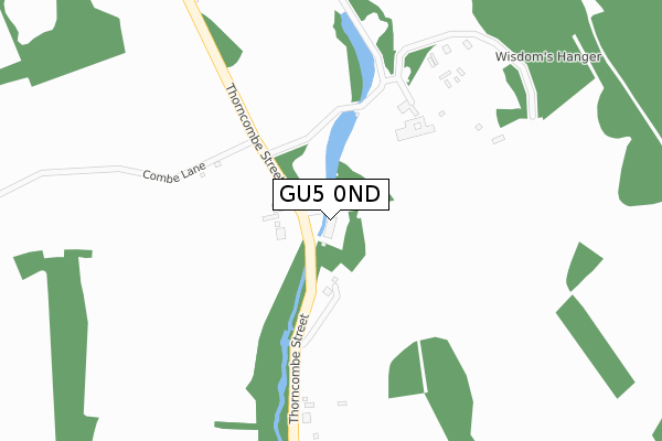
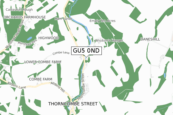
GU5 0ND lies on Thorncombe Street in Bramley, Guildford. GU5 0ND is located in the Bramley & Wonersh electoral ward, within the local authority district of Waverley and the English Parliamentary constituency of South West Surrey. The Sub Integrated Care Board (ICB) Location is NHS Surrey Heartlands ICB - 92A and the police force is Surrey. This postcode has been in use since January 1980.


GetTheData
Source: OS Open Zoomstack (Ordnance Survey)
Licence: Open Government Licence (requires attribution)
Attribution: Contains OS data © Crown copyright and database right 2025
Source: Open Postcode Geo
Licence: Open Government Licence (requires attribution)
Attribution: Contains OS data © Crown copyright and database right 2025; Contains Royal Mail data © Royal Mail copyright and database right 2025; Source: Office for National Statistics licensed under the Open Government Licence v.3.0
| Easting | 500137 |
| Northing | 142835 |
| Latitude | 51.175994 |
| Longitude | -0.568894 |
GetTheData
Source: Open Postcode Geo
Licence: Open Government Licence
| Street | Thorncombe Street |
| Locality | Bramley |
| Town/City | Guildford |
| Country | England |
| Postcode District | GU5 |
➜ See where GU5 is on a map ➜ Where is Thorncombe Street? | |
GetTheData
Source: Land Registry Price Paid Data
Licence: Open Government Licence
Elevation or altitude of GU5 0ND as distance above sea level:
| Metres | Feet | |
|---|---|---|
| Elevation | 60m | 197ft |
Elevation is measured from the approximate centre of the postcode, to the nearest point on an OS contour line from OS Terrain 50, which has contour spacing of ten vertical metres.
➜ How high above sea level am I? Find the elevation of your current position using your device's GPS.
GetTheData
Source: Open Postcode Elevation
Licence: Open Government Licence
| Ward | Bramley & Wonersh |
| Constituency | South West Surrey |
GetTheData
Source: ONS Postcode Database
Licence: Open Government Licence
| Chestnut Way (Birtley Road) | Bramley | 1,773m |
| Chestnut Way (Birtley Road) | Bramley | 1,787m |
| Brighton Road | South Munstead | 1,870m |
| Birtley Rise (Birtley Road) | Bramley | 1,874m |
| Brighton Road | South Munstead | 1,882m |
| Farncombe Station | 3.4km |
| Godalming Station | 3.7km |
| Shalford (Surrey) Station | 4.3km |
GetTheData
Source: NaPTAN
Licence: Open Government Licence
| Percentage of properties with Next Generation Access | 100.0% |
| Percentage of properties with Superfast Broadband | 100.0% |
| Percentage of properties with Ultrafast Broadband | 100.0% |
| Percentage of properties with Full Fibre Broadband | 100.0% |
Superfast Broadband is between 30Mbps and 300Mbps
Ultrafast Broadband is > 300Mbps
| Median download speed | 3.3Mbps |
| Average download speed | 4.0Mbps |
| Maximum download speed | 7.67Mbps |
| Median upload speed | 0.8Mbps |
| Average upload speed | 0.7Mbps |
| Maximum upload speed | 1.06Mbps |
| Percentage of properties unable to receive 2Mbps | 0.0% |
| Percentage of properties unable to receive 5Mbps | 0.0% |
| Percentage of properties unable to receive 10Mbps | 0.0% |
| Percentage of properties unable to receive 30Mbps | 0.0% |
GetTheData
Source: Ofcom
Licence: Ofcom Terms of Use (requires attribution)
GetTheData
Source: ONS Postcode Database
Licence: Open Government Licence


➜ Get more ratings from the Food Standards Agency
GetTheData
Source: Food Standards Agency
Licence: FSA terms & conditions
| Last Collection | |||
|---|---|---|---|
| Location | Mon-Fri | Sat | Distance |
| Thorncombe Street | 16:15 | 08:30 | 152m |
| Snowdenham Road | 16:30 | 08:30 | 1,468m |
| Munstead Heath | 16:00 | 08:45 | 1,582m |
GetTheData
Source: Dracos
Licence: Creative Commons Attribution-ShareAlike
The below table lists the International Territorial Level (ITL) codes (formerly Nomenclature of Territorial Units for Statistics (NUTS) codes) and Local Administrative Units (LAU) codes for GU5 0ND:
| ITL 1 Code | Name |
|---|---|
| TLJ | South East (England) |
| ITL 2 Code | Name |
| TLJ2 | Surrey, East and West Sussex |
| ITL 3 Code | Name |
| TLJ25 | West Surrey |
| LAU 1 Code | Name |
| E07000216 | Waverley |
GetTheData
Source: ONS Postcode Directory
Licence: Open Government Licence
The below table lists the Census Output Area (OA), Lower Layer Super Output Area (LSOA), and Middle Layer Super Output Area (MSOA) for GU5 0ND:
| Code | Name | |
|---|---|---|
| OA | E00157377 | |
| LSOA | E01030865 | Waverley 008B |
| MSOA | E02006446 | Waverley 008 |
GetTheData
Source: ONS Postcode Directory
Licence: Open Government Licence
| GU5 0NB | Thorncombe Street | 350m |
| GU5 0NA | Thorncombe Street | 605m |
| GU5 0LZ | Thorncombe Street | 638m |
| GU5 0LY | The Square | 717m |
| GU5 0NH | Thorncombe Street | 779m |
| GU5 0LT | Thorncombe Street | 963m |
| GU5 0LU | Thorncombe Street | 1158m |
| GU8 4AR | Munstead Heath Road | 1212m |
| GU8 4AP | Alldens Lane | 1253m |
| GU5 0DA | Munstead View Road | 1274m |
GetTheData
Source: Open Postcode Geo; Land Registry Price Paid Data
Licence: Open Government Licence